
Bucharest is one of the most populated cities in Romania, and at the same time, this city is the capital of this country. Located in Europe, you may find the city easily with the following GPS coordinates: 44.27N latitude / 26.10E longitude. For routing in Bucharest, please check the free driving directions Bucharest service below.
Europe maps
Explore the countries in Europe with all their Wiki, find information on weather, population, facts, history, landmarks of major cities data, and enjoy free Google maps Satellite imagery & Street views. Each Country Profile in Europe provides information on Geography data, area maps, Google maps, flag, history, area, population, the capital city, largest cities, economy, spoken languages, ethnicity/race, religion, literacy rate, government, and many more!
In this map category, you will find these European countries and their capital cities:
Albania, Andorra, Austria, Belarus, Belgium, Bosnia and Herzegovina, Bulgaria, Croatia, Czech Republic, Denmark, Estonia, Finland, France, Germany, Greece, Hungary, Iceland, Ireland, Italy, Latvia, Liechtenstein, Lithuania, Luxembourg, Macedonia, Malta, Montenegro, Moldova, Monaco, Netherlands, Norway, Poland, Portugal, Romania, Russia, San Marino, Serbia, Slovakia, Slovenia, Spain, Sweden, Switzerland, Ukraine, United Kingdom, Vatican City.
Google Maps™ driving directions home » Europe maps
Budapest Google maps
Budapest is one of the most populated cities in Hungary, and at the same time, this city is the capital of this country. Located in Europe, you may easily find the city with the following GPS coordinates: 47.29N latitude / 19.05E longitude. For routing in Budapest, please check the free driving directions Budapest service below.
Google Maps™ driving directions home » Europe maps
Bulgaria
Driving Directions Bulgaria
BULGARIA is a southeast European republic located on the east of the Balkan Peninsula with a coast on the Black Sea to the east. It is bounded to the north by Romania, to the west by Serbia and the Former Yugoslav Republic of Macedonia, and the south by Greece and Turkey.
Hills or mountains cover about half of Bulgaria’s land area. The center of Bulgaria is crossed from west to east by the Balkan Mountains. In the south, the Rhodopi Mountains straddle the border with Greece, and, in the western central region of the country, the Rila mountain chain contains the country’s highest peak, Musala (2,925 meters or 9,597 feet).
Google Maps™ driving directions home » Europe maps

Bulgaria Google Map

Google Maps and Detailed Facts of Bulgaria (BU). This page lets you explore Bulgaria and its border countries (Country Location: Southeastern Europe, bordering the Black Sea, Romania, and Turkey) through detailed Satellite imagery – fast and easy as never before Google Maps.
Find comprehensive information about this country’s diversity below: Google maps, geography, economy, science, people, culture, environment, government, and history – All in One Wiki page.
There is also a Street View and free Driving Directions at your service. Your Google Satellite Map Sightseeing in Bulgaria, Europe, starts here at Driving Directions and Maps.com.
Google Maps™ driving directions home » Europe maps
Chisinau Google maps
Chisinau is one of the most populated cities in Moldova, and at the same time, this city is the capital of this country. Located in Europe, you may find the city easily with the following GPS coordinates: 47.02N latitude / 28.50E longitude. For routing in Chisinau, please check the free driving directions Chisinau service below.
Google Maps™ driving directions home » Europe maps
Copenhagen Google maps
Copenhagen is one of the most populated cities in Denmark, and at the same time, this city is the capital of this country. Located in Europe, you may find the city easily with the following GPS coordinates: 55.41N latitude / 12.34E longitude. For routing in Copenhagen, please check the free driving directions Copenhagen service below.
Google Maps™ driving directions home » Europe maps
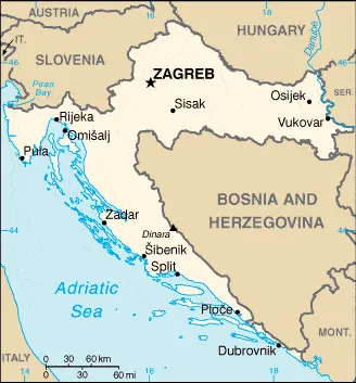
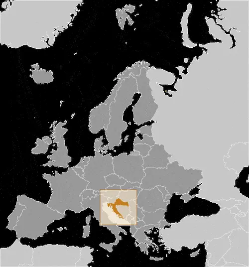
Croatia
Driving Directions Croatia
CROATIA, a republic of former Yugoslavia, made a unilateral declaration of independence on 25 June 1991. Sovereignty was not formally recognised by the international community until early in 1992. Located in southeast Europe, it is bounded to the west by the Adriatic Sea, to the north by Slovenia and Hungary, to the east by Yugoslavia, and the south Bosnia-Herzegovina.
Google Maps™ driving directions home » Europe maps
Croatia Google Map
 |
 |
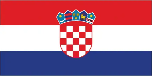 |
| Borderline map of Croatia | Location map of Croatia | Flag of Croatia |
Google Maps and Detailed Facts of Croatia (HR). This page lets you explore Croatia and its border countries (Country Location: Southeastern Europe, bordering the Adriatic Sea, between Bosnia and Herzegovina and Slovenia) through detailed Satellite imagery – fast and easy as never before Google Maps.
Find comprehensive information about this country’s diversity below: Google maps, geography, economy, science, people, culture, environment, government, and history – All in One Wiki page.
There is also a Street View and free Driving Directions at your service. Your Google Satellite Map Sightseeing in Croatia, in Europe, starts here at Driving Directions and Maps.com.
Google Maps™ driving directions home » Europe maps
Cyprus
Driving Directions Cyprus
CYPRUS is an island republic that lies in the eastern Mediterranean about 85 kilometers or 53 miles south of Turkey. It has been unofficially partitioned since 1974 – the northeastern portion forming the Turkish Republic of Northern Cyprus.
The island’s shape somewhat resembles a saucepan with the “handle” formed by the long, narrow Karpas Peninsula pointing northeastwards towards Turkey. A range of mountains extends along much of the northern coast with a still higher range, the Troodos Mountains, in the center and southwest. Between the mountains lies the extensive Messoria Plain. The highest point is Mount Olympus (1,951 meters or 6,401 feet) in the southwest.
Google Maps™ driving directions home » Europe maps
Czech Republic
Driving Directions Czech Republic
The CZECH REPUBLIC was newly constituted on 1 January 1993 with the dissolution of Czechoslovakia’s 74-year-old federal republic. The Czech Republic consists of two ancient former kingdoms and part of a third: Bohemia in the center and west, Moravia in the east, and Silesia in the northeast of the republic. It is a landlocked country at the heart of central Europe, bounded by Slovakia (the Slovak Republic), Germany, Poland, and Austria. Natural boundaries are formed by the Sudeten Mountains in the north, the Erzgebirge or Ore Mountains to the northwest, and the Bohemian Forest in the southwest. Lying east of the country’s center, the Moravian Highlands give way to lower-lying, rolling plains. There are numerous rivers in the country and some freshwater lakes.