Google Maps™ driving directions home » Southeast Asia

Brunei Google Map

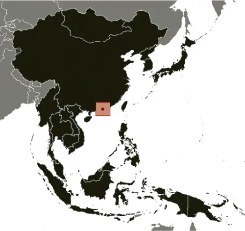
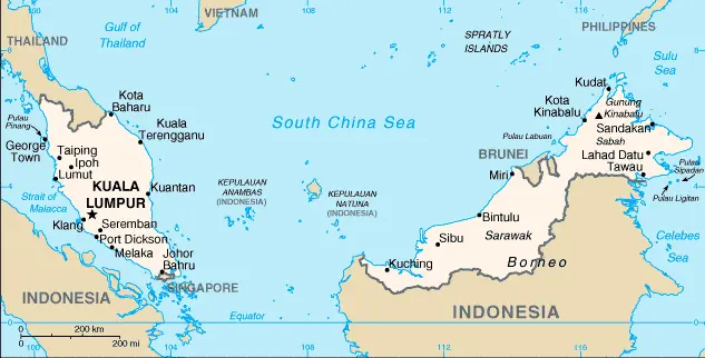
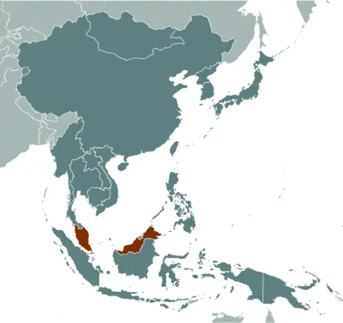
Google Maps and Detailed Facts of Brunei (BX). This page lets you explore Brunei and its border countries (Country Location: Southeastern Asia, along the northern coast of the island of Borneo, bordering the South China Sea and Malaysia) through detailed Satellite imagery – fast and easy as never before Google Maps.

Find comprehensive information about this country’s diversity below: Google maps, geography, economy, science, people, culture, environment, government, and history – All in One Wiki page.

There is also a Street View and free Driving Directions at your service. Your Google Satellite Map Sightseeing in Brunei in Southeast Asia starts at Driving Directions and Maps.com.

Read more

Google Maps™ driving directions home » Southeast Asia

Cambodia Google Map

Google Maps and Detailed Facts of Cambodia (CB). This page lets you explore Cambodia and its border countries (Country Location: Southeastern Asia, bordering the Gulf of Thailand, between Thailand, Vietnam, and Laos) through detailed Satellite imagery – fast and easy as never before Google Maps.

Find comprehensive information about this country’s diversity below: Google maps, geography, economy, science, people, culture, environment, government, and history – All in One Wiki page.

There is also a Street View and free Driving Directions at your service. Your Google Satellite Map Sightseeing in Cambodia starts at Driving Directions and Maps.com in Southeast Asia.

Read more

Google Maps™ driving directions home » Southeast Asia

Christmas Island Google Map

This image shows the draft map of Christmas Island, Southeast Asia. For more details of the map of Christmas Island, please see this page below. This image shows the location of Christmas Island, Southeast Asia. For more geographical details of Christmas Island, please see this page below. This image shows the flag of Christmas Island, Southeast Asia. For more details of the flag of Christmas Island, please see this page below.
Borderline map of Christmas Island Location map of Christmas Island Flag of Christmas Island

Christmas Island Google map

Google Maps and Detailed Facts of Christmas Island (CX). This page lets you explore Christmas Island and its border countries (Country Location: Southeastern Asia, an island in the Indian Ocean, south of Indonesia) through detailed Satellite imagery – fast and easy as never before Google Maps.

Find comprehensive information about this country’s diversity below: Google maps, geography, economy, science, people, culture, environment, government, and history – All in One Wiki page.

There is also a Street View and free Driving Directions at your service. Your Google Satellite Map Sightseeing in Christmas Island, in Southeast Asia, starts here at Driving Directions and Maps.com.

Read more

Google Maps™ driving directions home » Southeast Asia

Hong Kong Google Map

This image shows the draft map of Hong Kong, Southeast Asia. For more details of the map of Hong Kong, please see this page below. This image shows the location of Hong Kong, Southeast Asia. For more geographical details of Hong Kong, please see this page below. This image shows the flag of Hong Kong, Southeast Asia. For more details of the flag of Hong Kong, please see this page below.
Borderline map of Hong Kong Location map of Hong Kong Flag of Hong Kong

Hong Kong Google map

Google Maps and Detailed Facts of Hong Kong (HK). This page lets you explore Hong Kong and its border countries (Country Location: Eastern Asia, bordering the South China Sea and China) through detailed Satellite imagery – fast and easy as never before Google Maps.

Find comprehensive information about this country’s diversity below: Google maps, geography, economy, science, people, culture, environment, government, and history – All in One Wiki page.

There is also a Street View and free Driving Directions at your service. Your Google Satellite Map Sightseeing in Hong Kong, in Southeast Asia, starts here at Driving Directions and Maps.com.

Read more

Google Maps™ driving directions home » Southeast Asia

Indonesia Google Map

This image shows the draft map of Indonesia, Southeast Asia. For more details of the map of Indonesia, please see this page below. This image shows the location of Indonesia, Southeast Asia. For more geographical details of Indonesia, please see this page below. This image shows the flag of Indonesia, Southeast Asia. For more details of the flag of Indonesia, please see this page below.
Borderline map of Indonesia Location map of Indonesia Flag of Indonesia

Indonesia Google map

Google Maps and Detailed Facts of Indonesia (ID). This page lets you explore Indonesia and its border countries (Country Location: Southeastern Asia, archipelago between the Indian Ocean and the Pacific Ocean) through detailed Satellite imagery – fast and easy as never before Google Maps.

Find comprehensive information about this country’s diversity below: Google maps, geography, economy, science, people, culture, environment, government, and history – All in One Wiki page.

There is also a Street View and free Driving Directions at your service. Your Google Satellite Map Sightseeing in Indonesia, in Southeast Asia, starts here at Driving Directions and Maps.com.

Read more

Google Maps™ driving directions home » Southeast Asia

Laos Google Map

This image shows the draft map of Laos, Southeast Asia. For more details of the map of Laos, please see this page below. This image shows the location of Laos, Southeast Asia. For more geographical details of Laos, please see this page below. This image shows the flag of Laos, Southeast Asia. For more details of the flag of Laos, please see this page below.
Borderline map of Laos Location map of Laos Flag of Laos

Laos Google map

Google Maps and Detailed Facts of Laos (LA). This page lets you explore Laos and its border countries (Country Location: Southeastern Asia, northeast of Thailand, west of Vietnam) through detailed Satellite imagery – fast and easy as never before Google Maps.

Find comprehensive information about this country’s diversity below: Google maps, geography, economy, science, people, culture, environment, government, and history – All in One Wiki page.

There is also a Street View and free Driving Directions at your service. Your Google Satellite Map Sightseeing in Laos, in Southeast Asia, starts here at Driving Directions and Maps.com.

Read more

Google Maps™ driving directions home » Southeast Asia

Macau Google Map

This image shows the draft map of Macau, Southeast Asia. For more details of the map of Macau, please see this page below. This image shows the location of Macau, Southeast Asia. For more geographical details of Macau, please see this page below. This image shows the flag of Macau, Southeast Asia. For more details of the flag of Macau, please see this page below.
Borderline map of Macau Location map of Macau Flag of Macau

Macau Google map

Google Maps and Detailed Facts of Macau (MO). This page lets you explore Macau and its border countries (Country Location: Eastern Asia, bordering the South China Sea and China) through detailed Satellite imagery – fast and easy as never before Google Maps.

Find comprehensive information about this country’s diversity below: Google maps, geography, economy, science, people, culture, environment, government, and history – All in One Wiki page.

There is also a Street View and free Driving Directions at your service. Your Google Satellite Map Sightseeing in Macau, in Southeast Asia, starts here at Driving Directions and Maps.com.

Read more

Google Maps™ driving directions home » Southeast Asia

Malaysia Google Map

This image shows the draft map of Malaysia, Southeast Asia. For more details of the map of Malaysia, please see this page below. This image shows the location of Malaysia, Southeast Asia. For more geographical details of Malaysia, please see this page below. This image shows the flag of Malaysia, Southeast Asia. For more details of the flag of Malaysia, please see this page below.
Borderline map of Malaysia Location map of Malaysia Flag of Malaysia

Malaysia Google map

Google Maps and Detailed Facts of Malaysia (MY). This page lets you explore Malaysia and its border countries (Country Location: Southeastern Asia, peninsula bordering Thailand and northern one-third of the island of Borneo, bordering Indonesia, Brunei, and the South China Sea, south of Vietnam) through detailed Satellite imagery – fast and easy as never before Google Maps.

Find comprehensive information about this country’s diversity below: Google maps, geography, economy, science, people, culture, environment, government, and history – All in One Wiki page.

There is also a Street View and free Driving Directions at your service. Your Google Satellite Map Sightseeing in Malaysia, in Southeast Asia, starts here at Driving Directions and Maps.com.

Read more

Google Maps™ driving directions home » Southeast Asia

Myanmar (Burma) Google Map

Google Maps and Detailed Facts of Burma (MM). This page lets you explore Burma and its border countries (Country Location: Southeastern Asia, bordering the Andaman Sea and the Bay of Bengal, between Bangladesh and Thailand) through detailed Satellite imagery – fast and easy as never before Google Maps.

Find comprehensive information about this country’s diversity below: Google maps, geography, economy, science, people, culture, environment, government, and history – All in One Wiki page.

There is also a Street View and free Driving Directions at your service. Your Google Satellite Map Sightseeing in Burma, Southeast Asia, starts here at Driving Directions and Maps.com.

Read more

Google Maps™ driving directions home » Southeast Asia

Philippines Google Map

This image shows the draft map of Philippines, Southeast Asia. For more details of the map of Philippines, please see this page below. This image shows the location of Philippines, Southeast Asia. For more geographical details of Philippines, please see this page below. This image shows the flag of Philippines, Southeast Asia. For more details of the flag of Philippines, please see this page below.
Borderline map of Philippines Location map of the Philippines Flag of Philippines

Philippines Google map

Google Maps and Detailed Facts of the Philippines (PH). This page lets you explore the Philippines and its border countries (Country Location: Southeastern Asia, archipelago between the Philippine Sea and the South China Sea, east of Vietnam) through detailed Satellite imagery – fast and easy as never before Google Maps.

Find comprehensive information about this country’s diversity below: Google maps, geography, economy, science, people, culture, environment, government, and history – All in One Wiki page.

There is also a Street View and free Driving Directions at your service. Your Google Satellite Map Sightseeing in the Philippines, in Southeast Asia, starts here at Driving Directions and Maps.com.

Read more