Google Maps™ driving directions home » Ecuador

South America

Welcome to South America’s vibrant and captivating continent, where swirling rhythms, breathtaking landscapes, and rich cultural diversity await your exploration. From the snow-capped peaks of the Andes to the lush Amazon rainforest, this blog post will take you on a thrilling journey through this enchanting part of our world. So buckle up and prepare for an adventure as we delve into the astonishing wonders that make South America unforgettable.

Google Maps™ driving directions home » Ecuador

North America

North America is the world’s third-largest continent, with a total area of 9,358,340 sq miles (24,238,000 sq km), including Greenland and the Caribbean islands. North America lies entirely within the Northern Hemisphere.

Area: 9,358,340 sq miles (24,238,000 sq km).
The highest point is Mount McKinley (Denali), USA, which is 20,332 ft (6194 m).
The lowest point is Death Valley, USA, which is -282 ft (-86 m) below sea level.
The longest river is Mississippi-Missouri, USA, 3710 miles (5969 km).
The largest lake is Lake Superior, Canada/USA, which is 31,151 sq miles (83,270 sq km).
The largest island is Greenland, which is 849,400 sq miles (2,200,000 sq km).
The highest recorded temperature is Death Valley, USA, at 135°F (57 °C).
The lowest recorded temperature was Northice, Greenland -87°F (-66°C).
The wettest place is Vancouver, Canada, at 183 in (4645 mm).
The driest place is Death Valley, USA, at 2 in (50 mm).
Population: approximately 579,490,000 people.
The number of countries: 23.

Read more

Google Maps™ driving directions home » Ecuador

Quito Google maps

Quito is one of the most populated cities in Ecuador, and at the same time, this city is the capital of this country. Located in America, you may find the city easily with the following GPS coordinates: 00.15S latitude / 78.35W longitude. For routing in Quito, please check the free driving directions Quito service below.

Read more

Google Maps™ driving directions home » Ecuador

Ecuador

Driving Directions Ecuador

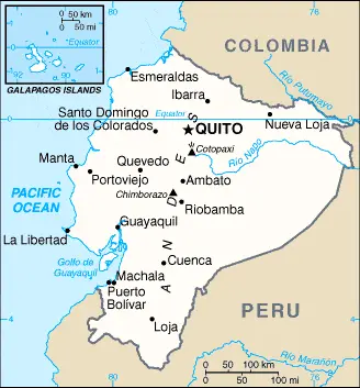
ECUADOR is an Andean country situated in the northwest of the South American continent. It is bounded to the north by Colombia, east and south by Peru, and the west by the Pacific Ocean. It also includes the Galapagos Islands, located about 965 kilometers or 600 miles west of the mainland.

Read more

Google Maps™ driving directions home » Ecuador

The most Googled products in each country in South America

Just like earlier, today, in our popular culture, most countries are stereotypically associated with certain products or services. Probably you also would think of Germany regarding beer or Mercedes, carpets of Turkey, electronics of Japan, or pizza of Italy.

Read more

Google Maps™ driving directions home » Ecuador

Ecuador Google Map

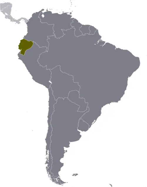
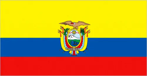
This image shows the draft map of Ecuador, South America. For more details of the map of Ecuador, please see this page below. This image shows the location of Ecuador, South America. For more geographical details of Ecuador, please see this page below. This image shows the flag of Ecuador, South America. For more details of the flag of Ecuador, please see this page below.
Borderline map of Ecuador Location map of Ecuador Flag of Ecuador

Ecuador Google map

Google Maps and Detailed Facts of Ecuador (EC). This page lets you explore Ecuador and its border countries (Country Location: Western South America, bordering the Pacific Ocean at the Equator, Colombia, and Peru) through detailed Satellite imagery – fast and easy as never before Google Maps.

Find comprehensive information about this country’s diversity below: Google maps, geography, economy, science, people, culture, environment, government, and history – All in One Wiki page.

There is also a Street View and free Driving Directions at your service. Your Google Satellite Map Sightseeing in Ecuador, in South America, starts here at Driving Directions and Maps.com.

Read more