
Driving Directions and Google Map of Hungary — Roads, Routes & Navigation Guide

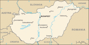
Hungary — Magyarország in Hungarian — is a landlocked country in Central Europe, bordered by Austria to the west, Slovakia to the north, Ukraine to the northeast, Romania to the east, Serbia to the south, Croatia to the southwest, and Slovenia to the west. With an area of 93,028 km² and a population of approximately 9.7 million, Hungary sits astride one of Europe’s most strategically important crossroads: the Budapest corridor links Western Europe with the Balkans, Turkey, and the Middle East, while the east–west motorway axes connect the Germanic heartland with Ukraine and Romania.
Hungary drives on the right-hand side of the road with left-hand drive vehicles. Speed limits are in kilometres per hour. The motorway network — designated with the M prefix (autópálya) — radiates from Budapest like spokes of a wheel, with major routes reaching all seven of Hungary’s land borders. The distinctive feature of driving in Hungary is the e-matrica electronic vignette: all vehicles using motorways and expressways must purchase a plate-registered vignette, fully electronic since 2013 with no physical sticker.
Hungary enforces an absolute zero-tolerance alcohol limit of 0.00% BAC — no alcohol is permitted for drivers under any circumstances. The currency is the Hungarian Forint (HUF / Ft); Hungary is an EU member but has not adopted the euro. The unified EU emergency number is 112; Hungarian dedicated numbers are 107 (police), 104 (ambulance), and 105 (fire brigade). Use the route planner on our homepage to plan your driving routes across Hungary.
The Hungarian Road Network
Hungary’s national road infrastructure is managed by Magyar Közút Nonprofit Zrt. (Hungarian Public Roads) for the secondary national road network, while motorway construction and operation falls under NMFK (National Motorway and Infrastructure Development), successor to NIF Zrt. (National Infrastructure Development Company). Hungary’s total road network extends to approximately 215,000 km; the national (primary) network is approximately 6,900 km. Since EU accession in 2004, Hungary has invested heavily in motorway and expressway expansion, financed substantially by EU Cohesion Funds.
Hungary’s motorway network of approximately 2,100 km is characterised by its radial structure: virtually all major motorways begin in or near Budapest and extend outward to a national border. This design reflects Hungary’s historical centralisation around the capital but creates significant bottlenecks in the Budapest metropolitan area.
Motorways (M-prefix — autópálya) and expressways (autóút):
- M1 — Budapest–Győr–Hegyeshalom (Austrian border, ~170 km): Hungary’s most strategically important motorway; the main corridor between Budapest and Vienna. Connects to the Austrian A4 (Ostautobahn) at the Hegyeshalom/Nickelsdorf border crossing. Journey time Budapest to Vienna approximately 2.5–3 hours (250 km total). This corridor carries some of the heaviest freight and passenger volumes in Central Europe — the Vienna–Budapest route is one of the busiest motorway pairs in the EU. The M1 also serves Győr, Hungary’s major industrial city in the northwest.
- M0 — Budapest orbital ring road (~83 km completed of ~108 km planned): The ring motorway around Budapest connecting all the radial motorways. The eastern and northern sections (M0 east: M5/M4/M3 to M2/M0 north: toward M11 and M2) are complete; the western section between the M1 and M7 corridors is the critical missing link, causing significant transit traffic to pass through central Budapest. Full ring completion remains one of Hungary’s highest infrastructure priorities.
- M2 — Budapest–Vác–Párkány (Slovak border approach, ~35 km): Short motorway north from Budapest toward the Slovak border at Esztergom/Štúrovo; connections to the planned M11 extension are under development.
- M3 — Budapest–Miskolc–Nyíregyháza–Záhony (Ukrainian border, ~280 km): The northeastern motorway; connects Budapest with the Miskolc industrial region, continues to Nyíregyháza and the Ukrainian border crossing at Záhony/Čop. Since the 2022 Russian invasion of Ukraine, the M3 corridor has experienced greatly elevated freight traffic as goods and humanitarian aid move between Western Europe and Ukraine. Journey time Budapest to Záhony approximately 3.5–4 hours.
- M4 — Budapest–Berettyóújfalu–Artánd (Romanian border, ~180 km): Eastern motorway connecting Budapest with Romania at the Artánd/Borș crossing near Oradea; continues as Romanian A3 toward Cluj-Napoca. The M4 was completed progressively 2016–2022. Journey time Budapest to Romanian border approximately 2.5–3 hours.
- M5 — Budapest–Kecskemét–Szeged–Röszke (Serbian border, ~177 km): The southern motorway to Serbia; connects Budapest with the Serbian border at Röszke/Horgoš and continues via the Serbian A1 toward Novi Sad and Belgrade. One of the primary routes of the Pan-European Corridor X. Journey time Budapest to Serbian border approximately 2–2.5 hours; to Belgrade approximately 4.5–5 hours total (380 km).
- M6 — Budapest–Dunaújváros–Pécs–Bóly (Croatian border, ~200 km): The southwest motorway, paralleling the Danube, connecting Budapest with Pécs (Hungary’s fifth-largest city) and the Croatian border. The M6 connects to the Croatian A5 near Osijek and offers an alternative route to Zagreb via the M7 corridor. Journey time Budapest to Pécs approximately 2–2.5 hours (200 km).
- M7 — Budapest–Lake Balaton–Nagykanizsa–Letenye (Croatian border, ~230 km): The southwest-to-west motorway; the primary route to Croatia and the Adriatic Sea, passing along the southern shore of Lake Balaton (Hungary’s largest lake and premier summer resort). Journey time Budapest to Croatian border approximately 2.5–3 hours; to Zagreb approximately 3.5–4 hours; to Split (Adriatic coast) approximately 7–8 hours. In July and August, the M7 is one of the most congested motorways in Central Europe as Hungarian and Austrian/German holidaymakers travel to the Croatian coast.
- M15 — branch of M1 toward Rajka (Slovak border, ~14 km): Short branch from the M1 to the Slovak border at Rajka/Čunovo, providing a secondary crossing option toward Bratislava (the Slovak capital is only ~15 km from this crossing).
- M30 — Miskolc branch (~30 km): Branch motorway serving Miskolc city from the M3.
- M35 — Debrecen bypass (~35 km): Bypass motorway around Debrecen (Hungary’s second city) connecting the M3 with the eastern road network.
- M43 — Szeged–Makó (~42 km): Branch from M5 serving the Szeged-Makó corridor, with plans to extend to the Romanian border at Nagylak/Nădlac.
- M70 — Letenye–Tornyiszentmiklós (Slovenian border, ~14 km): Short branch from M7 to the Slovenian border at Tornyiszentmiklós/Pince; connects to Slovenian A5 toward Maribor and Ljubljana.
National roads (főút, numbered 1–89 and numbered two-digit/three-digit routes): Below the motorway tier, Hungary’s national road network provides connections between towns and regions. Roads numbered 1–9 are the primary national routes (elsőrendű főút), broadly matching the original routes superseded by motorways. Roads numbered 10–89 are secondary national routes. Most national roads outside Budapest are single-carriageway two-lane roads; road quality is generally good in western Hungary (Transdanubia) and reasonable in the Great Hungarian Plain (Alföld) east of the Danube.
Driving Rules and Legal Requirements
Hungarian road traffic law is governed by the Road Traffic Act (Közúti Közlekedési Törvény, Act I of 1988 and subsequent amendments) and related government decrees. Hungary is a full EU member and applies EU traffic legislation; it has been a Schengen Area member since 21 December 2007.
Driving licences: EU/EEA driving licences are fully valid in Hungary without restriction. UK licences remain valid for visitor use post-Brexit. Non-EU nationals may drive in Hungary on their national licence for short visits; for licences in non-Latin scripts or from countries not party to the 1968 Vienna Convention, an International Driving Permit (IDP) is required alongside the national licence. Non-EU residents staying more than 185 days must exchange their licence for a Hungarian vezetői engedély.
Insurance: Third-party liability insurance (kötelező gépjármű-felelősségbiztosítás — KGFB) is mandatory for all vehicles. EU-registered vehicles carry automatic third-party coverage across EU member states. Carrying the Green Card is strongly recommended for non-EU vehicles and as proof of coverage for all foreign-registered vehicles.
Alcohol — absolute zero tolerance: Hungary enforces a 0.00% BAC limit — no measurable alcohol is permitted in the driver’s blood. This is one of the strictest drink-drive rules in Europe. Any detectable amount of alcohol constitutes an infraction; above 0.08% BAC is a criminal offence. Police conduct regular breathalyser checks at roadside checkpoints, particularly on weekends, public holidays, and near nightlife areas. The practical advice for visitors is identical to Czech Republic: treat Hungary as completely zero-tolerance — do not drive after consuming any alcohol.
Headlights — mandatory at all times: Dipped headlights (or daytime running lights) must be in use at all times of day throughout the entire year on all roads outside built-up areas. Within built-up areas, headlights are required between sunset and sunrise and during poor visibility. Most modern vehicles comply automatically via DRL. Failing to use headlights outside urban areas in daylight results in a fine.
Seatbelts: Mandatory for all occupants front and rear. Children under 150 cm must use an appropriate approved child restraint system. Children under 3 must travel in an approved child seat; they may not travel in the front seat unless a deactivated-airbag rear-facing seat is used. Non-compliance fine: HUF 15,000–HUF 30,000 per passenger.
Mobile phones: Use of handheld mobile phones while driving is strictly prohibited. Fine: HUF 10,000–HUF 30,000. Hands-free devices are permitted. Enforcement is active across the Hungarian Police Traffic Department.
Winter tyres: Winter tyres are not universally legally mandated in Hungary (unlike in Austria or Slovakia), but their use is strongly recommended from November to March, particularly in the northeastern highlands (Borsod, Zemplén), the Mátra–Bükk mountain areas, and the Hungarian–Romanian border region. The Great Hungarian Plain (Alföld) is relatively flat and less prone to severe snow, but ice on unlit rural roads is common. All-season tyres are a practical compromise.
Required safety equipment: All vehicles must carry a reflective warning triangle and a first-aid kit (elsősegély-felszerelés). A high-visibility vest is required to be worn when exiting the vehicle on a road or hard shoulder. Fire extinguisher: required for vehicles over 3.5t; strongly recommended for passenger cars. Spare tyre or tyre repair kit is required. Police roadside checks verify equipment; missing items result in fines.
Trams in Budapest: Trams have priority over all road traffic at junctions in Budapest. Overtaking a stationary tram at a stop is prohibited when passengers are boarding or alighting — unless a raised passenger refuge is provided. Budapest’s extensive tram network (over 200 km, the most-used in Europe by ridership) creates frequent interactions with road traffic; visitors unfamiliar with tram priority rules are at particular risk of violations.
Traffic Police (Közlekedési rendőrség): Traffic enforcement is carried out by the Rendőrség (Hungarian Police) Traffic Division. Police vehicles are white with blue and yellow-green livery. Officers stop vehicles by activated blue lights. When stopped, pull over safely, remain in the vehicle, and present your driving licence (jogosítvány), vehicle registration (forgalmi engedély), and insurance document. English language ability varies; officers in major cities and on border motorways generally have some English. Fixed-penalty fines (helyszíni bírság) for minor offences are paid on the spot or within 30 days; for serious offences, court or administrative proceedings are initiated.
Speed Limits on Hungarian Roads
Speed limits in Hungary are set by government decree and apply by default by road type; posted signs always override defaults. All limits are in km/h.
| Road Type | Cars / Light Vehicles | Vehicles with Trailer | Trucks / Buses |
|---|---|---|---|
| Motorway (autópálya, M-prefix) | 130 km/h | 80 km/h | 90 km/h |
| Expressway (autóút, M-prefix) | 110 km/h | 80 km/h | 90 km/h |
| National road outside built-up area (főút) | 90 km/h | 70 km/h | 70 km/h |
| Urban / built-up area (lakott terület) | 50 km/h | 50 km/h | 50 km/h |
| Residential zone (lakóövezet) | 20 km/h | 20 km/h | 20 km/h |
Speed enforcement uses fixed cameras, mobile police units, and section speed cameras on some motorway sections. The VÉDA (Városi és elővárosi közúti közlekedés detektív automatizált rendszere — automated urban and suburban traffic monitoring system) camera network in Budapest monitors speeds, red-light violations, and lane discipline. Hungary operates a demerit points system (pontrendszer); drivers accumulate points for violations and face licence suspension on reaching the threshold. Speed fines range from HUF 5,000 for minor excess to HUF 300,000 and immediate licence confiscation for the most severe violations.
Zero-tolerance BAC penalties: Any detectable alcohol (0.00–0.079% BAC): misdemeanour fine HUF 15,000–HUF 300,000, licence suspension up to 6 months, demerit points. Above 0.08% BAC: criminal offence, imprisonment up to 2 years, permanent licence revocation possibility for repeat offenders. Refusal to submit to testing carries the same penalty as exceeding the criminal threshold.
The e-matrica Vignette System
Hungary operates an electronic motorway vignette system called e-matrica (elektronikus matricarendszer). Since 1 January 2013, Hungary replaced the traditional paper windscreen sticker with a fully electronic system: there is no physical sticker. The vignette is registered to your vehicle’s licence plate and verified electronically by roadside cameras and police plate-readers. Virtually all motorways and expressways designated with the M-prefix require a valid e-matrica.
Who needs an e-matrica: All vehicles up to 3.5 tonnes gross vehicle weight using M-designated motorways or expressways. This includes passenger cars, motorcycles (from 50cc), campervans under 3.5t, and light vans. Emergency vehicles, disabled badge vehicles, and certain other categories are exempt. Vehicles over 3.5t use the separate HU-GO distance-based toll system (OBU transponder required).
Vignette validity and prices (2025/26 rates in HUF; subject to annual revision):
| Vignette Type | Validity Period | Price (HUF) | Approx. (EUR) |
|---|---|---|---|
| Annual (éves) | 1 calendar year | HUF 24,610 | ~€63 |
| Monthly (havi) | 30 consecutive days | HUF 6,240 | ~€16 |
| 10-day (tíz napos) | 10 consecutive days | HUF 5,390 | ~€14 |
| 1-day (egynapos) | 1 calendar day | HUF 2,975 | ~€8 |
County-specific (annual) vignettes are also available for drivers who only use motorways in one or two Hungarian counties, at a lower price than the nationwide annual vignette — useful if you only intend to drive in a specific region (e.g., just around Budapest, or just the Balaton area).
How to purchase e-matrica: The vignette can be bought through the following channels:
- Official website: motorway.hu (available in English, German, Hungarian, and other languages) — the recommended advance purchase option. Enter your licence plate, vehicle category, vignette type, and payment details. The vignette is registered immediately; no sticker or confirmation document needs to be carried, though keeping a digital record is advisable.
- Mobile app: e-matrica official app (iOS and Android); same functionality as the website.
- Petrol stations and post offices: Available at MOL, Shell, OMV, and other petrol station chains throughout Hungary, and at Magyar Posta offices. Also at border crossing shops and service areas immediately inside Hungary.
Driving on a motorway without a valid e-matrica results in a fine of HUF 35,000–HUF 70,000 (approximately €90–€180), significantly exceeding the vignette cost itself. Police verify vignette status via automated plate-recognition cameras and roadside checks. The fine can also be imposed retrospectively if camera records show a vehicle using a motorway without registration. Paying on the spot within a short window (purchasing immediately at the next petrol station if stopped near entry) may reduce the fine.
HU-GO (for vehicles over 3.5t): Heavy vehicles pay distance-based tolls on motorways, expressways, and selected national roads via the HU-GO system. An OBU (on-board unit) transponder is required, obtainable at HU-GO customer points at borders and major motorway service areas. Toll rates for heavy vehicles are based on vehicle emission category (EURO standard) and number of axles.
Fuel, Electric Vehicles, and Charging
Fuel is widely available from MOL (Magyar Olaj- és Gázipari Nyrt. — the dominant Hungarian state-related energy company with the largest petrol station network), Shell, OMV, Lukoil, Esso, and supermarket chains (Tesco, Auchan). MOL stations are ubiquitous across Hungary, including on all major motorway service areas. Fuel prices in Hungary are regulated; the government has at various times imposed price caps on petrol and diesel, which can make Hungarian fuel prices lower than regional neighbours (Austria, Slovakia), though this varies with policy changes. Fill up before entering remote areas of the Alföld (Great Plain), the Zemplén hills, or the Somogy and Baranya counties in southwest Hungary, where stations can be spaced widely on rural roads.
Fuel types: 95 RON unleaded (benzin 95) and 98 RON premium are standard. Diesel (gázolaj) in standard and premium grades. LPG (LPG / autogas) is moderately available at MOL and some independent stations. CNG (compressed natural gas) is available at selected MOL stations in major cities. Fuel prices — particularly on motorway service areas — are noticeably higher than at off-motorway stations; it is common practice among Hungarian drivers to fill up at supermarket or independent stations in cities before motorway journeys.
Electric vehicles (EV): Hungary’s EV charging infrastructure is growing. MOL Plugee (MOL’s EV charging brand) operates fast chargers at MOL petrol stations across the motorway network and in cities. MOBILITI (E.ON Hungary’s network) provides AC and DC charging points in urban areas. Tesla Superchargers are present in Budapest (multiple locations), Győr, Debrecen, Pécs, and at several motorway service areas along M1, M3, and M7. CCS Combo 2 is the dominant standard for DC fast charging; AC Type 2 for slow/overnight. The IONITY network has chargers at M1 and M7 service areas. For long-distance EV travel, the M1 (Budapest–Vienna), M7 (Budapest–Croatian border), and M3 (Budapest–Ukraine direction) corridors have adequate charging; the southeastern motorways (M4, M5, M6) have improving but sparser coverage. Rural areas of eastern Hungary (Alföld, Szabolcs) have limited public charging outside major towns.
Driving in Budapest, Debrecen, and Pécs
Budapest
Budapest — Hungary’s capital and primate city — has a population of approximately 1.75 million within the city limits and nearly 3.3 million in the metropolitan area, making it one of the largest capital cities in Central Europe. The city is divided by the Danube (Duna) into Buda (hilly, western bank) and Pest (flat, eastern bank). Nine road bridges cross the Danube in Budapest, of which the Erzsébet híd, Szabadság híd, Lánchíd (Chain Bridge), Margit híd, and Árpád híd are the most significant for road traffic. Several bridges are under reconstruction or weight-restricted; check current status before routing heavy vehicles across them.
Driving in central Budapest is challenging and generally unnecessary for sightseeing: the city has an excellent public transport network comprising Metro (4 lines), trams (the No. 2 Danube tram and No. 4/6 ring trams are among the most-used in Europe), trolleybuses, and buses. For visitors, parking at a hotel outside the historic core and using public transport is strongly recommended. The central paid parking zone (fizető parkolózóna) covers most of Pest’s inner districts (V, VI, VII, VIII, XIII) with hourly rates of HUF 400–HUF 900 depending on zone; residential parking permits restrict non-resident daytime parking in many streets.
The incomplete M0 ring road is the dominant traffic management challenge for Budapest. Transit traffic from M5/M4/M3 (east and south) wishing to reach M1/M7 (west and northwest) cannot currently use a complete orbital bypass; significant volumes must use the city’s radial roads (the Hungária körút ring road and connecting routes) or the partially complete M0. The Budapest urban motorway sections (M3, M5 entering the city) can be severely congested during morning and evening peak hours. Allow significant extra time for rush-hour journeys through or around Budapest.
Debrecen
Debrecen, Hungary’s second-largest city (population ~200,000; metropolitan area ~330,000), is the regional capital of the Northern Great Plain and Eastern Hungary. Located approximately 230 km east of Budapest on the M35 bypass motorway (connected to the M3), Debrecen is Hungary’s principal eastern city and the gateway to both Ukraine (via M3/Záhony) and Romania (via M4/Artánd). The city has a compact centre; driving in Debrecen is generally manageable, with a well-maintained urban road network. A tram line connects the railway station to the university and main destinations. Debrecen International Airport serves the region with domestic and selected European flights.
Pécs
Pécs (population ~140,000; metropolitan ~220,000) in southern Hungary (Baranya county) is Hungary’s fifth-largest city, situated at the foot of the Mecsek Mountains near the Croatian border. Accessible via the M6 motorway from Budapest (approximately 2–2.5 hours), Pécs is a UNESCO World Heritage city (Early Christian Necropolis), a former European Capital of Culture (2010), and an important cultural and university centre. Driving in central Pécs is moderate in difficulty; the compact historic area has pedestrianised streets around the cathedral and main square (Széchenyi tér). Parking in the centre uses a blue-zone ticket system.
Long-Distance Routes and Scenic Drives
Budapest – Vienna (~250 km via M1/A4): One of the most travelled motorway corridors in Europe. The M1 connects Budapest with the Austrian border at Hegyeshalom/Nickelsdorf, where it becomes the Austrian A4 (Ostautobahn) toward Vienna. Journey time approximately 2.5–3 hours including border crossing (no formal controls between Schengen members, but variable traffic at the junction). This route is extremely busy on Friday afternoons (westbound) and Sunday evenings (eastbound) with workers and tourists. The full Vienna–Budapest expressway route is designated European route E60.
Budapest – Lake Balaton (~100–130 km via M7): The M7 motorway takes you to the southern shore of Lake Balaton, Hungary’s largest lake (approximately 77 km long), within about 1.5 hours. Lake Balaton is Hungary’s most popular domestic holiday destination, with a string of resort towns on both the southern shore (Siófok, Fonyód, Keszthely) and the more upscale northern shore (Balatonfüred, Tihany, Badacsony). In peak summer (late July–August), the M7 between Budapest and the lake becomes one of the most congested roads in Hungary; journey times can double on Friday afternoons. The northern shore is reached via the M7 to Balatonalmádi and then around the lake, or via the national road 71 (Balatoni kiskörút — the Balaton Ring Road) which circumnavigates the entire lake.
Budapest – Bratislava (~200 km via M1/M15 or via M0/M2 + ferry): Bratislava, the Slovak capital, is close to Budapest and easily reached via the M1 motorway to Hegyeshalom, then Austrian A4/Slovak D2, or via the M15 branch to the Rajka/Čunovo crossing connecting directly to the Slovak road network toward Bratislava. The most direct approach is via M1–M15–Slovak Route 2–D2, approximately 200 km and 2.5 hours. Alternatively, a scenic Danube ferry crossing at Štúrovo/Esztergom provides a picturesque route north through the Danube Bend.
The Danube Bend (Dunakanyar): One of Hungary’s most spectacular drives, the road through the Danube Bend northeast of Budapest follows the river through dramatic curves between the Börzsöny, Visegrád, and Pilis mountain ranges. Key stops include Szentendre (charming Serbian Orthodox heritage town), Visegrád (medieval castle ruins with panoramic Danube views), and Esztergom (Hungary’s ecclesiastical capital, home to the largest basilica in Hungary). The Danube Bend roads are primarily national routes (roads 11 and 12); they are scenic and popular but can be congested on summer weekends. No motorway access — this is deliberately a slower, scenic drive.
Tokaj Wine Region and Zemplén Hills (northeast Hungary): The Tokaj Wine Region — a UNESCO World Heritage Site famous for its sweet aszú wines — is located approximately 220 km northeast of Budapest, reachable via the M3 motorway toward Miskolc then regional roads. The volcanic hills of the Zemplén range and the picturesque wine villages of Tokaj, Tarcal, and Erdőbénye reward unhurried exploration on narrow mountain roads. This area borders Slovakia across the Bodrog and Tisza rivers. The roads in the Zemplén hills are often narrow and winding; allow ample time.
Budapest – Belgrade (~380 km via M5): The M5 motorway provides a fast, well-maintained route to the Serbian border at Röszke. South of Röszke, the Serbian A1 (Autoput) continues to Novi Sad (approximately 90 km from the border) and Belgrade (approximately 175 km). Journey time Budapest to Belgrade approximately 4.5–5 hours. This is a major Balkan transit corridor heavily used by truck freight and summer holiday traffic from Western Europe to Greece, North Macedonia, and Turkey.
Border Crossings with Neighbouring Countries
Hungary borders seven countries: Austria, Slovakia, Ukraine, Romania, Serbia, Croatia, and Slovenia. Four of these (Austria, Slovakia, Croatia, and Slovenia) are Schengen members; crossings with them have no passport controls for EU/Schengen nationals. Romania became a full Schengen land-border member in January 2025. Serbia remains non-Schengen (EU candidate); Ukraine is non-Schengen. Full border crossing formalities apply at Serbian and Ukrainian crossings.
- Hegyeshalom / Nickelsdorf — Austria (M1 / A4): Hungary’s busiest border crossing; the main Vienna–Budapest motorway corridor. Schengen — no controls for EU citizens. Open 24 hours. Exceptionally heavy freight and tourist traffic.
- Rajka / Čunovo — Slovakia (M15): Secondary motorway crossing; connects to the Slovak road network toward Bratislava (~15 km). Schengen — no controls. Open 24 hours.
- Esztergom / Štúrovo — Slovakia (road bridge): The Maria Valeria Bridge connects Esztergom (Hungary) with Štúrovo (Slovakia) across the Danube. National road crossing; popular with tourists visiting the Danube Bend. Schengen — no controls.
- Komárom / Komárno — Slovakia (road bridge): Twin cities on opposite banks of the Danube; road crossing connecting Hungarian road 13 with Slovak Route 64 toward Nitra. Schengen — no controls.
- Záhony / Čop — Ukraine (M3 / M06 Ukraine): Hungary’s primary crossing with Ukraine; the main logistics corridor for goods transiting between Western Europe and Ukraine, especially since 2022. Passport and customs controls apply. Expect very significant queuing — particularly for freight; passenger cars typically have shorter waits. Open 24 hours. Non-EU nationals crossing into Ukraine must meet Ukrainian visa/entry requirements. Verify current border wait times via Hungarian Police real-time border crossing information.
- Artánd / Borș — Romania (M4 / Romanian A3): The main motorway crossing to Romania; connects Budapest to Oradea (~30 km east of the border) and onward to Cluj-Napoca and Bucharest. Romania is a full Schengen land-border member since January 2025 — passport controls have been phased out. Open 24 hours.
- Nagylak / Nădlac — Romania (road 43 / Romanian A1): Southern crossing connecting Szeged area with Arad (Romania) and the Romanian motorway toward Bucharest. Schengen (Romania). Open 24 hours.
- Röszke / Horgoš — Serbia (M5 / Serbian A1): Hungary’s primary crossing with Serbia; the Corridor X motorway. Full passport and customs checks apply (Serbia is non-Schengen). Queue times can be significant at peak holiday periods. Open 24 hours.
- Tompa / Kelebija — Serbia (national road): Secondary crossing south of Röszke; national road connection. Full border controls apply. Open 24 hours.
- Letenye / Goričan — Croatia (M7 / Croatian A4): Main motorway crossing to Croatia; the primary route to Zagreb and the Adriatic. Schengen — no controls. Open 24 hours. Extremely high traffic in summer (July–August) with Balaton and Adriatic holidaymakers.
- Tornyiszentmiklós / Pince — Slovenia (M70): Motorway branch crossing to Slovenia; connects to Slovenian A5 toward Maribor and Ljubljana. Schengen — no controls. Open 24 hours.
- Rédics / Dolga Vas — Slovenia (national road): Secondary crossing south of the M70; national road connection to the Slovenian Prekmurje region. Schengen — no controls.
Road Safety and Emergency Procedures
Hungary’s road safety has improved significantly over the past two decades: annual road fatalities fell from approximately 1,400 in 2000 to around 480–550 in recent years — a reduction of roughly 60%. Despite this improvement, Hungary’s fatality rate per billion vehicle-km remains above the EU average. The primary risk factors are speeding on rural national roads, urban pedestrian accidents, fatigue on long-distance journeys, and alcohol-related incidents (despite the zero-BAC rule).
Most dangerous road types: Single-carriageway national roads (főút) outside urban areas — particularly those crossing the flat Alföld where long straight sections encourage excessive speed and attention lapses. The section of Road 4 (Budapest–Debrecen–Záhony) is among the most accident-prone national roads in Hungary. Urban pedestrian zones transitions and poorly lit rural village passages also present significant risk.
Breakdown on a motorway: Move immediately to the hard shoulder; hazard lights on; exit the vehicle wearing your high-visibility vest. Deploy the warning triangle at minimum 100 m behind the vehicle. Call 112 (EU unified emergency) or the motorway assistance number 188 (Magyar Közút emergency). Motorway SOS telephones are installed at regular intervals on M-roads. The Hungarian Automobile Club (Magyar Autóklub, 188) provides roadside assistance; ADAC/ÖAMTC members may be able to claim reciprocal assistance.
Accident procedure: Call 112 if there are injuries or significant damage. Complete the European Accident Statement form with the other party. Photograph the scene thoroughly. Police attendance (107) is required for personal injury accidents or if parties cannot agree on fault. For rental vehicles, contact the rental company emergency line immediately. Do not move vehicles before police arrive if there are injuries.
Emergency contacts: 112 (unified EU — police/ambulance/fire), 107 (Police — Rendőrség), 104 (Ambulance — Mentőszolgálat), 105 (Fire Brigade — Tűzoltóság), 188 (Magyar Közút motorway emergency / Hungarian Automobile Club roadside assistance). English-speaking operators on 112.
FAQ: Driving in Hungary
Q: Do I need an e-matrica (vignette) to drive on Hungarian motorways?
A: Yes. All vehicles up to 3.5t using M-designated motorways and expressways in Hungary must have a valid e-matrica electronic vignette registered to their licence plate. There is no physical sticker — the system is entirely electronic. Purchase it in advance at motorway.hu, or at a Hungarian petrol station, post office, or border shop. Options include: 1-day (HUF 2,975/~€8), 10-day (HUF 5,390/~€14), monthly (HUF 6,240/~€16), or annual (HUF 24,610/~€63). Driving without a valid e-matrica results in a fine of HUF 35,000–70,000. County-specific vignettes are available for travellers using only part of the network.
Q: What is the drink-drive limit in Hungary?
A: Hungary enforces an absolute zero-tolerance alcohol limit of 0.00% BAC. No alcohol whatsoever is legally permitted in the driver’s blood — one of the strictest rules in Europe. Any detectable amount results in a fine and demerit points; above 0.08% BAC is a criminal offence. Police conduct regular breathalyser tests. Treat Hungary as completely zero-tolerance: do not drive after any alcohol consumption.
Q: What currency does Hungary use — can I pay in euros?
A: Hungary uses the Hungarian Forint (HUF / Ft). Hungary is an EU member but has not adopted the euro, with no fixed timeline for adoption. Euro cash is accepted at some border services, major tourist hotels, and motorway service areas, but you will generally receive change in HUF. ATMs (bankautomaták) are widely available. Credit and debit cards are broadly accepted. Currency exchange (valutaváltó) offices are available in Budapest and border areas; avoid airport and hotel exchange desks for best rates.
Q: How should I plan driving to Croatia via Hungary for the Adriatic coast?
A: The M7 motorway is the standard route from Budapest to Croatia. From Budapest, take the M7 southwest toward Lake Balaton and continue to the Croatian border at Letenye/Goričan (~230 km, ~2.5–3 hours). The Croatian A4 then connects to Zagreb (~50 km south of the border) and the full Croatian motorway network toward Split, Dubrovnik, and Rijeka. In July–August, the M7 between Budapest and Balaton is one of the most congested motorways in the region; consider departing Friday early morning or Saturday to avoid peak outbound Friday-evening traffic. Remember to purchase a Croatian motorway vignette (ENC sticker or e-vignette) for the Croatian section.
Q: Do I need headlights on during the day in Hungary?
A: Yes, on roads outside built-up areas. Hungarian law requires dipped headlights (or DRL) to be on at all times on roads outside urban areas, year-round. Within urban areas, headlights are required between dusk and dawn and in poor visibility. Vehicles with automatic daytime running lights comply automatically; older vehicles without DRL must use dipped headlights on all open roads.
Q: Is there a tram priority rule in Budapest?
A: Yes. Trams in Budapest have absolute priority over road traffic at intersections. You must give way to trams at all times. When a tram stops at a stop without a raised pedestrian refuge platform, you must stop and allow passengers to board and alight safely before proceeding — you may not drive past a stationary tram with doors open unless a raised refuge is present. Budapest’s tram network is one of the most extensive in Europe; violations of tram priority rules are among the most common traffic offences by visiting drivers.
Q: What are wait times like at the Hungarian–Ukrainian border at Záhony?
A: Since Russia’s full-scale invasion of Ukraine in February 2022, the Záhony/Čop crossing has experienced extremely elevated freight volumes as goods transit through Hungary to and from Ukraine. Freight truck queues can extend for many hours; passenger car waits are typically shorter (30 minutes to several hours depending on the day and time). Check real-time border wait information from the Hungarian Police website (police.hu/hatarinfo) before travelling. Arrive with a full fuel tank and sufficient food and water.
Q: Is Lake Balaton easily accessible by road from Budapest?
A: Yes — Lake Balaton is one of the easiest day-trip or weekend destinations from Budapest. The M7 motorway takes you to Siófok on the southern shore in approximately 1.5 hours (105 km). The northern shore (Balatonfüred, Tihany Peninsula, Badacsony) is approximately 130–160 km, about 1.5–2 hours. The Balaton Ring Road (national road 71) circumnavigates the entire lake, making a circuit of all major resort towns feasible in a day. In peak summer, however, Friday afternoon traffic on the M7 from Budapest can add 1–2 hours to your journey.
Sources and Update Note
This guide was compiled from the following primary sources: Hungarian Road Traffic Act (Közúti Közlekedési Törvény, Act I/1988 and amendments); NMFK (National Motorway and Infrastructure Development) official motorway data; e-matrica official documentation (motorway.hu); HU-GO official documentation; Magyar Közút Nonprofit Zrt. road network data; Hungarian Police (Rendőrség) traffic enforcement guidelines; KSH (Hungarian Central Statistical Office) road accident statistics; CIA World Factbook — Hungary; Wikipedia — Transport in Hungary, Hungarian motorways, Lake Balaton; OpenStreetMap Hungary. Speed limits, vignette prices (in HUF), and traffic regulations are correct as of early 2026 and are subject to change; vignette prices are set annually by government decree and the HUF exchange rate fluctuates. Always verify current vignette prices and regulations at motorway.hu. This page will be updated as regulations change.