Google Maps™ driving directions home » Europe maps

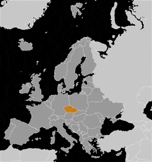
Czechia Google Map

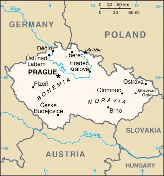
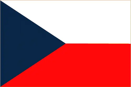
This image shows the draft map of Czechia, Europe. For more details of the map of Czechia, please see this page below. This image shows the location of Czechia, Europe. For more geographical details of Czechia, please see this page below. This image shows the flag of Czechia, Europe. For more details of the flag of Czechia, please see this page below.
Borderline map of Czechia Location map of Czechia Flag of Czechia

Czechia Google map

Google Maps and Detailed Facts of Czechia (CZ). This page lets you explore Czechia and its border countries (Country Location: Central Europe, between Germany, Poland, Slovakia, and Austria) through detailed Satellite imagery – fast and easy as never before Google Maps.

Find comprehensive information about this country’s diversity below: Google maps, geography, economy, science, people, culture, environment, government, and history – All in One Wiki page.

There is also a Street View and free Driving Directions at your service. Your Google Satellite Map Sightseeing in Czechia, in Europe, starts here at Driving Directions and Maps.com.

Read more

Google Maps™ driving directions home » Europe maps

Denmark

Driving Directions Denmark

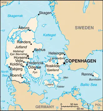
DENMARK, the most southerly and smallest of Scandinavia, is a constitutional monarchy in northern Europe. It com­prises most of the Jutland or Jylland Peninsula, which protrudes north­wards from the North German Plain, and more than 500 islands, 100 of which are inhabited. The main islands, sandwiched between the east coast of Jutland and the southwest of Sweden, are Fyn, Langeland, Olland, Falster, Mon, and Sjaelland. Bornholm, which lies about 128-kilo­meters or 80 miles east of Sjaelland off the southeastern tip of Sweden, also belongs to Denmark. The Faeroe (Foroyar) Islands in the Atlantic Ocean and Greenland off the coast of Canada are self-governing, depen­dent territories of Denmark. The North Sea lies to the west of the Jutland Peninsula. The North Sea arm between northwest Jutland and Norway is called the Skagerrak, while that between northeast Jutland and Sweden is named the Kattegat. The Baltic Sea lies to the east of the Danish islands, and the southernmost portion of the Jutland Peninsula is within Germany.

Read more

Google Maps™ driving directions home » Europe maps

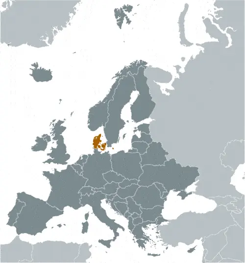
Denmark Google Map

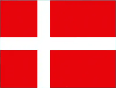
This image shows the draft map of Denmark, Europe. For more details of the map of Denmark, please see this page below. This image shows the location of Denmark, Europe. For more geographical details of Denmark, please see this page below. This image shows the flag of Denmark, Europe. For more details of the flag of Denmark, please see this page below.
Borderline map of Denmark Location map of Denmark Flag of Denmark

Denmark Google map

Google Maps and Detailed Facts of Denmark (DK). This page lets you explore Denmark and its border countries (Country Location: Northern Europe, bordering the Baltic Sea and the North Sea, on a peninsula north of Germany (Jutland); also includes several major islands (Sjaelland, Fyn, and Bornholm)) through detailed Satellite imagery – fast and easy as never before Google Maps.

Find comprehensive information about this country’s diversity below: Google maps, geography, economy, science, people, culture, environment, government, and history – All in One Wiki page.

There is also a Street View and free Driving Directions at your service. Your Google Satellite Map Sightseeing in Denmark, in Europe, starts here at Driving Directions and Maps.com.
Read more

Google Maps™ driving directions home » Europe maps

Dublin Google maps

Dublin is one of the most populated cities in Ireland, and at the same time, this city is the capital of this country. Located in Europe, you may easily find the city with the following GPS coordinates: 53.21N latitude / 06.15W longitude. For routing in Dublin, please check the free driving directions Dublin service below.

Read more

Google Maps™ driving directions home » Europe maps

Estonia

Driving Directions Estonia

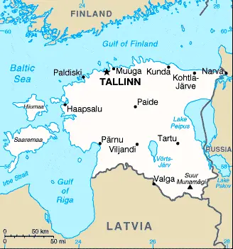
ESTONIA is a low-lying republic in northeastern Europe bounded by the Gulf of Finland and the Baltic Sea in the north and west, Russia in the east, and Latvia in the south. Estonia is a former constituent republic of the USSR and consists largely of a marshy, undulating plain with numerous forests, lakes, wetlands, and offshore islands. The largest of the islands, Saaremaa and Hiiumaa, lies across the Gulf of Riga’s mouth. The largest lakes are Peipus, which straddles the Russian border, and Vorts-Jarv in its southern central part. Numerous rivers and streams drain the country, including the Narva, which runs along the border with Russia, and the Párnu.

Read more

Google Maps™ driving directions home » Europe maps

Estonia Google Map

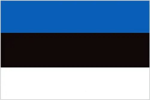
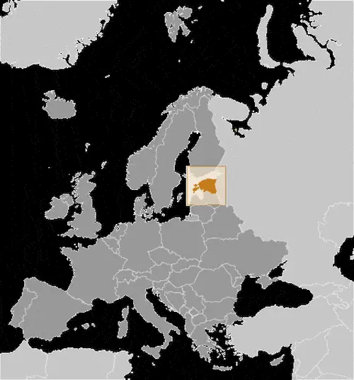
This image shows the draft map of Estonia, Europe. For more details of the map of Estonia, please see this page below. This image shows the location of Estonia, Europe. For more geographical details of Estonia, please see this page below. This image shows the flag of Estonia, Europe. For more details of the flag of Estonia, please see this page below.
Borderline map of Estonia Location map of Estonia Flag of Estonia

Estonia Google map

Google Maps and Detailed Facts of Estonia (EE). This page lets you explore Estonia and its border countries (Country Location: Eastern Europe, bordering the Baltic Sea and the Gulf of Finland, between Latvia and Russia) through detailed Satellite imagery – fast and easy as never before Google Maps.

Find comprehensive information about this country’s diversity below: Google maps, geography, economy, science, people, culture, environment, government, and history – All in One Wiki page.

There is also a Street View and free Driving Directions at your service. Your Google Satellite Map Sightseeing in Estonia, in Europe, starts here at Driving Directions and Maps.com.
Read more

Google Maps™ driving directions home » Europe maps

Faroe Islands

Driving Directions Faroe Islands

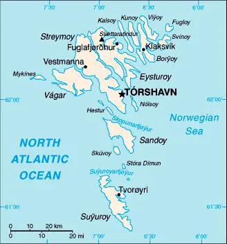
FAROE (FAEROE) ISLANDS (Foroyar) has been a self-governing region of Denmark since 1948. They consist of a group of 18 basaltic islands and situated in the North Atlantic, approximately halfway between the Shetland Islands and Iceland. The landscape of these islands characterized by steep, stepped peaks rising out of the sea to nearly 900 meters or 3,000 feet and glaciated, trough-shaped valleys.

Read more

Google Maps™ driving directions home » Europe maps

Faroe Islands Google Map

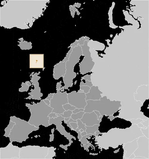
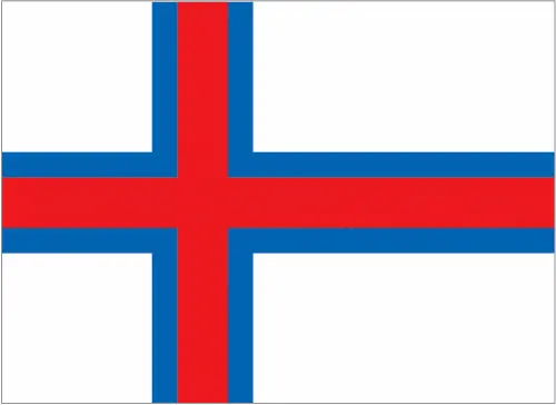
This image shows the draft map of Faroe Islands, Europe. For more details of the map of Faroe Islands, please see this page below. This image shows the location of Faroe Islands, Europe. For more geographical details of Faroe Islands, please see this page below. This image shows the flag of Faroe Islands, Europe. For more details of the flag of Faroe Islands, please see this page below.
Borderline map of Faroe Islands Location map of Faroe Islands Flag of Faroe Islands

Faroe Islands Google map

Google Maps and Detailed Facts of Faroe Islands (FO). This page lets you explore the Faroe Islands and its border countries (Country Location: Northern Europe, island group between the Norwegian Sea and the North Atlantic Ocean, about halfway between Iceland and Norway) through detailed Satellite imagery – fast and easy as never before Google Maps.

Find comprehensive information about this country’s diversity below: Google maps, geography, economy, science, people, culture, environment, government, and history – All in One Wiki page.

There is also a Street View and free Driving Directions at your service. Your Google Satellite Map Sightseeing in the Faroe Islands, in Europe, starts here at Driving Directions and Maps.com.
Read more

Google Maps™ driving directions home » Europe maps

Finland

Driving Directions Finland

FINLAND is a north European republic with about a third of its territo­ry lying within the Arctic Circle. A Scandinavian country of forests, lakes, and islands shares borders with Sweden in the northwest, Norway in the north, and the Russian Federation in the east. Its coastline lies along the Gulf of Bothnia in the west and southwest and the Gulf of Finland in the south. Both of which are arms of the Baltic Sea. Some 30,000 islands and islets line Finland’s coast, with the densest concentration in the southwest and south. The most important is the 6,500 Ahvenanmaa or Aland Islands, which lie in the Gulf of Bothnia between the mainlands of Finland and Sweden.

Read more

Google Maps™ driving directions home » Europe maps

Finland Google Map

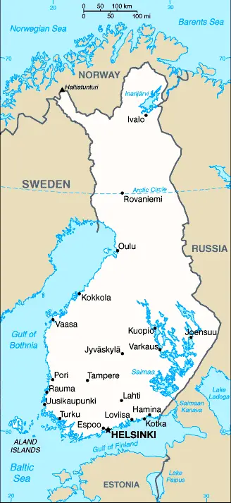
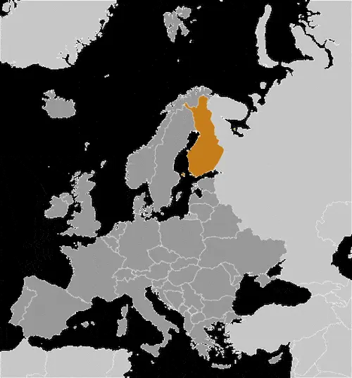
This image shows the draft map of Finland, Europe. For more details of the map of Finland, please see this page below. This image shows the location of Finland, Europe. For more geographical details of Finland, please see this page below. This image shows the flag of Finland, Europe. For more details of the flag of Finland, please see this page below.
Borderline map of Finland Location map of Finland Flag of Finland

Finland Google map

Google Maps and Detailed Facts of Finland (FI). This page lets you explore Finland and its border countries (Country Location: Northern Europe, bordering the Baltic Sea, Gulf of Bothnia, and the Gulf of Finland, between Sweden and Russia) through detailed Satellite imagery – fast and easy as never before Google Maps.

Find comprehensive information about this country’s diversity below: Google maps, geography, economy, science, people, culture, environment, government, and history – All in One Wiki page.

There is also a Street View and free Driving Directions at your service. Your Google Satellite Map Sightseeing in Finland, in Europe, starts here at Driving Directions and Maps.com.
Read more