
Driving Directions and Google Map of Sweden — Roads, Routes & Navigation Guide

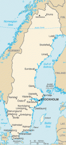
Sweden — Sverige — is the largest of the Nordic countries by area, covering 450,295 km² and stretching from the fertile plains of Skåne in the south through the vast boreal forests and lakes of central Sweden (Svealand and Götaland) to the remote sub-Arctic tundra and mountain ranges of Norrland in the north. The country shares borders with Norway to the west and northwest, Finland to the northeast (at the Torne River), and is connected to Denmark via the iconic Öresund Bridge to the southwest. Sweden’s geography — dominated by ancient granite and gneiss bedrock, over 95,000 lakes, and 2,100 km of Baltic Sea coastline — gives Swedish road travel a consistently varied and often spectacular quality.
Sweden drives on the right-hand side of the road — a change that took place on 3 September 1967 (Dagen H, “Högertrafikomläggningen”), when Sweden switched overnight from left to right in one of the largest peacetime traffic operations in history. Speed limits are in kilometres per hour. The road network is managed by Trafikverket (Swedish Transport Administration) and uses E-prefix European routes (E4, E6, E18, etc.), national roads (Riksväg / RV), and county roads (Länsväg / Lv). Sweden does not use a national vignette; tolls are levied at congestion charging cordons in Stockholm and Gothenburg, on the Öresund Bridge to Denmark, and at a small number of other specific infrastructure points.
Sweden enforces a blood alcohol limit of 0.02% BAC — identical to Norway and significantly stricter than the EU standard of 0.05%. The currency is the Swedish Krona (SEK / kr); Sweden is an EU member but has not adopted the euro and retains the krona by policy choice following a 2003 referendum. Sweden is a full Schengen Area member, so internal borders with Norway, Finland, and Denmark (via the Öresund Bridge) are open for EU/Schengen citizens. The single emergency number is 112, covering police, ambulance, and fire. Plan your Swedish road trip with the route planner on our homepage.
The Swedish Road Network
Sweden’s road network is managed by Trafikverket (the Swedish Transport Administration) for national roads and by regional authorities (regioner) for county roads. The total road network is approximately 575,000 km; national roads (E-routes and Riksväg) account for roughly 17,000 km. Sweden has approximately 2,100 km of motorways (motorväg), heavily concentrated around the three major cities — Stockholm, Gothenburg, and Malmö — and the E4 and E6 corridors linking them. The comparatively limited motorway coverage in northern and central Sweden reflects both the lower population density and the forested, lake-dotted terrain that does not require high-speed roads for the traffic volumes carried.
Sweden’s road numbering uses E-prefix for European routes, Riksväg (RV) for national roads, and Länsväg (Lv) for county roads. Many E-roads in Sweden are built to motorway standard (green signs, central reservation, grade-separated junctions) but some E-designated roads in northern Sweden remain single-carriageway routes through forest and mountain. The category of “2+1 roads” (2+1-väg) — a distinctively Swedish innovation — features alternating two-lane and one-lane sections with a continuous cable safety barrier in the central zone, dramatically reducing head-on collisions on rural single-carriageway roads.
Primary E-roads and national routes:
- E4 — Helsingborg–Malmö–Jönköping–Stockholm–Sundsvall–Umeå–Haparanda (~1,900 km, Sweden’s longest road): The spine of Sweden’s road network, running the full length of the country from Helsingborg on the Öresund strait (ferry to Denmark) in the south to Haparanda on the Finnish border in the far north. The E4 passes through Malmö, Helsingborg, Jönköping, Norrköping, Södertälje (gateway to Stockholm), Uppsala, Gävle, Sundsvall, Härnösand, Härnösand, Örnsköldsvik, Umeå, and Luleå before reaching Haparanda/Tornio at the Finnish border. The E4 south of Stockholm (through Jönköping and Helsingborg) is motorway standard throughout; north of Stockholm the motorway standard gives way to high-quality dual carriageways then single carriageway in the far north. Journey time Stockholm–Gothenburg via E4 is approximately 5–5.5 hours (470 km, via E4 and E20); Stockholm–Malmö approximately 6 hours (620 km).
- E6 — Malmö–Gothenburg–Oslo (Norway, ~300 km within Sweden): The southwest coastal motorway connecting Malmö and the Öresund Bridge to Gothenburg (Sweden’s second city), then continuing northward to the Norwegian border at Svinesund, where it crosses the Svinesund suspension bridge into Norway (E6 continuing to Oslo). The Swedish E6 between Malmö and Gothenburg is motorway standard throughout and is one of Sweden’s busiest roads. Journey time Malmö–Gothenburg approximately 2.5 hours (280 km).
- E18 — Stockholm–Örebro–Karlstad–Eda (Norwegian border, ~340 km within Sweden): The central corridor connecting Stockholm to Norway via the Värmland lake region. The E18 is motorway standard in the Stockholm metropolitan section and around Örebro; between Karlstad and the border it becomes high-quality single/dual carriageway. At the Norwegian border near Eda/Charlottenberg, the E18 connects to the Norwegian E18 toward Oslo. Journey time Stockholm–Oslo via E18 approximately 6 hours (530 km).
- E20 — Gothenburg–Örebro–Stockholm–Södertälje–Nynäshamn (~600 km): The main east–west corridor across southern Sweden. The E20 connects Gothenburg on the west coast with Stockholm on the east coast via a central corridor through Örebro and Södertälje. This is the primary route for east–west freight traffic across Sweden. Journey time Gothenburg–Stockholm via E20 approximately 5 hours (470 km).
- E22 — Malmö–Karlskrona–Kalmar–Norrköping (~470 km): The southeastern coastal corridor, running along the Baltic coast from Malmö through the scenic Blekinge archipelago coast, Kalmar (gateway to Öland island via the Öland Bridge), and Norrköping. The E22 connects Malmö to the E4 at Norrköping, offering an alternative to the inland E4 route from Malmö to Stockholm. The southern sections around Malmö are motorway standard.
- E45 — Gothenburg–Borås–Örebro–Mora–Östersund–Gällivare (~1,400 km, the Inlandsvägen): Sweden’s great inland highway, the longest north–south route in the interior. The E45 runs through the Swedish lake and forest heartland, from Gothenburg through the industrial Bergslagen region, continuing through Dalarna (Dalecarlia — Sweden’s folkloric heartland), past Lake Siljan, through Östersund (gateway to Åre ski resort), and northward through Lapland to Gällivare (gateway to the Arctic iron-ore region) and on to the Finnish border at Karesuando. The E45 is single carriageway through most of its length; it is the road backbone of Sweden’s interior regions. The section from Mora to Gällivare is marketed as the historic Inlandsvägen (Inland Road).
- E14 — Sundsvall–Östersund–Storlien (Norwegian border, ~350 km): The main east–west crossing between the Gulf of Bothnia coast at Sundsvall and Norway via Östersund and the Åre mountain valley. The E14 passes through Östersund (Jämtland’s principal city), the ski resort of Åre (Sweden’s premier alpine destination), and crosses into Norway at Storlien/Hell to continue as the Norwegian E14 toward Trondheim. Journey time Sundsvall–Trondheim approximately 4.5 hours (450 km).
The Öland and Gotland islands: Two of Sweden’s most popular driving destinations are the Baltic islands of Öland and Gotland. Öland is connected to the mainland via the Öland Bridge (6.072 km — the longest bridge in Sweden and the Nordic countries) at Kalmar; crossing is free. The southern part of Öland is a UNESCO World Heritage landscape. Gotland is accessible only by car ferry from Nynäshamn (south of Stockholm) or Oskarshamn (summer services), operated by Destination Gotland; the ferry crossing takes approximately 3–3.5 hours. Gotland’s capital Visby is a UNESCO-listed medieval walled city.
Driving Rules and Legal Requirements
Sweden enforces a blood alcohol limit of 0.02% BAC (0.2 per mille) — identical to Norway and among Europe’s strictest, far below the EU standard of 0.05%. Professional drivers (bus, taxi, heavy goods) and transport operators face a 0.00% BAC limit in practice. Swedish Police (Polisen) conduct regular roadside breath-testing checkpoints nationwide. Penalties are graduated: fines are income-proportional (day-fine system), and above 0.10% BAC, or for repeat offences, custodial sentences are imposed. Driving under the influence of drugs is equally prohibited; Swedish Police use oral fluid drug-testing devices at checkpoints.
Mandatory headlights: All vehicles must use headlights — or daytime running lights (DRL) — at all times while driving, regardless of time of day or weather conditions. This rule has been in force in Sweden since 1977 and is strictly observed.
Speed cameras and average speed control: Sweden operates an extensive network of fixed speed cameras (ATK — automatisk trafiksäkerhetskontroll) on national roads and motorways, plus section-control average speed cameras (mätarsträckor) on many roads. Section control measures average speed over a defined road section (between 1 km and several kilometres); exceeding the average limit triggers an automatic fine. GPS navigation apps include ATK camera locations. Mobile police radar units supplement fixed cameras.
Winter tyres: Sweden requires vehicles to use winter-approved tyres (friction or studded) from 1 December to 31 March whenever winter driving conditions exist (snow, ice, or slush on the road). In practice, in the north and mountain regions, winter conditions arrive earlier and persist later — winter tyres should be fitted from October in Norrland. Studded tyres (dubbdäck) are permitted from 1 October to the Sunday after Easter Sunday (typically late April). Certain roads in Stockholm and Gothenburg levy a dubbdäcksförbud (studded tyre ban) on some central sections to reduce particulate pollution — check city-specific rules. A vehicle must always be equipped with tyres matched to the road conditions; summer tyres on icy roads can result in police fines for dangerous driving.
Mobile phones and distracted driving: Using a handheld mobile phone while driving is prohibited. Fines are substantial (SEK 1,500+). Hands-free operation is permitted. Sweden also prohibits any distraction-causing device use that impairs safe driving.
Seat belts: Mandatory for all occupants in all seats. The driver is responsible for ensuring all passengers under 15 are correctly belted or restrained. Sweden introduced mandatory front seat belts in 1975, among the first countries to do so nationally.
Child restraints: Children must use appropriate child restraints. Sweden is internationally renowned for the rear-facing child seat philosophy — Swedish safety research from the 1960s–1970s pioneered the rear-facing principle, and Swedish parents typically keep children in rear-facing seats until age 3–4 (or the maximum weight capacity of the seat). This approach has been widely adopted internationally. Rear-facing seats are mandatory until the child can safely sit forward-facing; child restraints are required until height 135 cm.
Wildlife hazards — moose (älg): Sweden has approximately 300,000–400,000 moose (älg — Eurasian elk), the highest density in the world. Moose–vehicle collisions are a serious road safety issue in Sweden; approximately 4,000–6,000 moose are killed in traffic each year, and collisions cause significant human injuries and deaths annually. Moose warning signs (yellow diamond with moose silhouette) mark active collision zones. The highest risk is at dusk, dawn, and during May–June (calving season) and September–November (rutting/hunting season disturbance). Moose stand approximately 1.8–2.1 m at the shoulder and, like Norwegian elk, their legs mean the body falls directly into the windscreen on impact. Reduce speed significantly in marked moose zones, particularly in forest corridors.
Yielding rules: At unmarked intersections, yield to traffic from the right. On roads marked with a priority road sign (yellow diamond), through traffic has priority. Roundabouts in Sweden give priority to traffic already in the roundabout (yield on entry), consistent with European convention — adopted in Sweden in the 1990s.
Speed Limits on Swedish Roads
Sweden has a flexible, evidence-based speed limit system — limits on national roads are set in increments of 10 km/h based on road safety data, road geometry, traffic volume, and proximity to populated areas. Variable message signs (VMS) dynamically lower limits in adverse weather, school hours, and congestion. The introduction of 40 km/h and 60 km/h zones alongside the traditional 30, 50, 70, 90, and 110 km/h limits was a deliberate policy choice to match limits more precisely to actual road conditions.
| Road Type | Typical Limit | Notes |
|---|---|---|
| Urban / built-up areas | 50 km/h | 30 km/h in school zones and residential streets; 40 km/h on many urban arterials |
| National rural roads | 70–80 km/h | 80 km/h typical on 2+1 roads; 70 km/h on curves and narrower sections |
| High-quality national roads | 90–100 km/h | 100 km/h on divided roads meeting higher safety standards |
| Motorways (motorväg) | 110–120 km/h | 120 km/h on highest-standard motorway sections; 110 km/h more common; variable signs frequently lower limit in conditions |
Speed enforcement: Sweden’s income-proportional fine system means penalties are calibrated to individual income. Day-fines (dagsböter) are calculated based on the offender’s net daily income; a serious speeding offence results in a large number of day-fines. Exceeding the limit by 30+ km/h results in licence revocation; by 50+ km/h results in criminal prosecution. The principle of proportionality is taken seriously — a high-income driver caught significantly speeding can receive a very substantial monetary fine. Swedish courts have issued fines of hundreds of thousands of krona to high-income offenders for serious speeding.
Tolls, Congestion Charges, and the Öresund Bridge
Sweden does not operate a national motorway vignette system — the vast majority of Swedish roads are toll-free. However, there are three main categories of road tolls that visitors may encounter:
1. Stockholm Congestion Tax (Trängselskatt Stockholm): Stockholm operates a congestion charging cordon system around the inner city (Stockholm Island / Normalm and Östermalm areas) and the Western Link bypass (Essingeleden). The tax applies to most motor vehicles entering or exiting the cordon during chargeable hours (Mon–Fri 06:00–21:30; not on public holidays, weekends, or in July). Charges vary by time of day: SEK 11–45 per passage depending on time (peak charges during 07:00–08:00 and 16:00–17:30). There is a daily maximum charge of SEK 135 per vehicle. Tolls are detected by ANPR cameras; Swedish-registered vehicles are billed monthly via the vehicle tax system. Foreign-registered vehicles must pay within a short period — visit transportstyrelsen.se/congestiontax to register and pay, or use a third-party payment service. Some rental companies include congestion charge administration in their fees.
2. Gothenburg Congestion Tax (Trängselskatt Göteborg): Gothenburg has operated a congestion tax since January 2013 on roads entering and exiting the city on all sides. Charges apply Mon–Fri 06:00–21:00 (not public holidays, the day before a public holiday, or in July). Rates SEK 9–22 per passage, maximum SEK 60 per day per vehicle. The same billing rules as Stockholm apply for foreign vehicles.
3. Öresund Bridge (Øresundsbroen / Öresundsbron): The iconic dual-mode (road and rail) bridge-tunnel link connecting Malmö, Sweden with Copenhagen, Denmark. The Öresund Bridge opened on 1 July 2000 and is one of Europe’s most significant infrastructure achievements: a 7.8 km cable-stayed bridge across the Öresund strait transitions to a 4 km artificial island (Peberholm) and then into the 3.7 km Drogden Tunnel on the Danish side. The road section carries motorway-standard E20 traffic. Tolls are levied at both entry and exit on the Swedish side at the Lernacken toll plaza.
| Vehicle Type | One-Way Toll (SEK, 2025–2026) | Notes |
|---|---|---|
| Passenger car (height ≤ 6 m) | SEK ~575 | BroBizz/AutoPASS/ETC tag gives discount; frequent passes available |
| Motorcycle | SEK ~290 | Half car rate |
| Camper / van (height 6–10 m) | SEK ~1,150 | Overheight vehicles use designated lanes |
The Öresund Bridge toll can be paid by card at the toll booth or via pre-paid BroBizz transponder (available from brobizz.com) — BroBizz is interoperable with AutoPASS and Danish Easygo for cross-Scandinavian toll road use. The toll cost makes the Öresund crossing relatively expensive for a single crossing but frequent commuters can buy monthly passes.
Sundsvall Bridge and E4 Sundsvall bypass: The E4 bypass around Sundsvall, including the Sundsvall Bridge (a large cable-stayed bridge across the Sundsvallsfjärden bay), carries a congestion-style toll for the duration of its financing period. Charges apply in both directions via ANPR cameras; rates and payment details are available at transportstyrelsen.se.
No national motorway vignette: Unlike many neighbouring European countries, Sweden does not require a windscreen sticker or electronic pass to drive on motorways. Outside the toll zones and specific bridge/bypass charges listed above, Swedish motorways and national roads are free to drive on.
Fuel, Electric Vehicles, and Charging
Fuel stations are widespread throughout southern and central Sweden. In northern Sweden (particularly above the Arctic Circle in Norrbotten and Lapland), stations can be 80–120 km apart on some routes, including sections of the E45 Inlandsvägen and roads through the mountain areas (fjällen). Many rural stations are unmanned and operate 24 hours via card payment only; carry a chip-and-PIN card (contactless may not be accepted at all unmanned stations). Major fuel brands include Circle K (formerly Statoil), St1, OKQ8, Preem, and Shell. Diesel and petrol are widely available; HVO100 (100% renewable diesel) is increasingly available at major chains. E85 (high-ethanol flex-fuel) is widely available at larger stations and used in Swedish flex-fuel vehicles (Sweden has a large fleet of E85 Volvos and Saabs from the 2000s–2010s).
Electric vehicles: Sweden has the second-highest per-capita EV adoption in Europe after Norway. In 2025, approximately 40% of new car registrations are fully electric or plug-in hybrid. The EV charging network is well developed in southern and central Sweden; in the north it becomes sparser. Key EV charging facts:
- Fast DC charging (50–300 kW): Available at regular intervals along E4, E6, E18, E20, and other major routes in southern/central Sweden. Major operators: Recharge, Mer, IONITY, Tesla Supercharger, Circle K Electric, Vattenfall InCharge, and Q8 Charge.
- Northern Sweden: Fast charging coverage is improving rapidly but remote E45 sections and mountain roads in Jämtland and Lapland require careful range planning. Use PlugShare or Chargemap to plan charging stops north of Östersund.
- Congestion charge exemption: Battery electric vehicles are currently exempt from Stockholm and Gothenburg congestion charges (verify current policy at transportstyrelsen.se as exemptions are subject to legislative review).
- Ferries with onboard charging: Several Destination Gotland and coastal ferries have Type 2 EV charging points onboard.
Scenic Drives and Notable Road Journeys
The Inlandsvägen (E45 / Inland Road — Mora to Gällivare, ~1,100 km): Sweden’s great north–south inland route through the boreal heartland is one of Scandinavia’s most epic driving journeys. Starting at Mora in Dalarna — the home of the Vasaloppet cross-country ski race — the road passes through Sveg, Östersund, Strömsund, Vilhelmina, Storuman, Sorsele, Arvidsjaur, and Jokkmokk (gateway to the Jokkmokk Winter Market, a 400-year-old Sami cultural tradition) before reaching Gällivare and the LKAB iron-ore mining landscapes. The Inlandsvägen traverses the vast Swedish norrlandslandskapet — rolling spruce and pine taiga, river valleys, reindeer grazing land, and the Arctic wilderness of Swedish Lapland. North of the Arctic Circle, the road passes through Sami territories; reindeer herds cross freely. Summer brings midnight sun; winter driving offers northern lights and extreme cold (down to −40°C in inland Lapland).
The High Coast (Höga Kusten, E4 / RV1 — around Härnösand and Kramfors): The High Coast UNESCO World Heritage Site north of Härnösand on the Gulf of Bothnia is one of Sweden’s most dramatic coastal landscapes. Post-glacial land uplift (isostatic rebound) has exposed towering red granite cliffs, offshore island archipelagos, and unique coastal topography. The High Coast Bridge (Höga Kustenbroen / Höga kusten-bron) — a 1,867 m cable-stayed bridge carrying E4 over the Ångermanälven river estuary — is one of Sweden’s most spectacular bridges. Driving the coastal roads (RV1) past the archipelago’s fishing villages and rocky inlets provides outstanding scenery.
Dalarna (Lake Siljan region, RV70 / E45): Dalarna county in central Sweden is the keeper of Swedish folk traditions — painted wooden Dala horses, midsommar maypole celebrations, distinctive red Falun-painted farmhouses, and the Lake Siljan ring (formed by a massive meteorite impact 377 million years ago). The 360-degree drive around Lake Siljan (RV70 / RV71) passes through the painted villages of Leksand, Rättvik, and Mora in a beautiful pastoral landscape that defines the Swedish rural ideal.
The Åre and Jämtland Mountains (E14 / RV321): Western Jämtland and the Åre mountain valley offer some of Sweden’s most dramatic alpine road scenery. The E14 through the Åre valley passes Åre village (Sweden’s premier ski resort and a growing summer outdoor destination), Duved, and climbs toward Storlien at the Norwegian border. The views of Åresjön lake and the mountains above are outstanding. In winter, the E14 is well maintained but requires winter tyres; passes can close in extreme conditions.
Kungsleden and the Abisko corridor (E10 — Riksgränsen to Gällivare): The E10 in northernmost Sweden passes through Kiruna (Sweden’s northernmost city, recently relocated due to LKAB mine subsidence), the spectacular Torneträsk lake, and the Abisko National Park before crossing into Norway at Riksgränsen/Bjørnfjell. The ICEHOTEL at Jukkasjärvi is just off E10 near Kiruna; the Northern Lights (aurora borealis) are frequently visible along this route in winter. Kiruna is also the site of the ESRANGE space centre and the Swedish Institute of Space Physics.
The Blue Highway (Blå Vägen, E12 — Mo i Rana to Umeå, ~600 km): An international scenic route running from the Norwegian coast at Mo i Rana through the Rana valley, across the Swedish border at Tärna, and through Lycksele and Örnsköldsvik to Umeå on the Gulf of Bothnia coast. The Blue Highway follows river valleys and passes through the southern Lapland wilderness; it is marked by the distinctive blue highway logo and traveller facilities.
Öland (via Öland Bridge from Kalmar): The island of Öland, connected to the mainland by the 6 km Öland Bridge, is flat, sun-drenched, and distinctive. The Southern Öland Agricultural Landscape is a UNESCO World Heritage Site for its ancient windmills, limestone grasslands, and prehistoric field patterns still visible from the road. The island is a popular summer destination with beaches, flower meadows, and the ruins of Borgholm Castle.
Driving in Stockholm, Gothenburg, and Malmö
Stockholm: Sweden’s capital (975,000 city / ~2.4 million metropolitan) is built across 14 islands where Lake Mälaren meets the Baltic Sea. Driving in central Stockholm is actively discouraged: the congestion tax cordon levies charges on most motor vehicles entering the inner city; parking is expensive, restricted, and deliberately scarce in the centre. The E4 and E18 funnel into Essingeleden (E4/E20 Western Link) as the main motorway bypass around the inner city; Essingeleden itself carries a congestion charge. For tourist drivers, the recommended approach is to use the ring road system (RV75 / RV222) and park at a peripheral area or satellite town, using the T-bana (Metro), commuter rail (Pendeltåg), or ferry services into the centre. Djurgårdslinjen (a tram/ferry service) provides charming access to the museum island of Djurgården. Stockholm’s major sights — Gamla Stan (Old Town), Södermalm, Östermalm, Kungsholmen — are all better explored on foot or by public transport. The best drive near Stockholm is along the Lidingövägen or out toward the archipelago (Värmdö / RV222 toward Gustavsberg and Stavsnäs for ferry access to the outer islands).
Gothenburg (Göteborg): Sweden’s second city (~590,000 / ~1.1 million metropolitan) is Sweden’s principal port and the gateway to the E6 corridor to Norway. The Gothenburg congestion tax applies on entering or leaving the city on all approach roads. Gothenburg’s ring road system (Riksväg 40, E6 bypass) carries most through traffic around the city. The central waterfront and Haga district are best explored on foot or by tram (Gothenburg’s tram network is the largest in Scandinavia). Liseberg amusement park and the Universeum science centre are within the city. For road access south toward Malmö, the E6 south is motorway standard throughout.
Malmö: Sweden’s third city (~360,000) at the southwestern tip of Skåne is the Swedish side of the Öresund metropolitan region (combined Malmö–Copenhagen population ~1.4 million). Malmö is the terminus of the E6 motorway from Gothenburg and the Swedish side of the Öresund Bridge (E20). The city has grown significantly since the bridge opened in 2000, transforming the Västra Hamnen (Western Harbour) into a flagship sustainable urban district. Parking in central Malmö is zone-regulated. The E22 runs northeast from Malmö toward Karlskrona and Norrköping; the E6 continues northeast along the coast toward Helsingborg (ferry to Helsingør, Denmark).
Border Crossings with Neighbouring Countries
Sweden shares land borders with Norway and Finland, and is connected to Denmark via the Öresund Bridge (fixed link). All neighbouring countries are Schengen Area members, so internal Schengen borders apply — no passport controls under normal circumstances. Sweden periodically reinstates temporary border checks at its southern border (the Öresund Bridge) under Schengen Borders Code rules; verify current border status before travel if travelling from Denmark.
Norway (many crossings — internal Schengen): The Sweden–Norway border runs approximately 1,630 km. Major road crossings include:
- E6 — Svinesund / Svinesund (Gothenburg–Oslo corridor): Sweden’s highest-traffic border crossing. The Svinesund suspension bridge (opened 2005, 420 m span) carries E6 over the Idefjord between Sweden and Norway. High motorway standard on both sides.
- E18 — Charlottenberg / Eda (Stockholm–Oslo corridor): Main central crossing via Karlstad and Örebro toward Oslo. Good road standard.
- E16 — Riksgränsen / Bjørnfjell (northernmost crossing, near Narvik): The northernmost E-road crossing in Lapland, serving E10/E16 traffic. Carries Kiruna–Narvik traffic.
- E14 — Storlien / Storlien (Sundsvall–Trondheim): Mountain crossing via the Åre valley; good standard but requires winter tyres in winter.
- E12 — Tärna / Umbukta (the Blue Highway): Scenic inland crossing through Lapland.
Finland (northern crossings — internal Schengen): The Sweden–Finland border follows the Torne River (Torneälven) for most of its length (~500 km). This is one of Europe’s most unusual borders — the twin cities of Haparanda (Sweden) and Tornio (Finland) straddle the border with shared shopping areas and IKEA (the only IKEA store served by two countries). Several bridges cross the Torne River:
- E4 — Haparanda / Tornio: Main southern crossing; E4 from Sweden becomes E8 in Finland toward Oulu and Helsinki.
- E10 — Karesuando / Karesuvanto: Northern crossing on the E45/E10 route through Swedish Lapland.
- Multiple minor Torne River bridge crossings along the river between these main points.
Denmark (Öresund Bridge — internal Schengen):
- E20 — Malmö/Lernacken to Copenhagen/Kastrup: The Öresund Bridge crossing — the only fixed road/rail link between Sweden and Denmark. A toll is levied (see Tolls section). In addition to the bridge, Helsingborg–Helsingør car ferry crossings (operated by Stena Line and ForSea) offer an alternative with shorter transit (20 minutes, frequent departures).
Road Safety and Emergency Procedures
Sweden is the birthplace of Vision Zero — the road safety philosophy that no loss of life in traffic is acceptable, and that the road system should be designed and managed to prevent fatal and serious injuries regardless of human error. Launched in Sweden in 1997, Vision Zero has been adopted by cities and governments across the world. Sweden consistently achieves one of the lowest road fatality rates in Europe, with approximately 3–4 deaths per 100,000 inhabitants per year. Key elements of the Swedish Vision Zero approach include 2+1 roads with central safety barriers (eliminating head-on collisions), systematic speed limit reductions on dangerous road sections, and alcohol interlocks in public transport.
In an emergency: Call 112 for all emergency services — Police (Polisen), Ambulance (Ambulans), and Fire Brigade (Brandkåren). 112 operates from any mobile phone in Sweden, including those with no SIM credit. The motoring organisation Motormännen provides roadside assistance; the Assistancekåren and Viking Assistance are the main breakdown service providers — often contracted through insurance policies. Many rental car companies include breakdown assistance. On motorways, emergency call boxes (nödtelefoner) are located at intervals.
Winter driving safety: Sweden experiences severe winter conditions throughout the country north of Stockholm and in mountain regions. In Norrland and Lapland, temperatures can reach −40°C and below; ice roads (isvägar) across frozen lakes are used in some areas. Black ice (halka) is a constant winter hazard; even well-travelled roads can be icy. Carry an emergency kit in winter: warm blankets, shovel, ice scraper, jump cables, warning triangle, high-visibility vest (not legally required but highly recommended), and a charged mobile phone. If stranded in a remote area in winter, remain with your vehicle and call 112 — exposure risk is very real in severe cold.
Warning triangles and high-visibility vests: Carrying a warning triangle is not legally mandatory in Sweden (unlike in most EU countries) but is strongly recommended. A high-visibility vest is not legally required in Sweden but should be carried and worn when exiting a vehicle on a road or motorway — good practice aligned with European norms.
FAQ: Driving in Sweden
Do I need a vignette to drive in Sweden?
No. Sweden does not use a national motorway vignette. The vast majority of Swedish roads are toll-free. The exceptions are the Stockholm and Gothenburg congestion tax cordons, the Öresund Bridge toll, and a small number of individual infrastructure charges (such as the Sundsvall bypass). If you are not entering Stockholm or Gothenburg city zones and not crossing the Öresund Bridge, you will pay no road tolls in Sweden.
What is the drink-drive limit in Sweden?
Sweden’s limit is 0.02% BAC (0.2 per mille) — the same as Norway and among Europe’s strictest, well below the EU standard of 0.05%. Even a small amount of alcohol can exceed this limit. Swedish Police conduct frequent roadside breath-test checkpoints, especially on weekends and holidays. Penalties are severe and income-proportional; criminal prosecution occurs above 0.10% BAC or for repeat offenders. Visitors from countries with higher limits must be aware that their normal drinking patterns before driving would be illegal in Sweden.
Is an International Driving Permit (IDP) needed in Sweden?
EU/EEA licence holders do not need an IDP to drive in Sweden. Non-EEA visitors (including those from the USA, Canada, Australia, and other countries outside the EEA) should carry their national driving licence along with an International Driving Permit (IDP) for maximum legal coverage. Sweden accepts IDPs issued under the 1968 Vienna Convention. Rental car companies may have their own requirements — check with your hire company.
How does the Stockholm congestion tax work for foreign vehicles?
When a foreign-registered vehicle passes through one of Stockholm’s congestion charge cameras, the passage is recorded by ANPR. The Swedish Transport Agency (Transportstyrelsen) sends a payment request to the vehicle’s registered owner via the relevant national authority. Payment can be made proactively at transportstyrelsen.se. If you are renting a car in Sweden, the rental company will typically charge a daily admin fee plus the congestion tax; confirm the arrangements in your rental agreement before driving into Stockholm. Unpaid congestion charges can result in higher future charges and issues with re-entry if Sweden and your home country have a vehicle information agreement.
Are winter tyres mandatory in Sweden?
Yes, winter-approved tyres are required from 1 December to 31 March whenever winter conditions (snow, ice, or slush) are present. In northern Sweden, the practical requirement extends from October in many years. Winter tyres are strongly advisable throughout Sweden from October to April. Studded tyres are permitted from 1 October to the Sunday after Easter; some city-centre roads in Stockholm have studded tyre bans on specific stretches — check local signs. Driving on summer tyres in winter conditions can result in a fine for dangerous driving.
Can I drive across the Öresund Bridge to Denmark from Sweden?
Yes — the Öresund Bridge is a toll road carrying the E20 motorway between Malmö, Sweden and Copenhagen, Denmark. The bridge is open 24 hours year-round. The current one-way toll for a passenger car is approximately SEK 575 (also payable in Danish Krone at approximately DKK 370 — rates are equivalent). Payment is by bank card or BroBizz transponder at the Lernacken toll plaza on the Swedish side. The crossing takes approximately 10 minutes by road; the total bridge-and-tunnel distance is around 16 km. An alternative is the Helsingborg–Helsingør car ferry (20 minutes, Stena Line or ForSea).
What is the 2+1 road system in Sweden?
Sweden invented the 2+1 road concept — a rural road design where two lanes in one direction alternate with one lane in the other direction, divided by a continuous cable barrier in the centre. The cable barrier prevents head-on collisions (the leading cause of rural road fatalities) while doubling overtaking opportunities. The 2+1 road has proven extremely effective: roads converted to 2+1 standard have seen head-on fatalities virtually eliminated. These roads are marked with standard white lane markings and carry 80 km/h or sometimes 90–100 km/h speed limits. Sweden has converted thousands of kilometres of national roads to 2+1 standard.
Sources and Update Note
This Sweden driving guide draws on information from Trafikverket (Swedish Transport Administration — trafikverket.se) for road network data and speed limit policy, Transportstyrelsen (Swedish Transport Agency — transportstyrelsen.se) for licence, congestion tax, and vehicle rules, Polisen (Swedish Police — polisen.se) for driving law enforcement, Öresundsbron (oresundsbron.com) for bridge toll data, Stockholms stad (stockholm.se) and Göteborgs stad for congestion charging details, Visit Sweden (visitsweden.com) for scenic route information, NAF/Motormännen for motoring organisation guidance, and OpenStreetMap contributor data. EV infrastructure data draws on Recharge, Vattenfall InCharge, IONITY, and PlugShare community data.
Swedish road tolls (Öresund Bridge rates, congestion tax rates), EV policy incentives, and speed limit adjustments are subject to annual revision. Verify current congestion tax rates at transportstyrelsen.se, current Öresund Bridge tolls at oresundsbron.com, and real-time road conditions at trafikverket.se/en/. This guide reflects information current as of February 2026.