
Rabat is one of the most populated cities in Morocco, and at the same time, this city is the capital of this country. Located in Africa, you may find the city easily with the following GPS coordinates: 33.97N latitude / 6.84W longitude. For routing in Rabat, please check the free driving directions Rabat service below.
Africa maps
Explore the countries in Africa with all their Wiki, find information on weather, population, facts, history, landmarks of major cities data, and enjoy free Google maps Satellite imagery & Street views. Each Country Profile in Africa provides information on Geography data, area maps, Google maps, flag, history, area, population, the capital city, largest cities, economy, spoken languages, ethnicity/race, religion, literacy rate, government, and many more!
In this map category, you will find these African countries and their capital cities:
Algeria, Angola, Benin, Botswana, Burkina Faso, Burundi, Cameroon, Cape Verde, Chad, Comoros, Democratic Republic of the Congo, Republic of Congo, Côte d’Ivoire, Djibouti, Egypt, Equatorial Guinea, Eritrea, Ethiopia, Gabon, Gambia, Ghana, Guinea, Guinea-Bissau, Guyana, Kenya, Lesotho, Liberia, Libya, Madagascar, Malawi, Mali, Mauritania, Mauritius, Morocco, Mozambique, Namibia, Niger, Nigeria, Rwanda, São Tomé and Príncipe, Senegal, Seychelles, Sierra Leone, Somalia, South Africa, Sudan, Swaziland, Tanzania, Togo, Tunisia, Uganda, Zambia, Zimbabwe.
Google Maps™ driving directions home » Africa maps
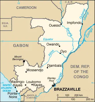
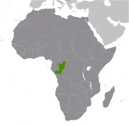
Republic of the Congo Google Map
 |
 |
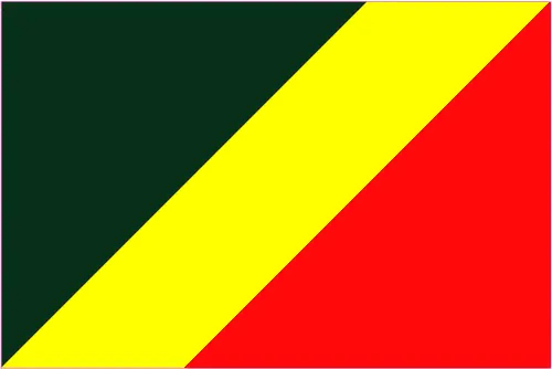 |
| Borderline map of Republic of the Congo | Location map of Republic of the Congo | Flag of Republic of the Congo |
Republic of the Congo Google map
Google Maps and Detailed Facts of the Republic of the Congo (CF). This page lets you explore the Republic of the Congo and its border countries (Country Location: Central Africa, bordering the South Atlantic Ocean, between Angola and Gabon) through detailed Satellite imagery – fast and easy as never before Google Maps.
Find comprehensive information about this country’s diversity below: Google maps, geography, economy, science, people, culture, environment, government, and history – All in One Wiki page.
There is also a Street View and free Driving Directions at your service. Your Google Satellite Map Sightseeing in the Republic of the Congo, in Africa, starts here at Driving Directions and Maps.com.
Google Maps™ driving directions home » Africa maps
Réunion
Google Maps™ driving directions home » Africa maps
Rwanda
Driving Directions Rwanda
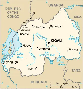
RWANDA is a small, landlocked republic in the heart of central Africa. Its predominant feature is a central high plateau with an average elevation of about 2,000 meters or 6,000 feet from which streams flow west to the River Congo and east to the River Nile.
High mountains rising to 4,507 meters or 14,786 feet dominate the north and west of the country sloping downwards to Lake Kivu’s basin on the western border. East of the plateau, the land drops downwards to a region of marshes and lakes surrounding the River Kagera.
Google Maps™ driving directions home » Africa maps
Rwanda Google Map
 |
 |
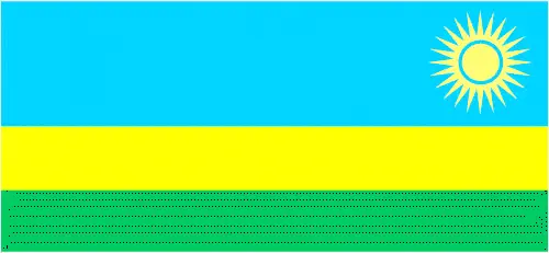 |
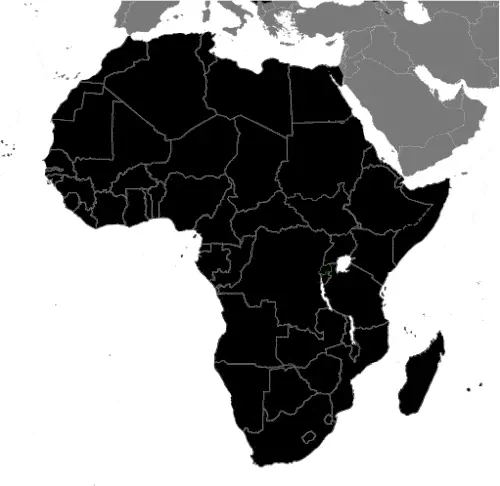
| Borderline map of Rwanda | Location map of Rwanda | Flag of Rwanda |
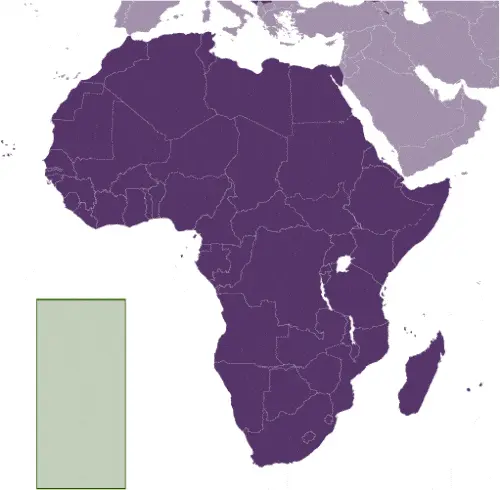
Google Maps and Detailed Facts of Rwanda (RW). This page lets you explore Rwanda and its border countries (Country Location: Central Africa, east of the Democratic Republic of the Congo, north of Burundi) through detailed Satellite imagery – fast and easy as never before Google Maps.
Find comprehensive information about this country’s diversity below: Google maps, geography, economy, science, people, culture, environment, government, and history – All in One Wiki page.
There is also a Street View and free Driving Directions at your service. Your Google Satellite Map Sightseeing in Rwanda, in Africa, starts here at Driving Directions and Maps.com.
Google Maps™ driving directions home » Africa maps
Saint Helena Google Map
 |
 |
 |
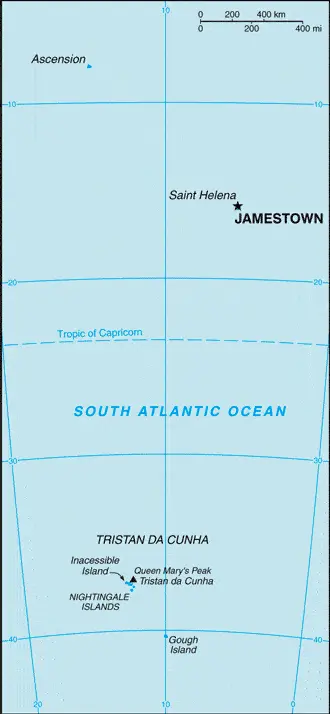
| Borderline map of Saint Helena | Location map of Saint Helena | Flag of Saint Helena |
Google Maps and Detailed Facts of Saint Helena (SH). This page lets you explore Saint Helena and its border countries (Country Location: islands in the South Atlantic Ocean, about midway between South America and Africa; Ascension Island lies 1,300 km (800 mi) northwest of Saint Helena; Tristan da Cunha lies 4,300 km (2,700 mi) southwest of Saint Helena) through detailed Satellite imagery – fast and easy as never before Google Maps.
Find comprehensive information about this country’s diversity below: Google maps, geography, economy, science, people, culture, environment, government, and history – All in One Wiki page.
There is also a Street View and free Driving Directions at your service. Your Google Satellite Map Sightseeing in Saint Helena, in Africa, starts here at Driving Directions and Maps.com.
Google Maps™ driving directions home » Africa maps
São Tomé and Príncipe
Driving Directions São Tomé and Príncipe
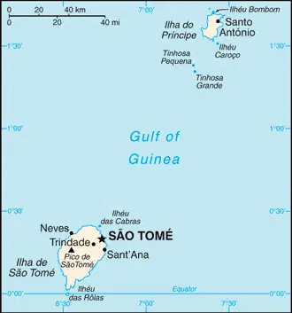
SÁO TOMÉ AND PRÍNCIPE are volcanic islands that lie off the west coast of Africa. The islands were colonized in the 15th century by the Portuguese, who developed a slave trade, grew sugar cane, and settled convicts and other exiles on the islands.
São Tomé is covered in extinct volcanic cones reaching heights of 2,024 meters or 6,641 feet. The coastal areas are hot and humid. Príncipe is a craggy island lying to the northeast of Sáo Tomé.
Google Maps™ driving directions home » Africa maps
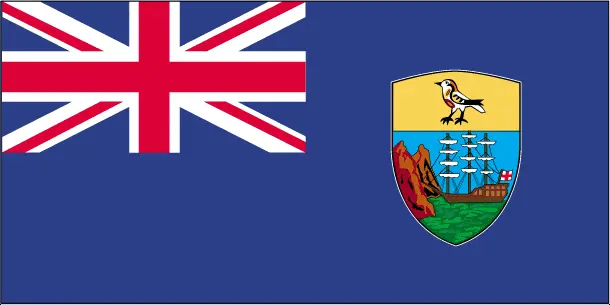
São Tomé and Principe Google Map
 |
 |
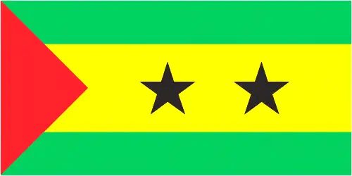 |
| Borderline map of Sao Tome and Principe | Location map of Sao Tome and Principe | Flag of São Tomé and Principe |
São Tomé and Principe Google map
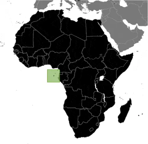
Google Maps and Detailed Facts of Sao Tome and Principe (ST). This page lets you explore Sao Tome and Principe and its border countries (Country Location: Central Africa, islands in the Gulf of Guinea, just north of the Equator, west of Gabon) through detailed Satellite imagery – fast and easy as never before Google Maps.
Find comprehensive information about this country’s diversity below: Google maps, geography, economy, science, people, culture, environment, government, and history – All in One Wiki page.
There is also a Street View and free Driving Directions at your service. Your Google Satellite Map Sightseeing in Sao Tome and Principe starts here at Driving Directions and Maps.com in Africa.
Google Maps™ driving directions home » Africa maps
Sáo Tomé Google maps
São Tomé is one of the most populated cities in São Tomé and Príncipe, and at the same time, this city is the capital of this country. Located in Africa, you may find the city easily with the following GPS coordinates: 00.10N latitude / 06.39E longitude. For routing in Sáo Tomé, please check the free driving directions Sáo Tomé service below.
Google Maps™ driving directions home » Africa maps
Senegal
Driving Directions Senegal
SENEGAL is a former French colony in West Africa that extends from the most western point in Africa, Cape Verde, to the border with Mali. The Republic of Senegal consists mainly of a low-lying savannah plain with higher ground only in the extreme southeast. The Fouta Djallon Mountains in the south rise to 1,515 meters or 4,971 feet. The River Senegal forms the northern boundary, and other rivers further south include the Gambia.