
Dakar is one of the most populated cities in Senegal, and at the same time, this city is the capital of this country. Located in Africa, you may find the city easily with the following GPS coordinates: 14.34N latitude / 17.29W longitude. For routing in Dakar, please check the free driving directions Dakar service below.
Africa maps
Explore the countries in Africa with all their Wiki, find information on weather, population, facts, history, landmarks of major cities data, and enjoy free Google maps Satellite imagery & Street views. Each Country Profile in Africa provides information on Geography data, area maps, Google maps, flag, history, area, population, the capital city, largest cities, economy, spoken languages, ethnicity/race, religion, literacy rate, government, and many more!
In this map category, you will find these African countries and their capital cities:
Algeria, Angola, Benin, Botswana, Burkina Faso, Burundi, Cameroon, Cape Verde, Chad, Comoros, Democratic Republic of the Congo, Republic of Congo, Côte d’Ivoire, Djibouti, Egypt, Equatorial Guinea, Eritrea, Ethiopia, Gabon, Gambia, Ghana, Guinea, Guinea-Bissau, Guyana, Kenya, Lesotho, Liberia, Libya, Madagascar, Malawi, Mali, Mauritania, Mauritius, Morocco, Mozambique, Namibia, Niger, Nigeria, Rwanda, São Tomé and Príncipe, Senegal, Seychelles, Sierra Leone, Somalia, South Africa, Sudan, Swaziland, Tanzania, Togo, Tunisia, Uganda, Zambia, Zimbabwe.
Google Maps™ driving directions home » Africa maps
Dar es Salaam Google maps
Dar es Salaam is one of the most populated cities in Tanzania, and at the same time, this city is the capital of this country. Located in Africa, you may find the city easily with the following GPS coordinates: 06.08S latitude / 35.45E longitude. For routing in Dar es Salaam, please check the free driving directions Dar es Salaam service below.
Google Maps™ driving directions home » Africa maps
Democratic Republic of the Congo Google Map
 |
 |
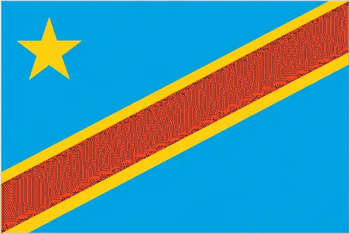 |
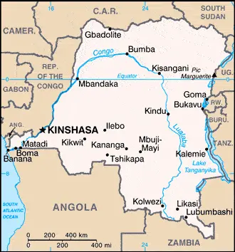
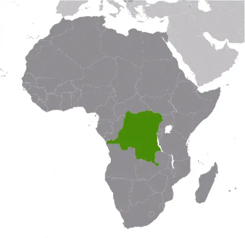
| Borderline map of the Democratic Republic of the Congo | Location map of the Democratic Republic of the Congo | Flag of the Democratic Republic of the Congo |
The Democratic Republic of the Congo Google map
Google Maps and Detailed Facts of the Democratic Republic of the Congo (CG). This page lets you explore the Democratic Republic of the Congo and its border countries (Country Location: Central Africa, northeast of Angola) through detailed Satellite imagery – fast and easy as never before Google Maps.
Find comprehensive information about this country’s diversity below: Google maps, geography, economy, science, people, culture, environment, government, and history – All in One Wiki page.
There is also a Street View and free Driving Directions at your service. Your Google Satellite Map Sightseeing in the Democratic Republic of the Congo, in Africa, starts here at Driving Directions and Maps.com.
Google Maps™ driving directions home » Africa maps
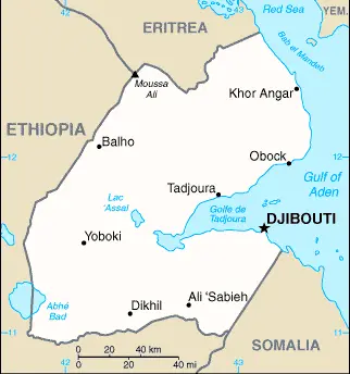
Djibouti
Driving Directions Djibouti
DJIBOUTI is a republic situated in northeast Africa bounded almost entirely by Ethiopia except in the southeast. It shares a border with Somalia, and in the northwest, where it shares a border with Eritrea. Its coastline is on the Gulf of Aden. The small republic of Djibouti achieved independence in 1977, formerly having been a French overseas territory.
Google Maps™ driving directions home » Africa maps
Djibouti Google Map
 |
 |
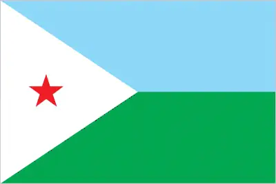 |
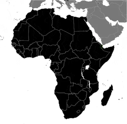
| Borderline map of Djibouti | Location map of Djibouti | Flag of Djibouti |
Google Maps and Detailed Facts of Djibouti (DJ). This page lets you explore Djibouti and its border countries (Country Location: Eastern Africa, bordering the Gulf of Aden and the Red Sea, between Eritrea and Somalia) through detailed Satellite imagery – fast and easy as never before Google Maps.
Find comprehensive information about this country’s diversity below: Google maps, geography, economy, science, people, culture, environment, government, and history – All in One Wiki page.
There is also a Street View and free Driving Directions at your service. Your Google Satellite Map Sightseeing in Djibouti, in Africa, starts here at Driving Directions and Maps.com.
Google Maps™ driving directions home » Africa maps
Djibouti Google maps
Djibouti is one of the most populated cities in Djibouti, and at the same time, this city is the capital of this country. Located in Africa, you may find the city easily with the following GPS coordinates: 11.08N latitude / 42.20E longitude. For routing in Djibouti, please check the free driving directions Djibouti service below.
Google Maps™ driving directions home » Africa maps
Egypt
Driving Directions Egypt
EGYPT is a republic in northeast Africa situated between Africa and Asia. The country’s outstanding physical feature is the River Nile, the valley and delta of which cover about 35,580 square kilometers or 13,737 square miles. Although over 90 percent of the Arab Republic of Egypt consists of desert, most of which are uninhabited, the country was the birthplace of one of the most astonishing, ancient civilizations globally, with a written record dating back to about 3,200 years BC.
Google Maps™ driving directions home » Africa maps
Egypt Google Map
 |
 |
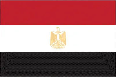 |
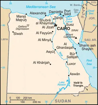
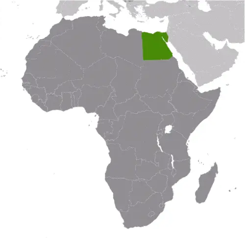
| Borderline map of Egypt | Location map of Egypt | Flag of Egypt |
Google Maps and Detailed Facts of Egypt (EG). This page lets you explore Egypt and its border countries (Country Location: Northern Africa, bordering the Mediterranean Sea, between Libya and the Gaza Strip, and the Red Sea north of Sudan, and includes the Asian Sinai Peninsula) through detailed Satellite imagery – fast and easy as never before Google Maps.
Find comprehensive information about this country’s diversity below: Google maps, geography, economy, science, people, culture, environment, government, and history – All in One Wiki page.
There is also a Street View and free Driving Directions at your service. Your Google Satellite Map Sightseeing in Egypt, in Africa, starts here at Driving Directions and Maps.com.
Google Maps™ driving directions home » Africa maps
Equatorial Guinea
Driving Directions Equatorial Guinea
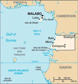
EQUATORIAL GUINEA lies about 200 kilometers or 124 miles north of the Equator on the hot, humid coast of West Africa. The country consists of a square-shaped mainland area (Mbini) with its few small offshore islets and the islands of Bioko and Pagalu (Annobon). The mainland has a densely forested, rolling landscape broken by some hills. Bioko is a very fertile volcanic island with two high mountains, steep slopes, and a tropical jungle. The capital, Malabo, is situated beside a volcanic crater flooded by the sea.
Google Maps™ driving directions home » Africa maps
Equatorial Guinea Google Map
 |
 |
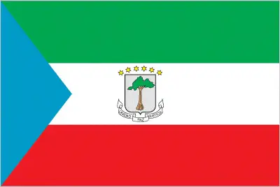 |
| Borderline map of Equatorial Guinea | Location map of Equatorial Guinea | Flag of Equatorial Guinea |
Google Maps and Detailed Facts of Equatorial Guinea (GQ). This page lets you explore Equatorial Guinea and its border countries (Country Location: Central Africa, bordering the Bight of Biafra, between Cameroon and Gabon) through detailed Satellite imagery – fast and easy as never before Google Maps.
Find comprehensive information about this country’s diversity below: Google maps, geography, economy, science, people, culture, environment, government, and history – All in One Wiki page.
There is also a Street View and free Driving Directions at your service. Your Google Satellite Map Sightseeing in Equatorial Guinea, in Africa, starts here at Driving Directions and Maps.com.