Explore the countries in Asia with all their Wiki, find information on weather, population, facts, history, landmarks of major cities data, and enjoy free Google maps Satellite imagery & Street views. Each Country Profile in Asia provides information on Geography data, area maps, Google maps, flag, history, area, population, the capital city, largest cities, economy, spoken languages, ethnicity/race, religion, literacy rate, government, and many more!
In this map category, you will find these Asian countries and their capital cities:
MACAO, or Macau formerly a Portuguese colony, reverted to China in 1999, becoming an individual admin- strive region under Chinese sovereignty. China has promised 50 years of non-interference in its economic and social systems.
MALAYSIA is a federal constitutional monarchy that lies in the South China Sea in southeast Asia. It comprises eleven states located in the southernmost part of the Malay Peninsula, which forms West Malaysia, and the two states of Sarawak and Sabah on the island of Borneo, which form East Malaysia. Sarawak and Sabah separated from the western part of the kingdom by 650 kilometers or 400 miles of the South China Sea.
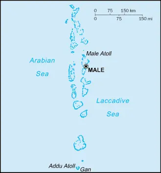
MALDIVES, the, is a republic consisting of 1,200 low-lying coral islands grouped into 12 atolls, lying 640 kilometers or 398 miles southwest of Sri Lanka in the Indian Ocean. Roughly 202 islands are inhabited, and the highest point is only 1.5 meters or 5 feet above sea level.
Independence gained in 1965, with a republic formed three years later.
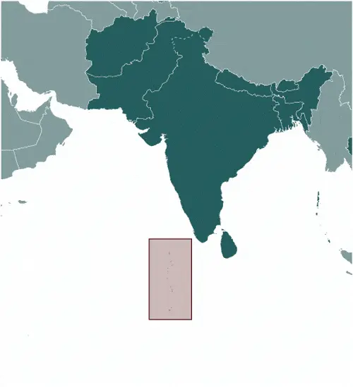
Google Maps and Detailed Facts of Maldives (MV). This page lets you explore the Maldives and its border countries (Country Location: Southern Asia, group of atolls in the Indian Ocean, south-southwest of India) through detailed Satellite imagery – fast and easy as never before Google Maps.
Find comprehensive information about this country’s diversity below: Google maps, geography, economy, science, people, culture, environment, government, and history – All in One Wiki page.
There is also a Street View and free Driving Directions at your service. Your Google Satellite Map Sightseeing in the Maldives, in Asia, starts here at Driving Directions and Maps.com.
Malé is one of the most populated cities in the Maldives, and at the same time, this city is the capital of this country. Located in Asia, you may find the city easily with the following GPS coordinates: 04.00N latitude / 73.28E longitude. For routing in Malé, please check the free driving directions Malé service below.
Manama is one of the most populated cities in Bahrain, and at the same time, this city is the capital of this country. Located in Asia, you may find the city easily with the following GPS coordinates: 26.10N latitude / 50.30E longitude. For routing in Manama, please check the free driving directions Manama service below.
Manila is one of the most populated cities in the Philippines, and at the same time, this city is the capital of this country. Located in Asia, you may find the city easily with the following GPS coordinates: 14.40N latitude / 121.03E longitude. For routing in Manila, please check the free driving directions Manila service below.
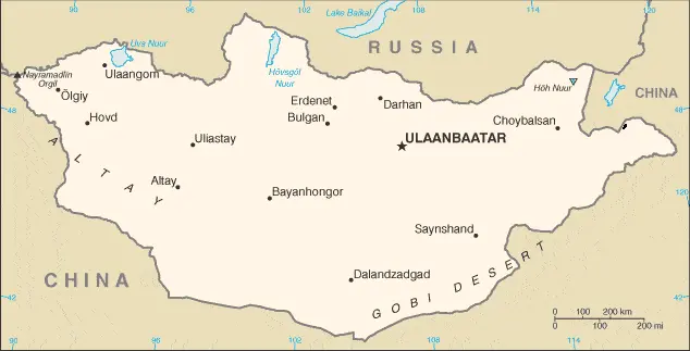
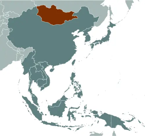
MONGOLIA is a large, central Asian republic that shares a long northern border with Russia and is surrounded by China‘s other sides.
The border with China extends for 4,670 kilometers or 2,901 miles. Mongolia consists mainly of a high plateau from which mountains rise in the west. The principal ranges are the Altai Mountains, which extend southeastward, and the Hangayn Mountains in the central western area.
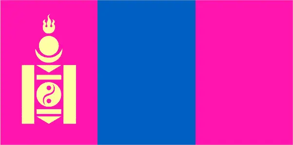
Google Maps and Detailed Facts of Mongolia (MN). This page lets you explore Mongolia and its border countries (Country Location: Northern Asia, between China and Russia) through detailed Satellite imagery – fast and easy as never before Google Maps.
Find comprehensive information about this country’s diversity below: Google maps, geography, economy, science, people, culture, environment, government, and history – All in One Wiki page.
There is also a Street View and free Driving Directions at your service. Your Google Satellite Map Sightseeing in Mongolia, in Asia, starts here at Driving Directions and Maps.com.
Muscat is one of the most populated cities in Oman, and at the same time, this city is the capital of this country. Located in Asia, you may find the city easily with the following GPS coordinates: 23.37N latitude / 58.36E longitude. For routing in Muscat, please check the free driving directions Muscat service below.
This website uses cookies to improve your experience. AcceptRead More
Privacy & Cookies Policy
Privacy Overview
This website uses cookies to improve your experience while you navigate through the website. Out of these, the cookies that are categorized as necessary are stored on your browser as they are essential for the working of basic functionalities of the website. We also use third-party cookies that help us analyze and understand how you use this website. These cookies will be stored in your browser only with your consent. You also have the option to opt-out of these cookies. But opting out of some of these cookies may affect your browsing experience.
Necessary cookies are absolutely essential for the website to function properly. This category only includes cookies that ensures basic functionalities and security features of the website. These cookies do not store any personal information.
Any cookies that may not be particularly necessary for the website to function and is used specifically to collect user personal data via analytics, ads, other embedded contents are termed as non-necessary cookies. It is mandatory to procure user consent prior to running these cookies on your website.