
Driving Directions and Google Map of Vietnam — Roads, Routes & Navigation Guide

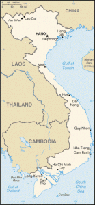
Vietnam — the Socialist Republic of Vietnam — is a long, slender nation stretching approximately 1,650 kilometres from the Chinese border in the north to the Ca Mau Peninsula in the far south, yet averaging only around 50 kilometres in width at its narrowest. This extraordinary geography — a country shaped like an elongated S along the South China Sea coast, backed by the Truong Son mountain range — defines its road network: a single great coastal artery, Highway 1 (Quoc Lo 1), threading the full length of the country, supplemented by a growing expressway network and a parallel inland route through the Central Highlands.
Vietnam drives on the right-hand side of the road, using left-hand drive vehicles. The country is famed — or notorious — for its extraordinary density of motorbikes: with approximately 50 million registered motorcycles among a population of 98 million, Vietnam has one of the highest per-capita motorbike densities in the world, and city traffic in Hanoi and Ho Chi Minh City is unlike anything experienced in Western countries. The alcohol limit is strictly zero tolerance (0.00% BAC) — enforced rigorously since the Road Traffic Law amendments of 2020. The currency is the Vietnamese Dong (VND / ₫). Emergency services are reached on 113 (Police), 114 (Fire), and 115 (Ambulance); the international 112 also connects. Use the route planner on our homepage for driving directions across Vietnam.
Road Network Overview
Vietnam’s national road network is administered by the Directorate for Roads of Vietnam (DRVN — Tổng cục Đường bộ Việt Nam), under the Ministry of Transport. The total road network exceeds 570,000 kilometres, though quality varies enormously between the modern expressway network in development and rural provincial roads. The network is broadly structured around three tiers: national highways (Quoc Lo), provincial roads (Tinh Lo), and district/commune roads.
Highway 1 — The Spine of Vietnam
Highway 1 (QL1 — Quoc Lo 1) is the single most important road in Vietnam: a continuous national highway running approximately 2,300 kilometres from Lang Son (near the Chinese border in the north) through Hanoi, Vinh, Hue, Da Nang, Nha Trang, and Phan Thiet all the way to Ca Mau at the southern tip of the country. QL1 passes through every major coastal city and is the backbone of commerce, freight, and long-distance travel in Vietnam. It is busy with trucks, buses, motorcycles, and private vehicles at all hours and can be congested through urban areas and market towns. Despite upgrades in many sections, portions remain two-lane single carriageway — overtaking requires patience and judgement.
The North-South Expressway (Cao tốc Bắc–Nam)
Vietnam’s most ambitious infrastructure project is the North-South Expressway — a planned 1,800-kilometre expressway corridor paralleling Highway 1 from Hanoi to Ho Chi Minh City. The project has been built in phases, with eastern and western alignment segments under different concessions. By early 2026, a substantial portion of the corridor is operational, including key sections in the north (Hanoi to Ninh Binh), central Vietnam, and the south (connecting to HCMC). Remaining gaps are actively under construction, with full corridor completion targeted for 2025–2027. Where open, the expressway dramatically reduces journey times versus Highway 1 and offers a far safer, higher-standard driving experience. Check the DRVN website or Waze for current open sections before planning a long-distance journey.
Key Expressways
- Hanoi–Haiphong Expressway (CT.04): A 105-kilometre four-lane expressway connecting the capital to Vietnam’s largest port city. One of the earliest and most heavily used expressways in the country, carrying both passenger and heavy freight traffic to Haiphong Port and Cat Bi Airport.
- Noi Bai–Lao Cai Expressway (CT.05): A 264-kilometre expressway linking Noi Bai International Airport (Hanoi’s main airport) northwest through the Hung Yen and Yen Bai provinces to Lao Cai city on the Chinese border — the gateway to Sa Pa. This expressway dramatically reduced the Hanoi–Sa Pa journey from around 8–9 hours on the old mountain road to approximately 3.5–4 hours.
- Hanoi–Ninh Binh Expressway (CT.01 / North-South corridor south of Hanoi): The initial southern section of the North-South Expressway corridor running from southern Hanoi to Ninh Binh, the gateway to the Trang An landscape complex (UNESCO World Heritage Site) and the Cuc Phuong National Park area.
- HCMC–Long Thanh–Dau Giay Expressway (CT.01 / southern section): The 55-kilometre expressway from Ho Chi Minh City east to the Dau Giay junction (connecting to Da Lat and the Central Highlands via QL20) and to Long Thanh (site of the new Long Thanh International Airport, under construction). This is one of the most heavily trafficked expressways in Vietnam.
- HCMC–Trung Luong Expressway (CT.02): A 40-kilometre expressway heading southwest from HCMC toward the Mekong Delta, the first step on the road to Can Tho, My Tho, and the Delta provinces.
- Da Nang–Quang Ngai Expressway (CT.02): A 139-kilometre central Vietnam expressway connecting Da Nang south through Quang Nam and Quang Ngai provinces, bypassing the congested sections of Highway 1 through central Vietnam’s most developed corridor.
Speed Limits
Speed limits in Vietnam are set under the Road Traffic Law (amended 2020) and enforced by CSGT (Cảnh sát giao thông — Traffic Police) at roadside checks and increasingly by fixed speed cameras and automatic number-plate recognition (ANPR) systems on expressways and major urban roads. Speed camera enforcement has expanded significantly in recent years and summonses are issued via registered vehicle owners.
| Road Type | Speed Limit | Notes |
|---|---|---|
| Expressways (4+ lanes, divided) | 100–120 km/h | 120 km/h on newer expressways; minimum speed 60 km/h on some sections |
| National highways, 4-lane outside urban | 90 km/h | Dual carriageway national roads |
| National highways, 2-lane outside urban | 80 km/h | Standard for most of Highway 1 outside built-up areas |
| Urban / built-up areas | 60 km/h | Default in all cities, towns, and populated areas |
| Residential / narrow streets | 40 km/h | As posted; many alleys (hẻm) effectively require walking pace |
Speed cameras are increasingly prevalent on Vietnamese expressways and major urban roads. Fines for speeding were substantially increased under the 2020 road traffic amendments. For rental vehicles, fines may be charged to the rental company and passed on to the driver — confirm the process with your rental provider. On Highway 1, mobile radar enforcement by CSGT is common, particularly near city outskirts.
Toll Roads & ETC Payment
Vietnam operates a pay-per-use toll system on all expressways and selected national highways — there is no national road vignette. Toll collection has been transitioning from cash to an Electronic Toll Collection (ETC) system using RFID transponders (known as VietPass or the national ETC tag). The government mandated ETC implementation across all toll stations from 2020, though cash lanes remain available at the vast majority of plazas as the transition continues. The ETC system requires a transponder device affixed to the windscreen, linked to a prepaid account. For rental vehicles, confirm with the rental company whether an ETC transponder is fitted and whether the account is pre-loaded — many rental providers include this, particularly for long-distance rentals.
| Route | Approx. Toll (Class 1 car, 2026) |
|---|---|
| Hanoi–Haiphong Expressway (full, ~105 km) | VND 140,000–160,000 |
| Noi Bai–Lao Cai Expressway (full, ~264 km) | VND 270,000–320,000 |
| HCMC–Long Thanh–Dau Giay (~55 km) | VND 44,000–80,000 |
| Da Nang–Quang Ngai Expressway (full, ~139 km) | VND 100,000–160,000 |
| Hai Van Tunnel (per direction) | VND 55,000–100,000 |
Toll rates are set by the Ministry of Transport and reviewed periodically. Highway 1 has a number of standalone BOT (Build-Operate-Transfer) toll stations — these are separate from the expressway toll system and generally accept cash. Check current rates and ETC coverage at the DRVN website before travel.
Road Rules & Driving Law
Vietnam drives on the right; vehicles have the steering wheel on the left. Road rules are set by the Road Traffic Law (Luật Giao thông đường bộ), substantially amended in 2020 with significantly increased fines and a stricter enforcement regime. Road signs follow the Vienna Convention format; in major cities and on expressways, signage is in Vietnamese with some English additions, particularly near airports and on tourist-frequented routes.
Driving licence — important IDP note: This is the most critical licence issue for foreign visitors to Vietnam. Vietnam is a signatory to the 1968 Vienna Convention on Road Traffic — and only recognises IDPs issued under that convention. Vietnam does not recognise IDPs issued under the older 1949 Geneva Convention. Many countries issue IDPs under the 1949 convention only — including historically the United States and United Kingdom. Drivers holding only a 1949 Geneva IDP cannot legally drive in Vietnam. Before travelling, verify that your home country’s motoring authority issues a 1968 Vienna Convention IDP. Most European, Australian, and many Asian country IDPs are Vienna-compliant. When in doubt, contact your national motoring club. Without a valid IDP, hiring a car with a local driver is the standard solution for foreign visitors.
Drink driving — zero tolerance: Vietnam enforces absolute zero tolerance (0.00% BAC) for all drivers since the amended Road Traffic Law of 2020. Penalties are severe: fines of VND 6,000,000–8,000,000 (approximately USD 240–320) for car drivers with any detectable alcohol, licence suspension of 10–12 months, and vehicle confiscation for 7–30 days. Roadside breathalyser checks by CSGT are very common, particularly on weekend evenings and public holidays. Visitors must not consume any alcohol if driving. The zero-tolerance rule applies equally to foreigners and Vietnamese nationals.
Seatbelts: Mandatory for all occupants of cars and trucks. Enforcement has increased substantially. Fines of VND 200,000–400,000 apply for non-compliance. Note that on motorcycles (the dominant vehicle type), helmets are mandatory for rider and pillion — a rule enforced seriously since 2007 with high compliance.
Mobile phones: Using a handheld mobile phone while driving is prohibited. Fines for car drivers start at VND 1,000,000–2,000,000. Hands-free use is permitted.
Traffic Police (CSGT): Cảnh sát giao thông officers in distinctive white uniforms with traffic batons are a constant presence on Vietnamese roads. Roadside checks are frequent — particularly on Highway 1 at city outskirts, near toll plazas, and at fixed police posts. Have all documents accessible: home country licence, IDP, vehicle registration, and insurance. Traffic fines must be paid through official channels; unofficial payments should be refused. The CSGT has modernised its enforcement significantly, with dashcam and ANPR evidence now commonly used.
Insurance: All vehicles in Vietnam must carry compulsory third-party liability insurance (bảo hiểm trách nhiệm dân sự — TNDS). For rental vehicles this is included. Comprehensive insurance is strongly recommended given the high accident rate and complex traffic environment.
Fuel & Petrol Stations
Fuel is sold through a large network of petrol stations across Vietnam. The dominant operators are Petrolimex (the largest, with the blue-and-white livery, state-linked) and PV Oil (Petrovietnam), supplemented by private operators including Comeco, Hải Linh, and others. The main fuel grades are:
- E5 RON92: A 95% petrol / 5% ethanol blend, the standard grade mandated to replace pure RON92 as part of Vietnam’s biofuel programme. Widely available at all Petrolimex stations. Suitable for most modern vehicles; some older or performance vehicles may require RON95.
- RON95: Standard premium unleaded petrol, without ethanol blending. The recommended grade for most rental cars and modern engines; slightly more expensive than E5 RON92 but universally compatible.
- RON95-III / RON95 Premium: Higher-specification premium fuel available at some Petrolimex and PV Oil stations.
- Diesel (dầu diesel): Available everywhere; used by trucks, buses, minibuses, and many larger rental vehicles (SUVs, vans).
Petrol stations are abundant on all major national highways and in urban areas. On remote mountain roads in the northwest (Ha Giang, Moc Chau, Lai Chau) and deep Central Highlands routes, stations can be far apart — fill up whenever the tank drops below half on any mountain or rural road. In very remote areas, small roadside vendors sell fuel in plastic bottles or jerricans at higher prices. Many petrol stations in Vietnam are manned — an attendant pumps the fuel; inform them of the grade and quantity or dollar amount required. Card payment is increasingly accepted at Petrolimex stations; cash (VND) is universally accepted.
Driving in Hanoi & Ho Chi Minh City
Vietnam’s two great cities — Hanoi (the capital, northern Vietnam, population ~8 million) and Ho Chi Minh City (HCMC / Saigon) (the commercial capital, southern Vietnam, population ~9 million) — are both extraordinarily challenging to drive in for foreign visitors unfamiliar with Southeast Asian urban traffic. The defining feature of both cities is the sheer density and fluidity of motorbike traffic.
At peak hours in Hanoi and HCMC, major roads become a continuous ocean of motorcycles, with cars navigating slowly through the flow. Junctions are negotiated by collective movement rather than strict compliance — traffic often proceeds through red lights in groups, pedestrians cross in a continuous stream through moving vehicles, and the concept of lane discipline is highly fluid. This is genuinely manageable once you understand the underlying logic: move slowly, predictably, and continuously; avoid sudden braking or swerving; allow motorbikes to flow around the car; sound the horn gently as a presence indicator, not as an aggression signal. Experienced drivers quickly adapt, but the first hour behind the wheel in HCMC or Hanoi can be deeply disorienting.
For the vast majority of visitors, Grab (ride-hailing, with both GrabCar and GrabBike options) or metered taxis (Vinasun and Mai Linh in the south; various operators in Hanoi) are far more practical than self-driving for city travel. Parking in central Hanoi and HCMC is limited and expensive. The cities’ narrow hẻm (alleys) that comprise most of the residential fabric are typically impassable by car — accessible only on foot or by motorbike.
Hanoi’s Old Quarter has vehicle restrictions on many streets at certain hours. The Hoan Kiem Lake area is pedestrianised on weekend evenings. In HCMC, the District 1 centre (Bến Nghé) has complex one-way systems. Use Waze or Google Maps for real-time routing in both cities — both apps have strong coverage in Vietnam and are widely used by local drivers and Grab riders alike.
Highway 1: Driving the Length of Vietnam
Driving the full length of Vietnam on Highway 1 (QL1) from Hanoi to Ho Chi Minh City — approximately 1,730 kilometres as measured by road distance between city centres — is one of Southeast Asia’s great road journeys. Using a combination of Highway 1 and the completed sections of the North-South Expressway, the journey can be completed in as few as four to five days of sustained driving, though most travellers allow two to three weeks to explore the cities, beaches, and landscapes along the way.
Key stopping points along the Highway 1 / North-South corridor from north to south include: Ninh Binh (limestone karst landscape and ancient Vietnamese capital); Thanh Hoa; Vinh; Dong Ha (DMZ — Demilitarised Zone area, historic wartime significance); Hue (Imperial capital, UNESCO citadel); Da Nang (largest central city, Dragon Bridge, My Son UNESCO site nearby); Hoi An (UNESCO Ancient Town, reached via a short detour from QL1); Quy Nhon; Nha Trang (beach resort city); Phan Thiet / Mui Ne (sand dunes, seafood); and finally the approach to Ho Chi Minh City via the HCMC–Long Thanh–Dau Giay Expressway.
The most dramatic section of Highway 1 is the Hai Van Pass — a mountain headland rising 496 metres above sea level between Da Nang and Hue, where the road clings to a cliff face above the South China Sea. The Hai Van Tunnel (6.28 km, opened 2005 — formerly the longest in Southeast Asia) bypasses the pass for through-traffic, but the old pass road remains open and is one of the most celebrated drives in Vietnam. Allow 30–40 minutes to cross the pass on the old road and stop at the summit for the extraordinary view north and south along the coast.
Regional Roads: North, Central & South
Northern Vietnam — Hanoi and beyond: The region around Hanoi is well-connected by national highways. Highway 2 leads northwest to Viet Tri and Tuyen Quang; Highway 6 heads southwest toward Hoa Binh and the spectacular Mai Chau valley; Highway 32 climbs through Nghia Lo toward Mu Cang Chai and the extraordinary rice terrace landscapes. The far northwest — Ha Giang, Dong Van, Meo Vac — is reached via Highway 4C and the Ma Pi Leng Pass, considered one of the most dramatic mountain roads in Asia. These far-northern mountain roads require a confident driver, a reliable vehicle, and ideally a local guide or good offline maps; mobile coverage can be minimal, roads are narrow and steep, and weather can change rapidly.
Central Vietnam: Between Da Nang and the Central Highlands, several notable roads branch inland. Highway 14 (Ho Chi Minh Highway) runs through the Central Highlands — the coffee-growing plateau of Kon Tum, Gia Lai, Dak Lak (Buon Ma Thuot), and Lam Dong (Da Lat) — an inland alternative to Highway 1 through a very different Vietnam of highland minority communities, coffee and pepper plantations, and cool-climate towns. Da Lat, the former French hill station at 1,500 metres, is reached via Highway 20 from HCMC or Highway 27/28 from the coast — the approach through pine forests is one of central Vietnam’s most distinctive drives.
Southern Vietnam and the Mekong Delta: South of Ho Chi Minh City, the landscape flattens dramatically into the vast alluvial plain of the Mekong Delta. Roads in the Delta are generally flat and well-maintained, though the network of rivers and canals means frequent bridges and occasional ferry crossings (though the major ferries have been replaced by bridges in recent years — notably the My Thuan Bridge and Can Tho Bridge over the Mekong’s main channels). Can Tho (the Delta’s largest city) is approximately 2.5 hours from HCMC via the HCMC–Trung Luong Expressway and then Highway 1. Road quality is generally good on the main provincial roads; minor delta roads can be very narrow, with sharp canal-side drops requiring careful driving.
Road Hazards: Motorbikes, Monsoons & Mountains
Motorbikes — the dominant hazard: With approximately 50 million registered motorbikes on Vietnamese roads, motorcycles are the single greatest road hazard for car drivers in Vietnam. They filter constantly between lanes, overtake on both sides, travel in dense clusters at junctions, and appear from alleys and side roads without warning. The key rule: check mirrors constantly, signal early and clearly, and never assume a gap will stay clear. At traffic lights, motorcycles fill every available space around stopped cars. When the light turns green, allow a few seconds for the motorcycle wave to begin moving before pulling away. Never drive aggressively or impatiently in motorbike traffic — the physical asymmetry means any collision is extremely serious for the motorcyclist.
Monsoons and flooding: Vietnam’s diverse geography produces distinct seasonal weather patterns across its regions. Central Vietnam (Hue, Da Nang, Hoi An, Quang Ngai) experiences its peak rainfall from October to January, coinciding with the northeast monsoon and typhoon season. This period brings devastating floods to the coastal lowlands — rivers burst their banks, roads are inundated, and entire districts can be cut off. The floods of October–November can close Highway 1 and even parts of the expressway for days. Check nchmf.gov.vn (National Centre for Hydro-Meteorological Forecasting) and local news before travelling through central Vietnam during this period. Southern Vietnam has its rainy season from May–October, bringing heavy afternoon and evening downpours but less catastrophic flooding than the central region. Northern Vietnam has a distinct four-season pattern — cold, dry winters (Hanoi temperatures can drop to 10–15°C in January); hot, wet summers (June–September); and a brief, pleasant spring and autumn.
Mountain roads in the north: The roads of northern Vietnam’s mountainous regions — Ha Giang, Lai Chau, Son La, Hoa Binh — are genuinely challenging. Steep gradients, tight hairpin bends, limited barriers at cliff edges, variable surface conditions, and frequent landslides in rainy season all demand careful, experienced driving. Fog is common in the mornings at altitude. Heavy vehicles (trucks carrying goods from the Chinese border) occupy the full road width on bends. Never attempt mountain roads in northern Vietnam at night, in fog, or in heavy rain. Take your time — the scenery rewards patience.
Livestock and animals on roads: Water buffalo, cattle, pigs, chickens, and dogs are common on rural roads throughout Vietnam, particularly in the Central Highlands and northern mountains. In highland minority areas, livestock may be herded across highways. Slow down and sound the horn gently when approaching livestock clusters.
Road condition variability: Even on Highway 1, road quality can shift abruptly — a newly resurfaced section gives way to a potholed stretch without warning. After any significant rainfall or flooding, road damage can appear on previously good sections. On nighttime driving on rural roads, unlit potholes, road damage, and slow-moving vehicles (ox carts, motorbikes without lights) are serious hazards. Avoid night driving on rural roads wherever possible.
Scenic Drives & Road Trip Routes
Hai Van Pass (Da Nang to Hue): The old Highway 1 road over the Hai Van Pass — the “Pass of Ocean Clouds” — is arguably Vietnam’s most celebrated drive. Rising to 496 metres on a headland that divides the climatic zones of central and north-central Vietnam, the pass road offers breathtaking views of Da Nang Bay to the south and Lang Co lagoon to the north. The summit fortifications are a remnant of successive Vietnamese, French, and wartime defensive installations. Famously featured in international motoring programmes as one of Asia’s great drives. Allow 45–60 minutes for the crossing; the descent toward Hue through Lang Co (a slender spit between sea and lagoon) is equally beautiful.
Ha Giang Loop (Dong Van Karst Plateau): The circuit through Ha Giang province in Vietnam’s extreme north — typically taken clockwise from Ha Giang city via Quan Ba (the “Fairy Bosom” twin-peaked hills), Yen Minh, Dong Van (a UNESCO Global Geopark), and Meo Vac over the Ma Pi Leng Pass back to Ha Giang — is considered one of the most spectacular motorcycle and car circuits in all of Asia. The Ma Pi Leng Pass road traverses vertiginous limestone gorges above the turquoise Nho Que River with near-vertical cliff faces dropping hundreds of metres on either side. Drive with extreme care; the road is narrow, barriers are minimal or absent, and the consequences of a lapse in attention are severe. Best driven in clear weather (April–June or September–October); avoid during monsoon (July–August) when landslides are common.
Noi Bai–Lao Cai Expressway to Sa Pa: The combination of the modern expressway from Hanoi northwest to Lao Cai, followed by the winding mountain road ascending through the Muong Hoa valley to Sa Pa at 1,600 metres, makes for one of Vietnam’s most rewarding and accessible road trips. Sa Pa is the gateway to Vietnam’s rice terrace country — the extraordinary stepped landscapes of the Muong Hoa valley and surrounding hills are most photogenic in the harvest seasons (September–October and May–June). The final ascent to Sa Pa from Lao Cai involves a steep, winding, but well-maintained road with dramatic valley views.
Ho Chi Minh Highway — Da Nang to Da Lat: The inland Ho Chi Minh Highway (QL14) through the Central Highlands offers a completely different Vietnam from the coastal Highway 1 route. Passing through the coffee highlands of Kon Tum, Gia Lai, Buon Ma Thuot, and the flower-growing plateau around Da Lat, the route traverses a Vietnam of misty highlands, ethnic minority villages, pine forests, and vast coffee and pepper estates. Da Lat itself — the former French hill station with its European-influenced architecture, cool climate, and strawberry farms — is one of the most charming destinations in southern Vietnam, reached via a spectacular descent from the Prenn Pass or the Di Linh Plateau.
The Mekong Delta Circuit: Driving south from Ho Chi Minh City into the Mekong Delta, looping through My Tho, Ben Tre (the coconut island), Vinh Long, Can Tho (the Delta’s largest city, with its famous floating market at Cai Rang), and returning via Long An gives a vivid experience of the Delta’s waterway culture, rice paddies, and fruit orchards. The flat, bridge-laced roads are easy to drive; the rewards are in stopping at floating markets, river ferries, and traditional villages along the way. Best visited in the dry season (November–April) when flooding is absent.
FAQ: Driving in Vietnam
Can I drive in Vietnam with an International Driving Permit?
Only if your IDP is issued under the 1968 Vienna Convention on Road Traffic. Vietnam does not recognise IDPs issued under the 1949 Geneva Convention. Many countries issue both; some (including historically the UK and USA) have issued only the 1949 version. Verify with your national motoring authority that your IDP is Vienna Convention (1968) compliant before travel. Without a valid IDP, hiring a car with a local driver is the standard solution — widely available through hotels, tour operators, and rental companies throughout Vietnam.
Which side of the road does Vietnam drive on?
Vietnam drives on the right-hand side of the road, with left-hand drive vehicles — the same as continental Europe, the Americas, China, and most of Asia. This is the same side as neighbouring China, Laos, and Cambodia. Road signs broadly follow the Vienna Convention format, with signage in Vietnamese; major tourist routes and expressways include English.
What is the drink-drive limit in Vietnam?
Vietnam enforces absolute zero tolerance — any detectable alcohol in the blood while driving is illegal. This was introduced by the 2020 Road Traffic Law amendments and is strictly enforced with breathalyser roadblocks, particularly on weekend evenings and public holidays. Fines for car drivers start at VND 6,000,000–8,000,000 (approximately USD 240–320), with licence suspension of 10–12 months and vehicle confiscation. Visitors must not consume any alcohol if they intend to drive.
How dangerous is driving in Vietnam?
Vietnam has a high road fatality rate by international standards — approximately 6,000–7,000 road deaths per year, primarily involving motorcyclists. For car drivers, the key challenges are the density of motorbike traffic (particularly in Hanoi and HCMC), variable road quality on secondary roads, monsoon flooding in central Vietnam, and steep mountain roads in the north. Driving in cities is genuinely challenging for first-time visitors; hiring a car with driver or using Grab in urban areas is strongly recommended. On intercity expressways and major national highways, driving in a modern rental car is manageable for careful, experienced drivers.
Is the Hai Van Pass worth the detour from the tunnel?
Absolutely — for drivers who enjoy scenic mountain roads and have time to spare. The Hai Van Pass old road adds approximately 30 km and 45–60 minutes versus the tunnel route, but the views — of Da Nang Bay to the south and the Lang Co lagoon to the north — are among the finest in Vietnam. The pass is best driven in clear weather; morning cloud is common and clears by mid-morning on most days. Check conditions before setting out. Note that some rental agreements restrict mountain roads — confirm with your rental provider.
What fuel should I use in a rental car in Vietnam?
Use RON95 for most modern rental cars — it is the universally compatible premium unleaded grade, available at all Petrolimex and PV Oil stations. E5 RON92 (a 5% ethanol blend) is also widely available and suitable for most modern engines, but RON95 is the safer default for rental vehicles when in doubt. Check your rental agreement for the specified fuel grade. For diesel vehicles, standard diesel is available everywhere. Always carry sufficient fuel before heading into remote mountain areas.
Sources and Update Note
This Vietnam driving guide draws on information from the Directorate for Roads of Vietnam (DRVN) (drvn.gov.vn) for road network and expressway data, the Ministry of Transport of Vietnam (mt.gov.vn) for road traffic law and toll regulations, the Ministry of Public Security / Cảnh sát giao thông (CSGT) for traffic enforcement and drink-drive law, the Road Traffic Law (Luật Giao thông đường bộ, amended 2020) for legal requirements, Petrolimex (petrolimex.com.vn) for fuel grade and station data, the National Centre for Hydro-Meteorological Forecasting (NCHMF) (nchmf.gov.vn) for weather and flood data, and Vietnam National Administration of Tourism (VNAT) (vietnam.travel) for scenic route information.
The North-South Expressway is under active construction with new sections opening regularly — verify current open sections at drvn.gov.vn or via Waze before planning a long-distance journey. ETC (VietPass) coverage is expanding; cash toll lanes remain available at all plazas as of February 2026. Drink-drive enforcement (zero tolerance) is actively maintained year-round. This guide reflects conditions as of February 2026.