
Tripoli is one of the most populated cities in Libya, and at the same time, this city is the capital of this country. Located in Africa, you may find the city easily with the following GPS coordinates: 32.49N latitude / 13.07E longitude. For routing in Tripoli, please check the free driving directions Tripoli service below.
Africa Maps
Explore the countries in Africa with all their Wiki, find information on weather, population, facts, history, landmarks of major cities data, and enjoy free Google maps Satellite imagery & Street views. Each Country Profile in Africa provides information on Geography data, area maps, Google maps, flag, history, area, population, the capital city, largest cities, economy, spoken languages, ethnicity/race, religion, literacy rate, government, and many more!
In this map category, you will find these African countries and their capital cities:
Algeria, Angola, Benin, Botswana, Burkina Faso, Burundi, Cameroon, Cape Verde, Chad, Comoros, Democratic Republic of the Congo, Republic of Congo, Côte d’Ivoire, Djibouti, Egypt, Equatorial Guinea, Eritrea, Ethiopia, Gabon, Gambia, Ghana, Guinea, Guinea-Bissau, Guyana, Kenya, Lesotho, Liberia, Libya, Madagascar, Malawi, Mali, Mauritania, Mauritius, Morocco, Mozambique, Namibia, Niger, Nigeria, Rwanda, São Tomé and Príncipe, Senegal, Seychelles, Sierra Leone, Somalia, South Africa, Sudan, Swaziland, Tanzania, Togo, Tunisia, Uganda, Zambia, Zimbabwe.
Google Maps™ Driving Directions (Home) » Africa Maps »
Tunis Google Maps
Tunis is one of the most populated cities in Tunisia, and at the same time, this city is the capital of this country. Located in Africa, you may find the city easily with the following GPS coordinates: 36.50N latitude / 10.11E longitude. For routing in Tunis, please check the free driving directions Tunis service below.
Google Maps™ Driving Directions (Home) » Africa Maps »
Tunisia
Driving Directions Tunisia
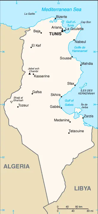
TUNISIA is a country in North Africa that lies on the south coast of the Mediterranean Sea. Algeria bounds it to the west and Libya to the south. Several islands, notably Djerba and Kerkennah, lie near the shore. Northern Tunisia consists of hills, plains, and valleys. Inland, the Atlas Mountains project’s foothills into the northwestern part of the country, rising from 610-1,520 meters or 2,000-5,000 feet.
Google Maps™ Driving Directions (Home) » Africa Maps »
Tunisia Google Maps
 |
 |
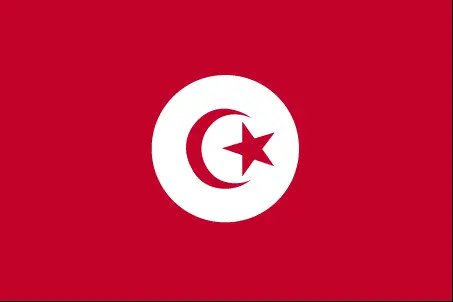 |
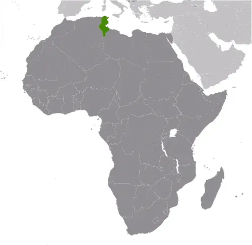
| Borderline map of Tunisia | Location map of Tunisia | Flag of Tunisia |
Google Maps and Detailed Facts of Tunisia (TN). This page lets you explore Tunisia and its border countries (Country Location: Northern Africa, bordering the Mediterranean Sea, between Algeria and Libya) through detailed Satellite imagery – fast and easy as never before Google Maps.
Find comprehensive information about this country’s diversity below: Google Maps, geography, economy, science, people, culture, environment, government, and history – All in One Wiki page.
There is also a Street View and free Driving Directions at your service. Your Google Satellite Map Sightseeing in Tunisia, in Africa, starts here at Driving Directions and Maps.com.
Google Maps™ Driving Directions (Home) » Africa Maps »
Uganda
Driving Directions Uganda
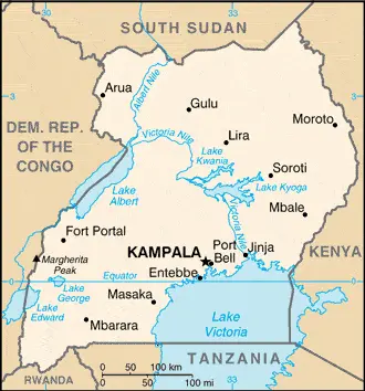
UGANDA is a landlocked republic in east-central Africa. The Equator runs through the south of the country, and for the most part, it is a richly fertile land, well-watered with a pleasant climate. Uganda is a plateaux country, mountains, lakes, and plains, presenting a great variety of landscapes and vegetation.
Google Maps™ Driving Directions (Home) » Africa Maps »
Uganda Google Maps
 |
 |
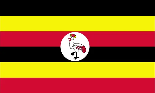 |
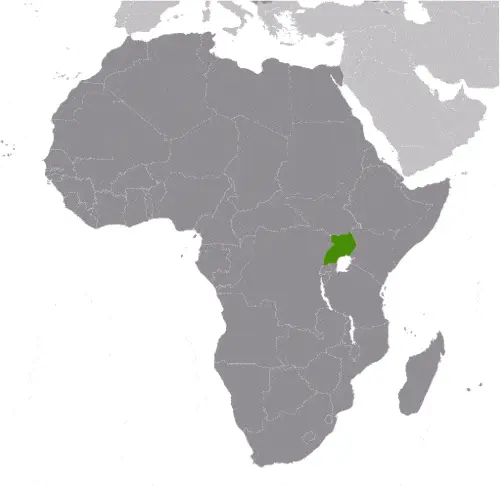
| Borderline map of Uganda | Location map of Uganda | Flag of Uganda |
Google Maps and Detailed Facts of Uganda (UG). This page lets you explore Uganda and its border countries (Country Location: East-Central Africa, west of Kenya, east of the Democratic Republic of the Congo) through detailed Satellite imagery – fast and easy as never before Google Maps.
Find comprehensive information about this country’s diversity below: Google Maps, geography, economy, science, people, culture, environment, government, and history – All in One Wiki page.
There is also a Street View and free Driving Directions at your service. Your Google Satellite Map Sightseeing in Uganda, in Africa, starts here at Driving Directions and Maps.com.
Google Maps™ Driving Directions (Home) » Africa Maps »
Victoria Google Maps
Victoria is one of the most populated cities in Seychelles, and at the same time, this city is the capital of this country. Located in Africa, you may find the city easily with the following GPS coordinates: 4.61S latitude / 55.45E longitude. For routing in Victoria, please check the free driving directions Victoria service below.
Google Maps™ Driving Directions (Home) » Africa Maps »
Western Sahara
Driving Directions Western Sahara
WESTERN SAHARA is a disputed west African territory with a coastline on the Atlantic Ocean. A thinly populated desert country of rocky plains and plateaux with low hills in the extreme northeast, it is rich in phosphates. Formerly Spanish Sahara, the entire territory has been claimed and administered since 1979 by Morocco, against the wishes of an active separatist movement, the Frente Polisario.
Google Maps™ Driving Directions (Home) » Africa Maps »
Windhoek Google Maps
Windhoek is one of the most populated cities in Namibia, and at the same time, this city is the capital of this country. Located in Africa, you may find the city easily with the following GPS coordinates: 22.35S latitude / 17.04E longitude. For routing in Windhoek, please check the free driving directions Windhoek service below.
Google Maps™ Driving Directions (Home) » Africa Maps »
Yamoussoukro Google Maps
Yamoussoukro is one of the most populated cities in Ivory Coast, and at the same time, this city is the capital of this country. Located in Africa, you may find the city easily with the following GPS coordinates: 6.82N latitude / 5.28W longitude. For routing in Yamoussoukro, please check the free driving directions Yamoussoukro service below.