Explore the countries in Central America and the Caribbean with all their Wiki, find information on weather, population, facts, history, landmarks of major cities data, and enjoy free Google maps Satellite imagery & Street views. Each Country Profile in Central America and the Caribbean provides information on Geography data, area maps, Google maps, flag, history, area, population, the capital city, largest cities, economy, spoken languages, ethnicity/race, religion, literacy rate, government, and many more!
In this map category, you will find these Central American and Caribbean countries and their capital cities:
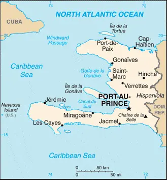
HAITI occupies the western third of the large island of Hispaniola in the Caribbean. It is a mountainous country consisting of five different ranges, the highest point being 2,680 meters or 8,793 feet at Pic La Selle. Deep valleys and plains separate the mountain ranges.
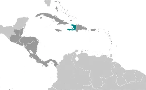
Google Maps and Detailed Facts of Haiti (HT). This page lets you explore Haiti and its border countries (Country Location: the Caribbean, western one-third of the island of Hispaniola, between the Caribbean Sea and the North Atlantic Ocean, west of the Dominican Republic) through detailed Satellite imagery – fast and easy as never before Google Maps.
Find comprehensive information about this country’s diversity below: Google maps, geography, economy, science, people, culture, environment, government, and history – All in One Wiki page.
There is also a Street View and free Driving Directions at your service. Your Google Satellite Map Sightseeing in Haiti, Central America, and the Caribbean starts here at Driving Directions and Maps.com.
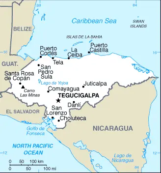
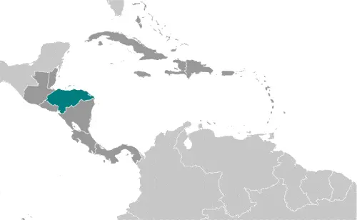
Four-fifths of the country covered in mountains which indented with river valleys running toward the very short Pacific coast. The highlands are covered with forests, mainly oak and pine, while palms and mangroves grow in the coastal areas.
There is little change in temperatures throughout the year, and rainfall is heavy, especially on the Caribbean coast, where temperatures are higher than inland.
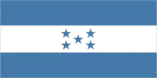
Google Maps and Detailed Facts of Honduras (HN). This page lets you explore Honduras and its border countries (Country Location: Central America, bordering the Caribbean Sea, between Guatemala and Nicaragua and bordering the Gulf of Fonseca (North Pacific Ocean), between El Salvador and Nicaragua) through detailed Satellite imagery – fast and easy as never before Google Maps.
Find comprehensive information about this country’s diversity below: Google maps, geography, economy, science, people, culture, environment, government, and history – All in One Wiki page.
There is also a Street View and free Driving Directions at your service. Your Google Satellite Map Sightseeing in Honduras, in Central America, and the Caribbean, starts here at Driving Directions and Maps.com.
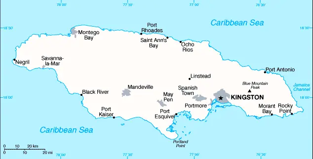
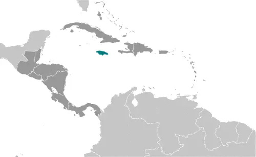
JAMAICA is an island state in the Caribbean Sea about 150-kilometers or 93 miles south of Cuba. The island’s center comprises a limestone plateau, and narrow coastal flatlands and palm-fringed beaches surround this. The highest mountains, the Blue Mountains, are in the east of the island.
Google Maps and Detailed Facts of Jamaica (JM). This page lets you explore Jamaica and its border countries (Country Location: the Caribbean, island in the Caribbean Sea, south of Cuba) through detailed Satellite imagery – fast and easy as never before Google Maps.
Find comprehensive information about this country’s diversity below: Google maps, geography, economy, science, people, culture, environment, government, and history – All in One Wiki page.
There is also a Street View and free Driving Directions at your service. Your Google Satellite Map Sightseeing in Jamaica, in Central America, and the Caribbean, starts here at Driving Directions and Maps.com.
MARTINIQUE is one of the larger Windward Islands in the Lesser Antilles group in the southern Caribbean. It is administered as an overseas department of France. The Lesser Antilles group consists of the smaller islands to the east and south of the Caribbean, which further divided into the Leeward Islands and the Windward Islands.
MEXICO is a vast, densely populated country whose people are Spanish-speaking. It is bounded in the north by its long border with the USA. In the south, it shares a long border with Guatemala and a shorter one with Belize.
The Gulf of Mexico and the northern Caribbean Sea lie to the east, the Gulf of California to the northwest and the Pacific Ocean to the southwest
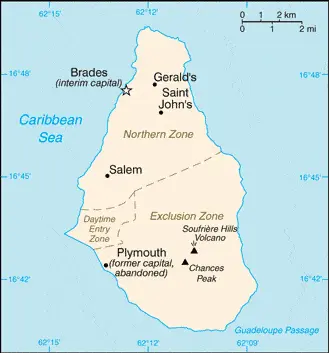
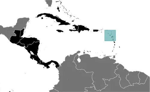
MONTSERRAT is a British overseas territory and one of the Leeward Islands in the Caribbean Sea. The island is rugged, heavily forested and mountainous with active volcanoes.
Google Maps and Detailed Facts of Montserrat (MS). This page lets you explore Montserrat and its border countries (Country Location: the Caribbean, an island in the Caribbean Sea, southeast of Puerto Rico) through detailed Satellite imagery – fast and easy as never before Google Maps.
Find comprehensive information about this country’s diversity below: Google maps, geography, economy, science, people, culture, environment, government, and history – All in One Wiki page.
There is also a Street View and free Driving Directions at your service. Your Google Satellite Map Sightseeing in Montserrat, in Central America, and the Caribbean, starts here at Driving Directions and Maps.com.
This website uses cookies to improve your experience. AcceptRead More
Privacy & Cookies Policy
Privacy Overview
This website uses cookies to improve your experience while you navigate through the website. Out of these, the cookies that are categorized as necessary are stored on your browser as they are essential for the working of basic functionalities of the website. We also use third-party cookies that help us analyze and understand how you use this website. These cookies will be stored in your browser only with your consent. You also have the option to opt-out of these cookies. But opting out of some of these cookies may affect your browsing experience.
Necessary cookies are absolutely essential for the website to function properly. This category only includes cookies that ensures basic functionalities and security features of the website. These cookies do not store any personal information.
Any cookies that may not be particularly necessary for the website to function and is used specifically to collect user personal data via analytics, ads, other embedded contents are termed as non-necessary cookies. It is mandatory to procure user consent prior to running these cookies on your website.