Driving Directions Netherlands Antilles
NETHERLANDS ANTILLES consists of two sets of islands, the Southern Netherlands Antilles (Bonaire and Curacao) and the Northern Netherlands Antilles (Saba, St Maarten, and St Eustatius).

Google Maps, Country Facts and Route Planner
Explore the countries in Central America and the Caribbean with all their Wiki, find information on weather, population, facts, history, landmarks of major cities data, and enjoy free Google maps Satellite imagery & Street views. Each Country Profile in Central America and the Caribbean provides information on Geography data, area maps, Google maps, flag, history, area, population, the capital city, largest cities, economy, spoken languages, ethnicity/race, religion, literacy rate, government, and many more!
In this map category, you will find these Central American and Caribbean countries and their capital cities:
Anguilla, Antigua and Barbuda, Aruba, Bahamas, Barbados, Belize, British Virgin Islands, Cayman Islands, Costa Rica, Cuba, Curacao, Dominica, Dominican Republic, El Salvador, Grenada, Guatemala, Haiti, Honduras, Jamaica, Martinique, Mexico, Montserrat, Netherlands Antilles, Nicaragua, Panama, Puerto Rico, Saint Barthelemy, Saint Kitts and Nevis, Saint Lucia, Saint Martin, Saint Vincent and the Grenadines, Sint Maarten, St Lucia, Trinidad and Tobago, Turks and Caicos Islands, Virgin Islands.
NETHERLANDS ANTILLES consists of two sets of islands, the Southern Netherlands Antilles (Bonaire and Curacao) and the Northern Netherlands Antilles (Saba, St Maarten, and St Eustatius).
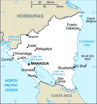
NICARAGUA is the largest of the Central American countries. It lies between the Pacific Ocean to the west and the Caribbean Sea to the east, on the isthmus of Central America, and is sandwiched between Honduras to the north and Costa Rica to the south.
The dense forests and sandy beaches of the Mosquito Coast in the eastern part of the country are the wettest part of the island and home to a variety of wildlife, including jaguar, monkey, puma, and crocodile.
 |
 |
 |
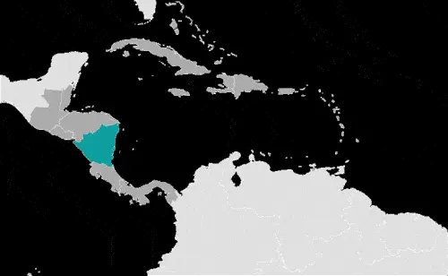
| Borderline map of Nicaragua | Location map of Nicaragua | Flag of Nicaragua |
Google Maps and Detailed Facts of Nicaragua (NI). This page lets you explore Nicaragua and its border countries (Country Location: Central America, bordering both the Caribbean Sea and the North Pacific Ocean, between Costa Rica and Honduras) through detailed Satellite imagery – fast and easy as never before Google Maps.
Find comprehensive information about this country’s diversity below: Google maps, geography, economy, science, people, culture, environment, government, and history – All in One Wiki page.
There is also a Street View and free Driving Directions at your service. Your Google Satellite Map Sightseeing in Nicaragua, in Central America, and the Caribbean, starts here at Driving Directions and Maps.com.
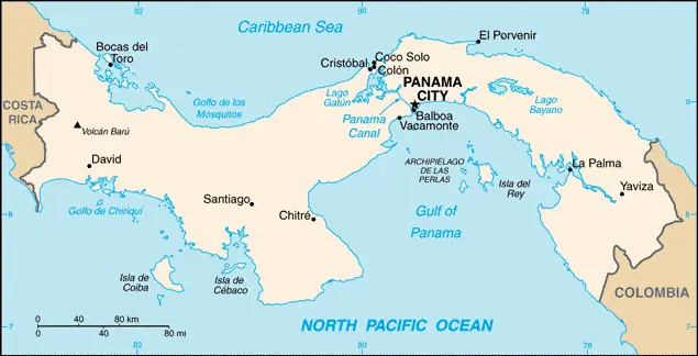
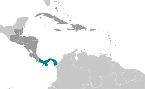
PANAMA is a narrow, S-shaped isthmus that links Central America and South America. It is only about 177 kilometers or 110 miles across at its widest point. Most of the country is mountainous, although the peaks are modest by Central American standards.
 |
 |
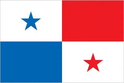 |
| Borderline map of Panama | Location map of Panama | Flag of Panama |
Google Maps and Detailed Facts of Panama (PA). This page lets you explore Panama and its border countries (Country Location: Central America, bordering both the Caribbean Sea and the North Pacific Ocean, between Colombia and Costa Rica) through detailed Satellite imagery – fast and easy as never before Google Maps.
Find comprehensive information about this country’s diversity below: Google maps, geography, economy, science, people, culture, environment, government, and history – All in One Wiki page.
There is also a Street View and free Driving Directions at your service. Your Google Satellite Map Sightseeing in Panama, in Central America, and the Caribbean, starts here at Driving Directions and Maps.com.
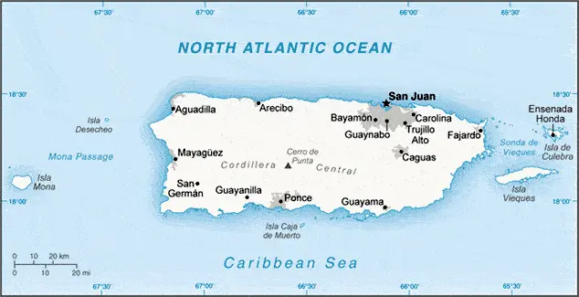
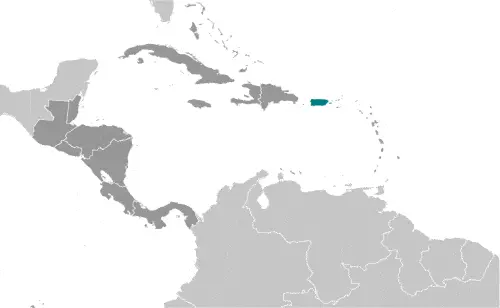
PUERTO RICO is the most easterly of the Greater Antilles Islands and lies in the Caribbean Sea between the Dominican Republic and the US Virgin Islands. It is a self-governing commonwealth in association with the USA, and its people are US citizens.
The country includes the main island, Puerto Rico, the two small islands of Vieques and Culebra, and a fringe of smaller uninhabited islands. The climate is tropical, modified slightly by cooling sea breezes.
 |
 |
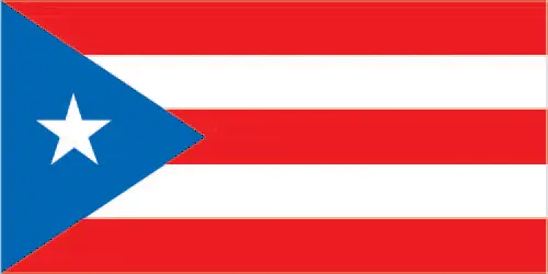 |
| Borderline map of Puerto Rico | Location map of Puerto Rico | Flag of Puerto Rico |
Google Maps and Detailed Facts of Puerto Rico (PR). This page lets you explore Puerto Rico and its border countries (Country Location: the Caribbean, island between the Caribbean Sea and the North Atlantic Ocean, east of the Dominican Republic) through detailed Satellite imagery – fast and easy as never before Google Maps.
Find comprehensive information about this country’s diversity below: Google maps, geography, economy, science, people, culture, environment, government, and history – All in One Wiki page.
There is also a Street View and free Driving Directions at your service. Your Google Satellite Map Sightseeing in Puerto Rico, Central America, and the Caribbean start here at Driving Directions and Maps.com.
 |
 |
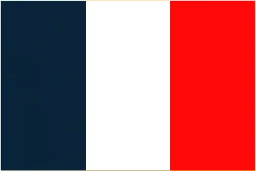 |
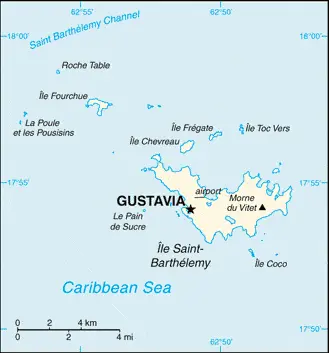
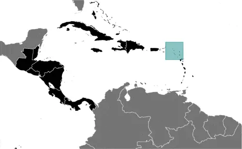
| Borderline map of Saint Barthelemy | Location map of Saint Barthelemy | Flag of Saint Barthelemy |
Google Maps and Detailed Facts of Saint Barthelemy (BL). This page lets you explore Saint Barthelemy and its border countries (Country Location: the Caribbean, island between the Caribbean Sea and the North Atlantic Ocean; located in the Leeward Islands (northern) group; Saint Barthelemy lies east of the US Virgin Islands) through detailed Satellite imagery – fast and easy as never before Google Maps.
Find comprehensive information about this country’s diversity below: Google maps, geography, economy, science, people, culture, environment, government, and history – All in One Wiki page.
There is also a Street View and free Driving Directions at your service. Your Google Satellite Map Sightseeing in Saint Barthelemy, in Central America, and the Caribbean, starts here at Driving Directions and Maps.com.
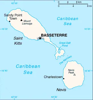 |
 |
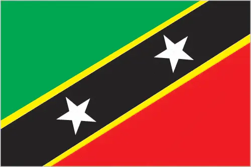 |
| Borderline map of Saint Kitts and Nevis | Location map of Saint Kitts and Nevis | Flag of Saint Kitts and Nevis |
Saint Kitts and Nevis Google map
Google Maps and Detailed Facts of Saint Kitts and Nevis (KN). This page lets you explore Saint Kitts and Nevis and its border countries (Country Location: the Caribbean, islands in the Caribbean Sea, about one-third of the way from Puerto Rico to Trinidad and Tobago) detailed Satellite imagery – fast and easy as never before Google Maps.
Find comprehensive information about this country’s diversity below: Google maps, geography, economy, science, people, culture, environment, government, and history – All in One Wiki page.
There is also a Street View and free Driving Directions at your service. Your Google Satellite Map Sightseeing in Saint Kitts and Nevis, in Central America, and the Caribbean, starts here at Driving Directions and Maps.com.
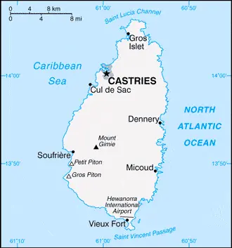 |
 |
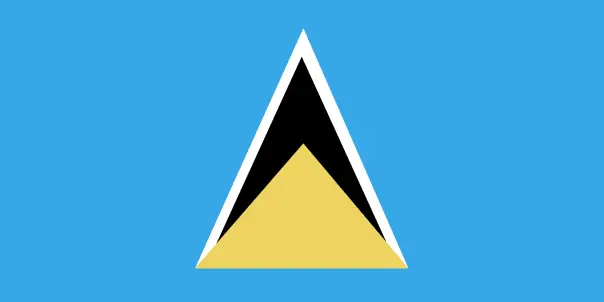 |
| Borderline map of Saint Lucia | Location map of Saint Lucia | Flag of Saint Lucia |
Google Maps and Detailed Facts of Saint Lucia (LC). This page lets you explore Saint Lucia and its border countries (Country Location: the Caribbean, island between the Caribbean Sea and North Atlantic Ocean, north of Trinidad and Tobago) through detailed Satellite imagery – fast and easy as never before Google Maps.
Find comprehensive information about this country’s diversity below: Google maps, geography, economy, science, people, culture, environment, government, and history – All in One Wiki page.
There is also a Street View and free Driving Directions at your service. Your Google Satellite Map Sightseeing in Saint Lucia, in Central America, and the Caribbean, starts here at Driving Directions and Maps.com.