Driving Directions British Virgin Islands
VIRGIN ISLANDS (British) lies at the northwestern end of the Lesser Antilles in the Caribbean Sea. They are a British overseas territory and comprise four large islands and 36 islets and cays.

Google Maps, Country Facts and Route Planner
Explore the countries in Central America and the Caribbean with all their Wiki, find information on weather, population, facts, history, landmarks of major cities data, and enjoy free Google maps Satellite imagery & Street views. Each Country Profile in Central America and the Caribbean provides information on Geography data, area maps, Google maps, flag, history, area, population, the capital city, largest cities, economy, spoken languages, ethnicity/race, religion, literacy rate, government, and many more!
In this map category, you will find these Central American and Caribbean countries and their capital cities:
Anguilla, Antigua and Barbuda, Aruba, Bahamas, Barbados, Belize, British Virgin Islands, Cayman Islands, Costa Rica, Cuba, Curacao, Dominica, Dominican Republic, El Salvador, Grenada, Guatemala, Haiti, Honduras, Jamaica, Martinique, Mexico, Montserrat, Netherlands Antilles, Nicaragua, Panama, Puerto Rico, Saint Barthelemy, Saint Kitts and Nevis, Saint Lucia, Saint Martin, Saint Vincent and the Grenadines, Sint Maarten, St Lucia, Trinidad and Tobago, Turks and Caicos Islands, Virgin Islands.
VIRGIN ISLANDS (British) lies at the northwestern end of the Lesser Antilles in the Caribbean Sea. They are a British overseas territory and comprise four large islands and 36 islets and cays.
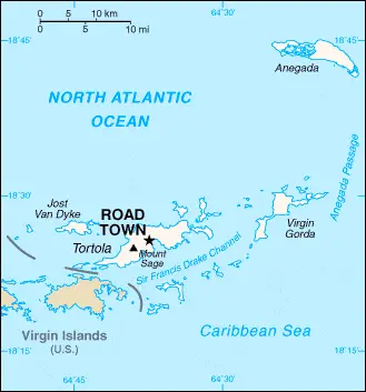
Google Maps and Detailed Facts of the British Virgin Islands (VG). This page lets you explore the British Virgin Islands and its border countries (Country Location: the Caribbean, between the Caribbean Sea and the North Atlantic Ocean, east of Puerto Rico) through detailed Satellite imagery – fast and easy as never before Google Maps.
Find comprehensive information about this country’s diversity below: Google maps, geography, economy, science, people, culture, environment, government, and history – All in One Wiki page.
There is also a Street View and free Driving Directions at your service. Your Google Satellite Map Sightseeing in the British Virgin Islands, Central America, and the Caribbean starts here at Driving Directions and Maps.com.
CAYMAN ISLANDS consist of three low-lying islands situated in the Caribbean Sea some 240 kilometers or 149 miles south of Cuba. They are a British overseas territory.
Google Maps and Detailed Facts of the Cayman Islands (CJ). This page lets you explore the Cayman Islands and its border countries (Country Location: the Caribbean, three-island group (Grand Cayman, Cayman Brac, Little Cayman) in the Caribbean Sea, 240 km south of Cuba and 268 km northwest of Jamaica) through detailed Satellite imagery – fast and easy as never before Google Maps.
Find comprehensive information about this country’s diversity below: Google maps, geography, economy, science, people, culture, environment, government, and history – All in One Wiki page.
There is also a Street View and free Driving Directions at your service. Your Google Satellite Map Sightseeing in the Cayman Islands, Central America, and the Caribbean starts here at Driving Directions and Maps.com.
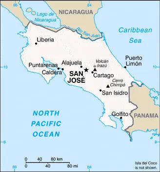
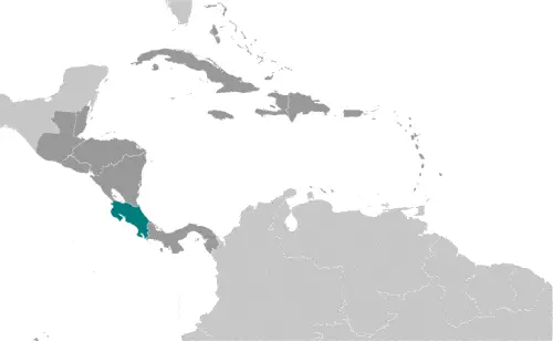
COSTA RICA is a small country bounded by Nicaragua to the north, Panama to the south, the Pacific Ocean to the south and west, and the Caribbean Sea to the east. Three mountain ranges, including some active volcanoes, form the backbone of the land. About half the population concentrated on the Meseta Central, a fertile plateau on the country’s western side, which was first settled by the Spanish in the 16th century.
 |
 |
 |
| Borderline map of Costa Rica | Location map of Costa Rica | Flag of Costa Rica |
Google Maps and Detailed Facts of Costa Rica (CR). This page lets you explore Costa Rica and its border countries (Country Location: Central America, bordering both the Caribbean Sea and the North Pacific Ocean, between Nicaragua and Panama) through detailed Satellite imagery – fast and easy as never before Google Maps.
Find comprehensive information about this country’s diversity below: Google maps, geography, economy, science, people, culture, environment, government, and history – All in One Wiki page.
There is also a Street View and free Driving Directions at your service. Your Google Satellite Map Sightseeing in Costa Rica, Central America, and the Caribbean starts here at Driving Directions and Maps.com.
 |
 |
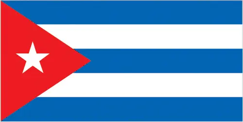 |
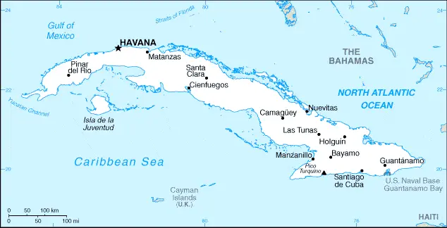
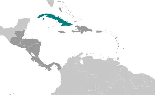
| Borderline map of Cuba | Location map of Cuba | Flag of Cuba |
Google Maps and Detailed Facts of Cuba (CU). This page lets you explore Cuba and its border countries (Country Location: the Caribbean, island between the Caribbean Sea and the North Atlantic Ocean, 150 km south of Key West, Florida) through detailed Satellite imagery – fast and easy as never before Google Maps.
Find comprehensive information about this country’s diversity below: Google maps, geography, economy, science, people, culture, environment, government, and history – All in One Wiki page.
There is also a Street View and free Driving Directions at your service. Your Google Satellite Map Sightseeing in Cuba, Central America, and the Caribbean starts here at Driving Directions and Maps.com.
 |
 |
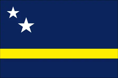 |
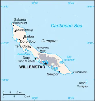
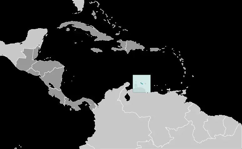
| Borderline map of Curacao | Location map of Curacao | Flag of Curacao |
Google Maps and Detailed Facts of Curacao (CC). This page lets you explore Curacao and its border countries (Country Location: the Caribbean, an island in the Caribbean Sea, 30 nm off the coast of Venezuela) through detailed Satellite imagery – fast and easy as never before Google Maps.
Find comprehensive information about this country’s diversity below: Google maps, geography, economy, science, people, culture, environment, government, and history – All in One Wiki page.
There is also a Street View and free Driving Directions at your service. Your Google Satellite Map Sightseeing in Curacao, in Central America, and the Caribbean, starts here at Driving Directions and Maps.com.
DOMINICA, discovered by Columbus, is the most northerly of the Windward Islands in the West Indies. It is situated between the islands of Martinique and Guadeloupe. The island is very rugged and, except for 225 square kilometers or 87 square miles of flat land, it consists of three inactive volcanoes, the highest of which is 1,447 meters or 4,747 feet.