Africa

Africa is the world’s second-largest continent, with a total area of 11,712,434 sq miles (30,335,000 sq km). It has 54 separate countries, including Madagascar in the Indian Ocean. It straddles the equator and is the only continent to stretch from the northern to southern temperate zones.

Area: 11,633,846 sq miles (30,131,536 sq km).
The highest point is Mt. Kilimanjaro, Tanzania, 19,341 ft (5,895 m).
Lowest Point: Lac ‘Assal, Djibouti -512 ft (-156 m) below sea level.
The longest river is the Nile, Egypt/Sudan/Uganda, 4,187 miles (6,738 km).
Largest lake: L. Victoria, Tanzania/Uganda/Kenya, 26,828 sq miles (69,484 sq km).
Largest island: Madagascar, 226,660 sq miles (587,040 sq km).
Highest recorded temperature: Al’Aziziyah, Libya 136°F (58°C).
Lowest recorded temperature: is in Ifrane, Morocco -11°F (-24°C).
Wettest Place: Cape Debundsha, Cameroon 405 in (10,290 mm).
Driest Place: Wadi Halfa, Sudan <0.1 in (<2.5 mm).
Population: approximately 849,000,000 people.
The number of countries: 53.

Read more

Freetown Google maps

Freetown is one of the most populated cities in Sierra Leone, and at the same time, this city is the capital of this country. Located in Africa, you may find the city easily with the following GPS coordinates: 08.30N latitude / 13.17W longitude. For routing in Freetown, please check the free driving directions Freetown service below.

Read more

Sierra Leone

Driving Directions Sierra Leone

SIERRA LEONE, a republic on the Atlantic coast of West Africa, is bounded by Guinea to the north and east and Liberia to the southwest. The country possesses a fine natural harbor where the capital and major port of Freetown is situated.

A range of mountains, the Sierra Lyon, rise above the capital on the Freetown Peninsula. However, elsewhere, the coastal plain is up to 110 kilometers or 70 miles wide, rising to a plateau and then mountains that are part of the Guinea Highlands Massif. The highest peaks are just under 2,000 meters or 6,562 feet. Eight rivers and many streams descend from the higher ground.

Read more

Sierra Leone Google Map

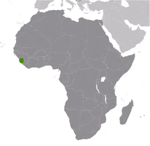
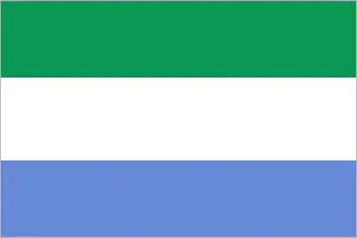
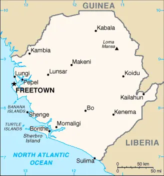
This image shows the draft map of Sierra Leone, Africa. For more details of the map of Sierra Leone, please see this page below. This image shows the location of Sierra Leone, Africa. For more geographical details of Sierra Leone, please see this page below. This image shows the flag of Sierra Leone, Africa. For more details of the flag of Sierra Leone, please see this page below.
Borderline map of Sierra Leone Location map of Sierra Leone Flag of Sierra Leone

Sierra Leone Google map

Google maps and detailed facts of Sierra Leone (SL). This page enables you to explore Sierra Leone and its border countries (Country Location: Western Africa, bordering the North Atlantic Ocean, between Guinea and Liberia) through detailed Satellite imagery – fast and easy as never before Google maps.

Find comprehensive information below about this country in its diversity: Google maps, geography, economy, science, people, culture, environment, government, and history – All in One Wiki page.

There is also Street View and free Driving Directions at your service. In Africa, your Google Satellite Map Sightseeing in Sierra Leone starts here at Driving Directions and Maps.com.

Read more

The most Googled products in each country in Africa

Just like earlier, today, in our popular culture, most countries are stereotypically associated with certain products or services. Probably you also would think of Germany regarding beer or Mercedes, carpets of Turkey, electronics of Japan, or pizza of Italy.

Read more