
 |
 |
 |
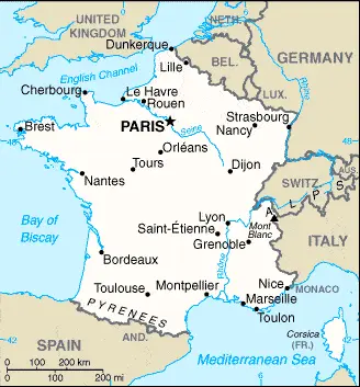
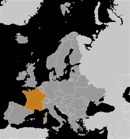
| Borderline map of France | Location map of France | Flag of France |
Google Maps and Detailed Facts of France (FR). This page lets you explore France and its border countries through detailed Satellite imagery – fast and easy as never before Google Maps.
Location of metropolitan France: Western Europe, bordering the Bay of Biscay and the English Channel, between Belgium and Spain, southeast of the UK; bordering the Mediterranean Sea, Italy, and Spain.
French overseas territories are:
French Guiana: Northern South America, bordering the North Atlantic Ocean, between Brazil and Suriname.
Guadeloupe: the Caribbean, islands between the Caribbean Sea and the North Atlantic Ocean, southeast of Puerto Rico.
Martinique: the Caribbean, island between the Caribbean Sea and North Atlantic Ocean, north of Trinidad and Tobago.
Mayotte: Southern Indian Ocean, an island in the Mozambique Channel, about halfway between northern Madagascar and northern Mozambique.
Reunion: Southern Africa, an island in the Indian Ocean, east of Madagascar.
Find comprehensive information about this country’s diversity below: Google maps, geography, economy, science, people, culture, environment, government, and history – All in One Wiki page.
There is also a Street View and free Driving Directions at your service. Your Google Satellite Map Sightseeing in France, in Europe, starts here at Driving Directions and Maps.com.