
Port Vila is one of the most populated cities in Vanuatu, and at the same time, this city is the capital of this country. Located in Oceania, you may find the city easily with the following GPS coordinates: 17.45S latitude / 168.18E longitude. For routing in Port Vila, please check the free driving directions Port Vila service below.
Oceania Maps
Explore the countries in Oceania with all their Wiki, find information on weather, population, facts, history, landmarks of major cities data, and enjoy free Google maps Satellite imagery & Street views. Each Country Profile in Oceania provides information on Geography data, area maps, Google maps, flag, history, area, population, the capital city, largest cities, economy, spoken languages, ethnicity/race, religion, literacy rate, government, and many more!
In this map category of Oceania, you will find these countries and their capital cities:
Australia, Fiji, Kiribati, Marshall Islands, Micronesia, Nauru, New Zealand, Palau, Papua New Guinea, Samoa, Solomon Islands, Tonga, Tuvalu, Vanuatu.
Google Maps™ Driving Directions (Home) » Oceania Maps »
Samoa Google Maps
 |
 |
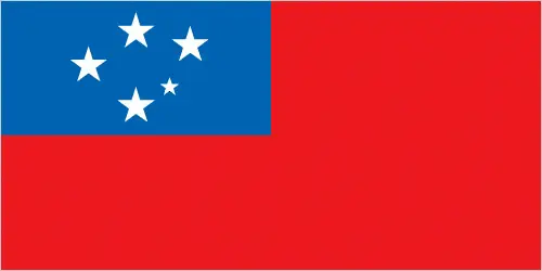 |
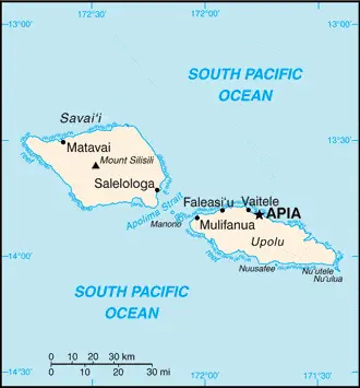
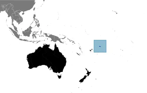
| Borderline map of Samoa | Location map of Samoa | Flag of Samoa |
Google Maps and Detailed Facts of Samoa (WS). This page lets you explore Samoa and its border countries (Country Location: Oceania, group of islands in the South Pacific Ocean, about halfway between Hawaii and New Zealand) through detailed Satellite imagery – fast and easy as never before Google Maps.
Find comprehensive information about this country’s diversity below: Google Maps, geography, economy, science, people, culture, environment, government, and history – All in One Wiki page.
There is also a Street View and free Driving Directions at your service. Your Google Satellite Map Sightseeing in Samoa, in Oceania, starts here at Driving Directions and Maps.com.
Google Maps™ Driving Directions (Home) » Oceania Maps »
Solomon Islands
Driving Directions Solomon Islands
SOLOMON ISLANDS is an archipelago of several hundred islands in the southwest Pacific Ocean. Formerly a British Territory, the Solomon Islands became an independent state in 1978.
Google Maps™ Driving Directions (Home) » Oceania Maps »
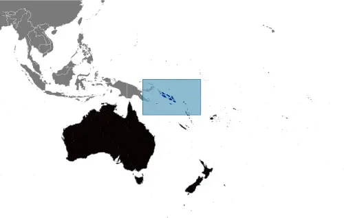
Solomon Islands Google Maps
 |
 |
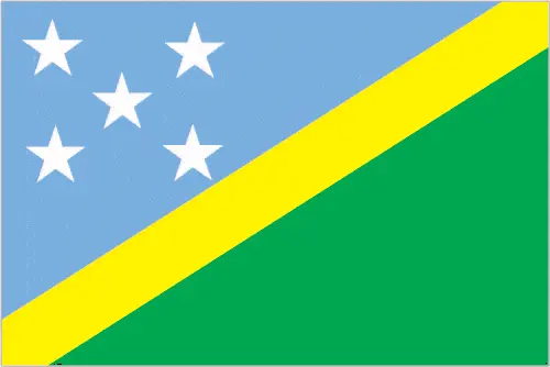 |
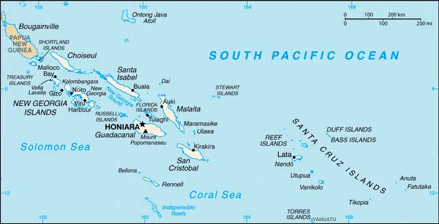
| Borderline map of Solomon Islands | Location map of Solomon Islands | Flag of Solomon Islands |
Google Maps and Detailed Facts of the Solomon Islands (BP). This page lets you explore the Solomon Islands and its border countries (Country Location: Oceania, group of islands in the South Pacific Ocean, east of Papua New Guinea) through detailed Satellite imagery – fast and easy as never before Google Maps.
Find comprehensive information about this country’s diversity below: Google Maps, geography, economy, science, people, culture, environment, government, and history – All in One Wiki page.
There is also a Street View and free Driving Directions at your service. In Oceania, your Google Satellite Map Sightseeing in the Solomon Islands starts here at Driving Directions and Maps.com.
Google Maps™ Driving Directions (Home) » Oceania Maps »
Suva Google Maps
Suva is one of the most populated cities in Fiji, and at the same time, this city is the capital of this country. Located in Oceania, you may find the city easily with the following GPS coordinates: 18.06S latitude / 178.30E longitude. For routing in Suva, please check the free driving directions Suva service below.
Google Maps™ Driving Directions (Home) » Oceania Maps »
Tarawa Google Maps
Tarawa is one of the most populated cities in Kiribati, and at the same time, this city is the capital of this country. Located in Oceania, you may find the city easily with the following GPS coordinates: 01.30N latitude / 173.00E longitude. For routing in Tarawa, please check the free driving directions Tarawa service below.
Google Maps™ Driving Directions (Home) » Oceania Maps »
Tokelau Google Maps
 |
 |
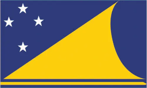 |
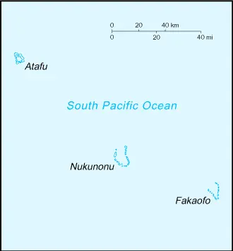
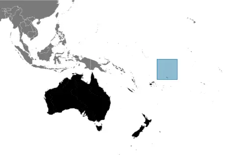
| Borderline map of Tokelau | Location map of Tokelau | Flag of Tokelau |
Google Maps and Detailed Facts of Tokelau (TK). This page lets you explore Tokelau and its border countries (Country Location: Oceania, group of three atolls in the South Pacific Ocean, about one-half of the way from Hawaii to New Zealand) through detailed Satellite imagery – fast and easy as never before Google Maps.
Find comprehensive information about this country’s diversity below: Google Maps, geography, economy, science, people, culture, environment, government, and history – All in One Wiki page.
There is also a Street View and free Driving Directions at your service. Your Google Satellite Map Sightseeing in Tokelau, in Oceania, starts here at Driving Directions and Maps.com.
Google Maps™ Driving Directions (Home) » Oceania Maps »
Tonga Google Maps
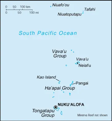 |
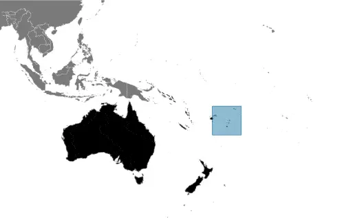 |
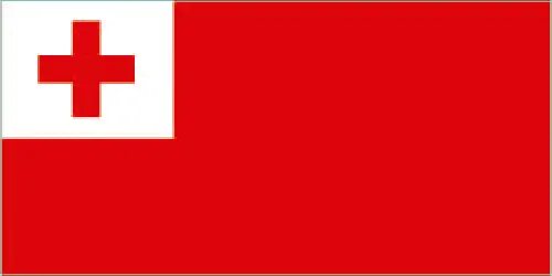 |
| Borderline map of Tonga | Location map of Tonga | Flag of Tonga |
Google Maps and Detailed Facts of Tonga (TO). This page lets you explore Tonga and its border countries (Country Location: Oceania, an archipelago in the South Pacific Ocean, about two-thirds of the way from Hawaii to New Zealand) through detailed Satellite imagery – fast and easy as never before Google Maps.
Find comprehensive information about this country’s diversity below: Google Maps, geography, economy, science, people, culture, environment, government, and history – All in One Wiki page.
There is also a Street View and free Driving Directions at your service. Your Google Satellite Map Sightseeing in Tonga, in Oceania, starts here at Driving Directions and Maps.com.