
 Location: Australasia & Oceania
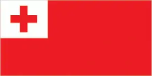
Official name: Kingdom of Tonga
Formation (date of independence / date current borders were established): 1970 / 1970
Capital city: Nuku’alofa
Population: 105,916 / 381 people per sq mile (147 people per sq km)
Total land area: 289 square miles (748 square km)
Language(s) spoken: English (official language), Tongan (official language)
Main religions: Free Wesleyan 41%, Other 17%, Roman
Catholic 16%, Church of Jesus Christ of Latter-day Saints 14%, Free Church of Tonga 12%
Ethnic mix: Tongan 98%, Other 2%
Government type: Monarchy
Currency: Pa’anga (Tongan dollar) = 100 seniti
Literacy rate: 99%
Calorie consumption (daily per person): Not available
For more detailed country information, driving directions, and Google Maps, please visit Tonga‘s corresponding page.