
Background
Antarctica, the southernmost continent, was largely speculative until the early 1820s when explorations began confirming its existence. Initially explored by commercial operators and national expeditions from Britain, America, and Russia, it was not until 1840 that Antarctica was recognized as a continent. Post-World War II, the continent saw a surge in scientific research, with numerous countries establishing research stations. The Antarctic Treaty of 1959, which entered into force in 1961, set a framework for activities in Antarctica, neither denying nor recognizing territorial claims and promoting peaceful and cooperative research.
Overview
Antarctica, covering 14.2 million square kilometers, is the fifth-largest continent, slightly less than 1.5 times the size of the US. It is governed by the Antarctic Treaty system, ensuring it is used for peaceful purposes only and conserving its environment. The continent is renowned for being the coldest, windiest, and driest place on Earth, with unique geographical features and rich biodiversity, particularly in its surrounding oceans.
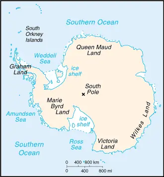
Google Maps
Google Maps provides a fascinating view of Antarctica’s vast icy expanses, research stations, and geographical features like mountain ranges and ice shelves. It offers an invaluable tool for understanding the continent’s remote and harsh environment.
Climate
Antarctica, the southernmost continent, is renowned for having the coldest and driest climate on Earth, with its weather conditions varying significantly across different regions. Here’s an extended overview of Antarctica’s climatic conditions, incorporating factual and interesting aspects:
- Extreme Cold: Antarctica holds the record for the lowest temperature ever recorded on Earth, which is -89.2°C (-128.6°F) at the Soviet Union’s Vostok Station on July 21, 1983. The continent’s interior is much colder than its coast due to its higher elevation and distance from the ocean’s moderating influence.
- East Antarctica Climate: East Antarctica, which includes the vast area covered by the East Antarctic Ice Sheet, is colder than West Antarctica. This region is at a higher elevation, with some areas over 3,000 meters (9,800 feet) above sea level, contributing to its lower temperatures. The average temperature in the interior can drop below -60°C (-76°F) in winter.
- West Antarctica Climate: West Antarctica is comparatively warmer than East Antarctica. This part of the continent is lower in elevation and closer to the ocean, which helps moderate temperatures. The West Antarctic Ice Sheet covers this region, and it is more vulnerable to climate change due to its lower altitude and proximity to the ocean.
- Antarctic Peninsula: The Antarctic Peninsula, which extends towards South America, has the most moderate climate on the continent. In the summer months (December to February), temperatures here can rise slightly above freezing, occasionally reaching up to 3°C (37.4°F) or higher. This region is experiencing some of the most rapid warming on the planet, with significant ice shelf collapses and glacier retreats observed in recent decades.
- Dry Conditions: Antarctica is the driest continent. The interior receives as little as 50 mm (2 inches) of precipitation annually, primarily in snow. This low precipitation is due to the cold temperatures, which reduce the moisture-carrying capacity of the air.
- Katabatic Winds: The continent is known for its strong katabatic winds, which are cold, dense air masses that flow downhill from the high interior plateau to the coast. These winds can reach hurricane force and significantly impact the climate and weather conditions.
- Polar Night and Midnight Sun: During winter, the interior of Antarctica experiences the polar night – a period of continuous darkness. In contrast, it experiences the midnight sun during the summer – a period of continuous daylight. These phenomena are due to the tilt of the Earth’s axis and its orbit around the sun.
- Ice Sheets and Global Climate: The Antarctic ice sheets are crucial in the global climate system. They reflect significant solar radiation back into space and store much of the Earth’s freshwater. Changes in the ice sheets due to global warming can have far-reaching effects on global sea levels and climate patterns.
- Climate Change Impact: Antarctica is particularly sensitive to the effects of climate change. Rising global temperatures are leading to increased ice melt, particularly in West Antarctica and the Antarctic Peninsula, contributing to rising global sea levels.
- Ozone Hole: The continent is also known for the “ozone hole,” a significant ozone layer depletion in the stratosphere above Antarctica. This phenomenon, caused primarily by human-made chemicals like chlorofluorocarbons (CFCs), was first observed in the 1980s. International efforts like the Montreal Protocol have been successful in reducing CFC emissions and helping the ozone layer to recover.
Antarctica’s climate, with its extreme cold, dryness, and strong winds, significantly shapes the continent’s unique environment and ecosystems. Understanding these climatic conditions is crucial for studying global climate change, sea-level rise, and the health of our planet’s environment.
Geography
Antarctica, the southernmost continent, is a unique geographical entity primarily known for its vast ice sheet and extreme environmental conditions. Here’s an extended overview of Antarctica’s geographical features, including more detailed statistics and information about its surrounding regions:
- Ice Sheet Coverage: Antarctica’s ice sheet is the largest single mass of ice on Earth, covering approximately 14 million square kilometers (5.4 million square miles), which is about 99% of the continent’s land area. This ice sheet contains about 70% of the world’s fresh water and about 90% of the world’s ice.
- Mountain Ranges: Despite being heavily ice-covered, Antarctica has several mountain ranges. The Transantarctic Mountains, one of the longest mountain ranges in the world, divide the continent into East and West Antarctica. These mountains have peaks with elevations between 2,000 and 4,000 meters (6,562 to 13,123 feet).
- Highest Point – Vinson Massif: The highest point in Antarctica is Vinson Massif, which reaches an elevation of 4,892 meters (16,050 feet). It is located in the Ellsworth Mountains and is one of the Seven Summits, representing the highest peaks on each of the seven continents.
- Lowest Point – Denman Glacier: The lowest point in Antarctica, and indeed the lowest point on Earth not covered by ocean, is within the Denman Glacier. It lies more than -3,500 meters (-11,483 feet) below sea level. This subglacial trench is a significant geological feature.
- Ice-Free Areas: While most of Antarctica is covered in ice, some ice-free areas are known as the Antarctic oases or dry valleys. These areas, found in parts of Victoria Land, Wilkes Land, and the Antarctic Peninsula, are among the driest places on Earth. The McMurdo Dry Valleys are the most notable, characterized by their barren, ice-free soil.
- Surrounding Oceans: Antarctica is surrounded by the Southern Ocean, which is characterized by the strong, cold Antarctic Circumpolar Current. The Southern Ocean plays a crucial role in global ocean circulation and climate.
- Subglacial Lakes: Beneath the ice sheet, there are numerous subglacial lakes, with Lake Vostok being the largest. These lakes are of significant scientific interest due to the potential for unique life forms and clues about past climate conditions.
- Peninsulas and Ice Shelves: The Antarctic Peninsula, extending towards South America, is the northernmost part of the mainland of Antarctica. Several large ice shelves, such as the Ross and Ronne Ice Shelf, float on the sea along the coast. These shelves are critical for stabilizing the ice sheet.
- Environmental Significance: Antarctica plays a crucial role in the Earth’s environment. Its ice sheet significantly affects global sea level, and its albedo (reflectivity) helps regulate Earth’s temperature. The continent is also a key area for climate research.
- Antarctic Treaty System: The Antarctic Treaty, signed in 1959, designates the continent as a scientific preserve, establishes freedom of scientific investigation, and bans military activity on the continent. This treaty is a unique example of international cooperation.
Antarctica’s geography, dominated by its ice sheet, mountain ranges, and unique subglacial features, not only defines its stark and beautiful landscape but also profoundly impacts global climate and sea levels. The continent’s isolation and extreme environment make it a critical location for scientific research, particularly in the fields of glaciology, meteorology, and climate science.
Natural Resources
Antarctica holds various minerals and hydrocarbons in small, non-commercial quantities. The Environmental Protocol to the Antarctic Treaty bans mineral exploitation except for scientific research. The continent’s marine life, including krill, icefish, toothfish, and crab, is managed by the Commission for the Conservation of Antarctic Marine Living Resources (CCAMLR).
Population
Antarctica has no indigenous inhabitants, but international personnel staff numerous research stations year-round and seasonally. The population varies from around 5,000 in summer to 1,100 in winter, with additional staff present in the surrounding waters.
Environmental Issues
The discovery of the Antarctic ozone hole in the 1980s led to global efforts to phase out ozone-depleting chemicals. Recent satellite data shows an accelerating ice loss driven by ocean change, with significant implications for global sea levels and ecosystems.
Governance
Antarctica is governed by the Antarctic Treaty System, which includes the Antarctic Treaty, the Environmental Protocol, and other legal instruments. This system ensures that the continent is used for peaceful purposes and scientific research, with 54 member nations participating in decision-making.
Legal System
Antarctica’s governance is administered through annual Antarctic Treaty Consultative Meetings. Decisions are carried out by member nations in accordance with their national laws. The continent falls under various legal instruments and procedures adopted by states party to the Antarctic Treaty.
Flag Description
Antarctica has no official flag, but the True South flag, created in 2018, has gained popularity. It symbolizes the continent’s extreme latitude, legacy of exploration, and hope for continued peace, discovery, and cooperation.
Energy and Resources
Antarctica has no known reserves of fossil fuels, and energy consumption and production are minimal, primarily for research stations’ operations.
Communications
Telecommunications in Antarctica primarily involve satellite systems, providing connectivity for scientific research and operations. The introduction of Starlink internet coverage has improved connectivity for researchers.
Transportation
Transportation in Antarctica includes 17 airports with unpaved runways and helicopter landing facilities at all year-round and seasonal stations. Coastal stations have anchorages and some basic wharf facilities.
Military Restrictions
The Antarctic Treaty prohibits military activities, establishment of military bases, maneuvers, or weapon testing, allowing only peaceful scientific research.
International Disputes
Territorial claims in Antarctica by various countries are frozen under the Antarctic Treaty, and the continent is dedicated to peaceful scientific study and environmental preservation.
Did You Know?
Did You Know? – Antarctica
- Coldest Place on Earth: Antarctica holds the record for the lowest temperature ever recorded on Earth, a staggering -89.2°C (-128.6°F) at Vostok Station in 1983. This extreme cold is due to the continent’s high elevation and its position at the Earth’s axis.
- Dryest and Windiest Continent: Despite its ice, Antarctica is the driest continent, classified as a desert because of its very low precipitation. It’s also the windiest, with some winds reaching up to 320 km/h (200 mph).
- Largest Ice Sheet: Antarctica’s ice sheet is the largest single mass of ice on Earth. It covers an area of about 14 million square kilometers (5.4 million square miles) and holds about 61% of all fresh water on Earth.
- Midnight Sun and Polar Night: At the South Pole, the sun rises and sets only once each year. This creates a period of 24-hour daylight for six months, known as the midnight sun, and six months of darkness, known as the polar night.
- Home to a Massive Subglacial Lake: Lake Vostok, beneath Russia’s Vostok Station, is one of the largest subglacial lakes in the world. It’s been sealed off under the ice for millions of years, and scientists believe it could harbor unique life forms.
- No Permanent Residents: There are no permanent human residents in Antarctica. The population consists of a mix of researchers and support staff at various research stations, with numbers fluctuating from about 1,000 in winter to about 5,000 in summer.
- Unique Wildlife: Despite its harsh conditions, Antarctica is home to unique wildlife adapted to the cold environment, including various species of penguins, seals, and whales. The Emperor Penguin is the only penguin species that breeds during the Antarctic winter.
- Meteorite Collection Site: Antarctica is one of the best places in the world for collecting meteorites. Dark meteorites are easier to spot against the icy white landscape, and the movement of the ice tends to concentrate these space rocks in certain areas.
- Vinson Massif – The Highest Peak: The highest peak in Antarctica is Vinson Massif, which stands at 4,892 meters (16,050 feet). It’s part of the remote Ellsworth Mountains.
- Active Volcanoes: Antarctica has active volcanoes. Mount Erebus, the southernmost active volcano on Earth, is known for its persistent lava lake.
- Icebergs the Size of Countries: The continent periodically calves icebergs that are massive in scale. The largest recorded iceberg, Iceberg B-15, broke off in 2000 and was about the size of Jamaica.
- The Antarctic Treaty: Signed in 1959, the Antarctic Treaty is a unique agreement that dedicates the continent to peaceful scientific research and bans military activity. It was the first arms control agreement established during the Cold War.
These facts about Antarctica reveal a continent of extremes, from its climate to its unique ecosystems, playing a crucial role in global weather patterns, ocean currents, and the overall health of our planet.
Many thanks for visiting and sharing this map & Antarctica information site!