Google Maps™ driving directions home » New Caledonia

New Caledonia

Driving Directions New Caledonia

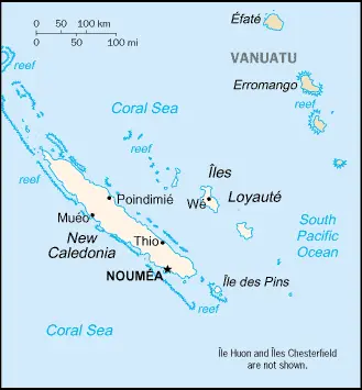
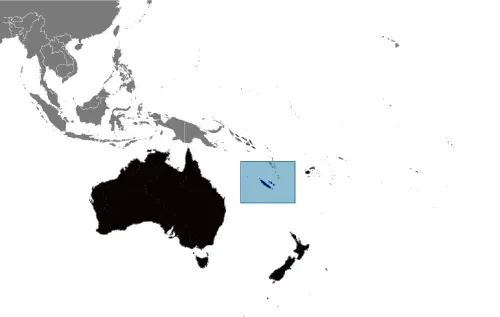
NEW CALEDONIA or Nouvelle Calédonie is the most southerly of the Melanesian countries in the Pacific Ocean. It is a French overseas territory, but there has been ongoing unrest in the country between the indigenous Melanesians and the French settlers over the question of independence.

The main island, Nouvelle Calédonie, is 400 kilometers or 248 miles long and rises to a height of 1,639 meters or 5,377 feet at Mount Panie.

Read more

Google Maps™ driving directions home » New Caledonia

New Caledonia Google Map

This image shows the draft map of New Caledonia, Oceania. For more details of the map of New Caledonia, please see this page below. This image shows the location of New Caledonia, Oceania. For more geographical details of New Caledonia, please see this page below. This image shows the flag of New Caledonia, Oceania. For more details of the flag of New Caledonia, please see this page below.
Borderline map of New Caledonia Location map of New Caledonia Flag of New Caledonia

New Caledonia Google map

Google Maps and Detailed Facts of New Caledonia (NC). This page lets you explore New Caledonia and its border countries (Country Location: Oceania, islands in the South Pacific Ocean, east of Australia) through detailed Satellite imagery – fast and easy as never before Google Maps.

Find comprehensive information about this country’s diversity below: Google maps, geography, economy, science, people, culture, environment, government, and history – All in One Wiki page.

There is also a Street View and free Driving Directions at your service. Your Google Satellite Map Sightseeing in New Caledonia, in Oceania, starts here at Driving Directions and Maps.com.

Read more