
Driving Directions and Google Map of Indonesia — Roads, Routes & Navigation Guide

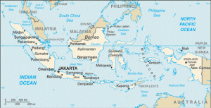
Indonesia — the Republic of Indonesia — is the world’s largest archipelago nation, comprising over 17,000 islands stretching across 5,100 kilometres of ocean between the Indian and Pacific Oceans. With a population of approximately 280 million, it is the world’s fourth most populous country and the largest economy in Southeast Asia. For drivers, Indonesia presents two quite different realities: the crowded, toll-road-connected cities and plains of Java and Sumatra, and the more adventurous roads of Bali, Lombok, Flores, Sulawesi, Kalimantan, and the vast reaches of Papua.
Indonesia drives on the left-hand side of the road, using right-hand drive vehicles — a legacy that Indonesia has maintained since independence despite the Netherlands (its former colonial ruler) driving on the right. An International Driving Permit (IDP) is mandatory alongside your home country licence for all foreign drivers. The alcohol limit is effectively zero tolerance (0.00%) — Indonesia is the world’s largest Muslim-majority nation and drink driving is treated as a serious offence. The currency is the Indonesian Rupiah (IDR / Rp). Emergency services are reached on 110 (Police), 113 (Fire), and 118 or 119 (Ambulance); the international number 112 also connects. Use the route planner on our homepage for driving directions across Indonesia.
Road Network Overview
Indonesia’s road network totals approximately 540,000 kilometres, administered by the Ministry of Public Works and Housing (Kementerian PUPR) at the national level and by provincial and district governments at lower levels. Road quality and density vary enormously across the archipelago — from the world-class tolled expressways of Java to the rough, flood-prone tracks of interior Kalimantan and Papua. For most visitors, driving in Indonesia effectively means driving on Java, Bali, or parts of Sumatra.
Trans-Java Toll Road
The greatest achievement in modern Indonesian infrastructure is the Trans-Java Toll Road — a continuous tolled expressway corridor spanning approximately 1,150 kilometres across the length of Java from Merak (the port linking Java to Sumatra via the Sunda Strait ferry) in the west through Jakarta, Bandung, Semarang, Surabaya, and on to Banyuwangi in the east (where ferries cross to Bali). Completed in stages and fully connected in 2019, the Trans-Java Toll Road reduced the Jakarta–Surabaya journey time from around 12–18 hours (on congested national roads) to approximately 8–10 hours on a good day. It is managed by multiple private and state-owned concessionaires — including Jasa Marga (the dominant state toll company), Astra Infra, Waskita Toll Road, and others.
Trans-Sumatra Toll Road
An equally ambitious project, the Trans-Sumatra Toll Road, is planned to run approximately 2,800 kilometres from Bakauheni in the south (port to Java) to Banda Aceh at the northern tip. Significant sections are already operational — including around Lampung, Palembang, and the Medan corridor in North Sumatra — but the full corridor remains under construction and is expected to be completed progressively through the late 2020s. The non-toll alternative, the Trans-Sumatra Highway, is passable but involves very long journey times, variable road quality, and periodic closures due to flooding and landslides.
National and Provincial Roads
Outside the toll road network, national roads (jalan nasional) form the backbone of intercity travel on each island. On Java, the old Pantura (Pantai Utara — North Coast Road) running along Java’s northern coast was the primary route before the Trans-Java Toll Road and remains a viable alternative for those wishing to avoid tolls, though it is very congested and slow through major cities. National roads are generally paved but vary in quality; provincial and district roads vary much more widely and may be unpaved, potholed, or subject to seasonal flooding. In Kalimantan, Sulawesi, and Papua, some routes that appear on maps as roads may be impassable in a standard vehicle outside the dry season.
Speed Limits
Indonesia’s speed limits are set under Government Regulation No. 79 of 2013. Enforcement is by POLANTAS (Polisi Lalu Lintas) officers at roadside checks and by speed cameras at selected locations, particularly on the toll road network and in urban areas. Adherence to speed limits is variable in practice, but enforcement is increasing especially on toll roads.
| Road Type | Speed Limit | Notes |
|---|---|---|
| Toll roads / expressways (Jalan Tol) | 100 km/h | Some sections posted at 80 km/h; minimum speed 60 km/h enforced on some toll roads |
| National roads outside built-up areas | 80 km/h | Single and dual carriageway intercity roads |
| Urban / built-up areas | 50 km/h | Default in all towns and cities; often lower in practice due to congestion |
| Residential / housing estates (perumahan) | 30 km/h | As posted; speed bumps (polisi tidur) are extremely common |
Speed bumps (polisi tidur — “sleeping policemen”): Indonesia has one of the world’s most extensive deployments of road speed bumps, used widely on village roads, residential streets, and even on national roads through settlements. They vary enormously in height and marking — some are barely visible at night. Drive slowly through all villages and residential areas, and be prepared for unmarked speed bumps at any time.
Toll Roads & e-Toll Payment
Indonesia introduced mandatory cashless e-Toll payment at all toll gates in October 2017 — cash is no longer accepted in toll lanes. All toll payments must be made using an e-Toll card: a contactless prepaid card that is tapped at the toll gate gantry. If you are renting a car and plan to use toll roads, obtaining an e-Toll card is essential before you begin driving.
e-Toll card providers: Several Indonesian bank-issued contactless cards function as e-Toll cards. The main options are:
- Mandiri e-money (Bank Mandiri) — the most widely accepted and recommended for visitors
- BCA Flazz (Bank Central Asia)
- BNI TapCash (Bank Negara Indonesia)
- BRI Brizzi (Bank Rakyat Indonesia)
- LinkAja (digital wallet, linked to toll payment)
Cards can be purchased and topped up at toll plazas (before entry), ATMs, minimarkets (Alfamart and Indomaret — Indonesia’s ubiquitous convenience store chains), and petrol stations. The card costs a small deposit (around Rp 30,000–50,000) plus the initial top-up value. Ensure the card has sufficient balance before entering — if the card runs out mid-journey, you will need to queue at a manned lane. Keep the card accessible at all times while driving on toll roads, as toll gates are frequent.
| Route | Approx. Toll (Class I car, 2026) |
|---|---|
| Jakarta → Surabaya (Trans-Java full, ~725 km) | Rp 450,000–550,000 |
| Jakarta → Semarang (~430 km) | Rp 260,000–300,000 |
| Jakarta → Bandung via Cipularang (~120 km) | Rp 45,000–60,000 |
| Ngurah Rai Airport Toll (Bali) | Rp 7,500–14,000 (varies by entry/exit) |
| Jakarta inner ring / inner city toll roads (per section) | Rp 5,000–20,000 typically |
Toll rates are set by each concession company and reviewed periodically. Check the Jasa Marga website (jasamarga.com) or the Travoy app for current rates. The MLFF (Multi-Lane Free Flow) cashless gantry system is being progressively introduced on some toll roads — follow signage at toll plazas for the correct lane type.
Road Rules & Driving Law
Indonesia drives on the left; vehicles have the steering wheel on the right. Visitors from right-hand traffic countries must adjust, particularly at junctions, roundabouts, and when joining roads. In Indonesia, roundabouts operate with vehicles inside having right of way (the same as most modern roundabout conventions), though adherence to this rule is variable — proceed with caution at all roundabouts and junctions.
International Driving Permit (IDP): An IDP is mandatory for all foreign drivers in Indonesia — carrying only a home country licence is not sufficient. Driving without a valid IDP plus your national licence can result in detention of the vehicle and a fine. IDPs must be obtained before travel from an authorised motoring organisation in your home country (e.g., AA, RAC, AAA). Visitors intending to stay longer than the IDP validity period (typically one year) must apply for a local Indonesian licence (Surat Izin Mengemudi / SIM).
Drink driving — zero tolerance: Indonesia enforces zero tolerance for drink driving. Driving under the influence of alcohol carries penalties under Law No. 22 of 2009 including fines of up to Rp 1,500,000 (approximately USD 90–100) and imprisonment of up to one year for a first offence; repeat offences or offences causing injury or death carry significantly harsher sentences. Given Indonesia’s status as the world’s largest Muslim-majority nation, enforcement attitudes toward alcohol are strict. Visitors must not drive after consuming any alcohol.
Seatbelts: Mandatory for driver and all front-seat passengers under Indonesian law. Rear seatbelt enforcement is less consistent in practice but legally required. Children must be appropriately restrained. Fines apply for non-compliance.
Mobile phones: Using a handheld mobile phone while driving is prohibited. Enforcement has increased in major cities. Hands-free use (Bluetooth, mounted holder) is permitted. Fines under the 2009 Road Traffic Act apply.
Police stops: POLANTAS officers conduct roadside checks across all major roads. Have your home country driving licence, IDP, vehicle registration, and insurance documents accessible. Corruption at police stops has historically been an issue in Indonesia — visitors who are stopped may be asked for informal payments. The correct approach is to remain polite, ask for a formal summons (surat tilang), and pay any legitimate fine through official channels. The Indonesian government has made efforts to reduce this practice and most interactions are straightforward.
Motorcycles and the road hierarchy: Indonesia has one of the largest motorcycle populations in the world — motorcycles vastly outnumber cars on most roads. Motorcycles filter through traffic, occupy gaps between lanes, and travel in large groups. As a car driver, constant vigilance for motorcycles is the single most important safety habit in Indonesia. Check mirrors frequently, signal early, and give wide berth to motorcycle clusters at junctions and traffic lights.
Seatbelt note for rental cars: When renting a car in Indonesia, always verify that seatbelts in all seats are functional before departing. Some older rental vehicles have non-functioning rear seatbelts. Comprehensive insurance for rental vehicles is strongly recommended — if an accident occurs, basic third-party insurance will not cover damage to your own vehicle, and repair costs can be substantial. Many international rental companies operating in Indonesia (particularly in Bali) offer both self-drive and driver-inclusive rental options. For first-time visitors, hiring a car with a local driver is often the most practical, safest, and most enjoyable approach — local drivers know the road hierarchy, shortcuts, parking spots, and local etiquette in ways that no navigation app can replicate. Driver-inclusive day hire in Bali typically costs USD 40–60, which compares favourably with the stress and insurance risk of self-driving in unfamiliar traffic conditions.
Fuel & Petrol Stations
Fuel in Indonesia is supplied primarily through Pertamina, the state-owned oil company, with its distinctive red-and-green SPBU (Stasiun Pengisian Bahan Bakar Umum — public fuel station) signage found everywhere. Shell, Total/Vivo, and BP stations also operate in major urban areas. The main fuel grades available are:
- Pertalite (RON 90): The heavily government-subsidised standard grade. Technically only entitled to registered Indonesian vehicles (enforced via QR code/MyPertamina app at some stations). Foreign-registered vehicles and rental cars should not use Pertalite even if available.
- Pertamax (RON 92): The standard non-subsidised unleaded grade. This is the correct fuel for visitors and rental vehicles. Widely available at all Pertamina SPBU stations throughout Java, Bali, Sumatra, and major urban areas on other islands.
- Pertamax Turbo (RON 98): Premium unleaded for high-performance and modern engines. Available at major stations in urban areas.
- Solar (diesel): Subsidised diesel for trucks, buses, and public transport. Visitors in diesel rental vehicles should use Dexlite (CN 51, non-subsidised diesel) or Pertamina Dex (CN 53, premium diesel) instead.
Petrol availability is generally good throughout Java and Bali. On other islands and in remote areas, plan ahead — fuel stations become increasingly sparse away from main routes. In very remote areas of Kalimantan, Sulawesi, or Papua, fuel may only be available in jerry cans at small roadside sellers (eceran) at significantly inflated prices. Fill up whenever you have the opportunity on long journeys away from Java.
Driving in Jakarta
Jakarta — Indonesia’s sprawling capital of over 10 million people (with a greater metropolitan area of some 30 million) — is one of the most challenging urban driving environments in Asia. Traffic congestion in Jakarta is among the worst in the world, routinely listed in global congestion rankings. The Indonesian term macet (traffic jam) has become synonymous with Jakarta life. Morning and evening peak hours (roughly 06:30–09:30 and 16:00–20:00) can see expressways and arterial roads at near-complete standstill.
Jakarta has an extensive inner-city toll road network — numerous elevated expressways (the Jakarta Inner Ring Road, the elevated Semanggi interchange, the Jakarta–Cikampek Elevated Toll Road, and others) that, at off-peak times, can move traffic reasonably quickly. At peak times they are just as congested as surface roads. The MLFF (Multi Lane Free Flow) system is being progressively introduced to replace manual and tap-to-pay toll gates on Jakarta’s toll roads — in the interim, e-Toll cards remain the payment method at conventional gates.
For visitors, the most practical advice for Jakarta is to avoid driving altogether where possible. Grab (Southeast Asia’s dominant ride-hailing app) operates extensively in Jakarta and is cheap, reliable, and eliminates parking stress. The MRT Jakarta and TransJakarta BRT (Bus Rapid Transit) bus network cover many key routes. If you must drive, budget double or triple the time Google Maps suggests during peak hours, use Waze for real-time traffic routing, and avoid the inner city during morning and evening rush hours entirely.
Odd-Even (Ganjil-Genap) restriction: Jakarta operates a licence plate number-based traffic restriction — known as Ganjil-Genap (odd-even) — on major arterial roads and expressway on-ramps during peak hours on weekdays. Vehicles with odd-numbered licence plates may only enter restricted roads at certain times; even-numbered plates at others. This system applies to private cars; motorcycles, public transport, and certain other vehicles are exempt. Foreign-registered rental cars are subject to this rule — check current Ganjil-Genap zones and schedules on the Jakarta Dishub website or Waze before driving in central Jakarta during peak hours.
Driving in Bali
Bali is the most popular destination for self-drive visitors to Indonesia and is genuinely manageable — though still demanding compared to driving in Europe or Australia. The island is compact (roughly 5,600 km²), road signs are adequate, and most tourist areas are connected by reasonably maintained roads. Bali drives on the left, like the rest of Indonesia.
Traffic congestion in South Bali — particularly in Kuta, Legian, Seminyak, Canggu, and around Denpasar — has become severe, particularly during peak tourist season (July–August and December). The road network in these areas has not kept pace with the enormous growth in vehicles and visitors. Waze is very widely used in Bali and is the best navigation tool — Google Maps tends to underestimate journey times.
Ngurah Rai International Airport is connected to the south Bali road network via a toll road; the Bali Mandara Toll Road (a sea bridge section) connects Ngurah Rai Airport to Nusa Dua and the Benoa Harbour area and is one of the most scenic toll road drives in Indonesia. e-Toll payment applies here as on Java.
Beyond South Bali, Ubud (cultural heartland in central Bali) is reached via increasingly congested roads from the south. The road north to Kintamani and the volcanic Lake Batur climbs steeply and dramatically through rice terraces and highland villages. The far north (Singaraja, Lovina) and the west (Tabanan, Negara, West Bali National Park) offer much less congested driving and reward those willing to venture beyond the tourist south. The road over the central Batur caldera to Singaraja is one of Bali’s most spectacular drives.
Monkeys on the road: Near the Sacred Monkey Forest in Ubud, the Sangeh Monkey Forest, and the coastal Uluwatu Temple area, long-tailed macaque monkeys frequently cross or sit on roads. Drive slowly in these areas; do not feed monkeys from vehicles and keep car windows closed if monkeys are present.
Motorbike rental in Bali: Rental scooters (typically 110–150cc automatics) are extremely popular with tourists in Bali and available for Rp 50,000–80,000 per day. Legally, riding a motorbike in Indonesia requires a valid motorcycle licence category on both your home licence and IDP. Enforcement has increased. Helmet wearing is mandatory; always wear one regardless of what you observe locals doing.
Driving on Other Islands
Sumatra: The Trans-Sumatra Highway runs the full 2,700-kilometre length of the island. The operational sections of the Trans-Sumatra Toll Road (particularly around Lampung, Palembang, and the Medan / Kualanamu Airport corridor) have dramatically improved journey times in those areas. The non-toll portions of the highway vary from well-maintained dual carriageways to narrow single-lane roads prone to flooding and landslides during the rainy season. The Padang–Bukittinggi road in West Sumatra offers some of the most dramatic mountain scenery on the island. Merak–Bakauheni ferry (across the Sunda Strait, approximately 2 hours) is the link between Java and Sumatra for vehicles.
Lombok: Lombok’s road network is well-maintained around the main tourist areas in the southwest (Senggigi, Mataram, Kuta Lombok). A ring road circles much of the island and is in good condition. The coastal road south to Kuta Lombok — a beautiful and far less crowded alternative to Bali’s south — passes through dramatic headlands and pristine bays and is well-suited to self-drive exploration. Roads in the north (near Senaru, Sembalun, and the approach to Mount Rinjani, at 3,726 m the second-highest volcano in Indonesia) are steeper, narrower, and less maintained, and require a higher-clearance vehicle. Lombok is reached from Bali by short flight (25 minutes) or by fast ferry (approximately 2 hours from Padang Bai, East Bali, to Lembar Harbour, West Lombok).
Flores: The Trans-Flores Highway stretches 700 kilometres from Labuan Bajo in the west to Maumere in the east, crossing volcanic terrain and offering extraordinary scenery. The road is generally passable but includes steep sections, tight bends, and variable surface quality. A 4WD is recommended for the full journey. The approach to Kelimutu (the famous tri-coloured crater lakes) from Ende involves a winding mountain ascent.
Sulawesi, Kalimantan, and Papua: These larger islands have far sparser road networks. Sulawesi’s Trans-Sulawesi Highway is improving and connects major cities like Makassar, Palu, and Manado. In Kalimantan (Indonesian Borneo), road infrastructure is very limited outside major coastal cities; rivers remain primary transport arteries in the interior. Papua has extremely limited road infrastructure; air and river travel are the primary means of getting around beyond the limited road network in and around Jayapura and Merauke.
Road Hazards & Safety
Indonesia has one of the world’s highest road fatality rates — approximately 25,000–30,000 deaths per year — driven primarily by motorcycle accidents. Vigilance is the single most important safety factor for drivers. Key hazards include:
- Motorcycles: The dominant road user throughout Indonesia. Motorcycles weave between lanes, overtake on both sides, and appear suddenly from side streets. At all junctions and traffic lights, check for motorcycles on your left before turning or pulling away.
- Speed bumps (polisi tidur): Ubiquitous and frequently unmarked or poorly lit. Slow down through all villages and residential areas — assume there may be a speed bump you cannot see.
- Animals on roads: Stray dogs, chickens, goats, cows, and in rural Bali and Java, ducks being herded across roads are all genuine hazards. Drive slowly in villages.
- Flooding: Jakarta and many low-lying coastal areas flood regularly, particularly during the wet season (roughly October–April). Flash flooding can inundate roads within minutes. Monitor local news and the BPBD (Badan Penanggulangan Bencana Daerah — regional disaster management agency) warnings during the wet season.
- Volcanic hazards: Indonesia is on the Pacific Ring of Fire and has over 130 active volcanoes. Volcanic ash can blanket roads and reduce visibility to near zero; access roads to volcanoes (Merapi, Bromo, Rinjani) may be closed during eruption periods. Always check PVMBG (Pusat Vulkanologi dan Mitigasi Bencana Geologi) alerts before approaching volcanic areas.
- Night driving: Avoid driving at night on rural roads wherever possible. Unlit motorcycles, unlit ox carts, pedestrians walking on the carriageway, animals, and unexpected potholes make night driving on non-toll roads genuinely dangerous in Indonesia.
Scenic Drives & Road Trip Routes
Trans-Java Toll Road — Merak to Banyuwangi: Driving the full length of Java on the Trans-Java Toll Road is one of Southeast Asia’s great road journeys. Departing the Merak ferry terminal after crossing the Sunda Strait from Sumatra, the toll road passes through the outer fringes of Jakarta, climbs into the highlands of Central Java near Semarang, descends through the Brantas Valley in East Java, and ends at Banyuwangi — gateway to the Bali ferry. The full journey of approximately 1,150 km takes 10–13 hours driving time.
Mount Bromo and the Tengger Caldera (East Java): The mountain road ascending to the viewpoint above the Tengger Caldera and Mount Bromo — one of Indonesia’s most iconic landscapes — involves a spectacular high-altitude drive through highland villages to the caldera rim at around 2,200 metres. The descent into the sand sea (lautan pasir) requires a 4WD or jeep (typically hired locally). The pre-dawn drive to the Penanjakan viewpoint for the famous Bromo sunrise is a once-in-a-lifetime experience.
Dieng Plateau (Central Java): The road winding up from Wonosobo to the ancient Hindu temple plateau of Dieng at 2,000 metres passes through cool-climate vegetable farms and dramatic volcanic terrain. Dieng hosts some of the oldest Hindu temples in Java and the extraordinary coloured volcanic lakes (Telaga Warna). The plateau road is narrow in places but well-suited to a compact car.
Bali Ring Road — from Seminyak to Lovina: A full circuit of Bali on the ring road can be completed in a day, taking in the cultural heartland of Ubud, the volcanic scenery of Kintamani and Lake Batur, the black-sand beaches of Lovina on the north coast, the Hindu sea temple of Tanah Lot on the west coast, and the Uluwatu clifftop temple in the south. Distances are short but journey times are long due to congestion in the south — start early and head north first to make the most of the day.
Flores — Labuan Bajo to Moni (Kelimutu): The Trans-Flores Highway from the gateway town of Labuan Bajo (base for Komodo Island boat trips and Komodo National Park — UNESCO World Heritage Site and home of the Komodo dragon) east to the highland village of Moni, from which the tri-coloured crater lakes of Kelimutu are accessible by a final steep ascent, is one of Indonesia’s most scenic and rewarding overland routes. The road winds through traditional Ngada and Manggarai villages, their thatched-roof clan houses (mbaru niang), past active volcanoes, rice terraces, and dramatic coastal viewpoints where fishing outriggers dot the turquoise sea. A 4WD or high-clearance vehicle is recommended for the full journey; allow two to three days from Labuan Bajo to Moni to fully appreciate the scenery, cultures, and photography opportunities along the way. The dawn viewing of Kelimutu’s crater lakes — whose waters shift from turquoise to black to brown depending on volcanic activity — is one of the most otherworldly experiences a road trip in Southeast Asia can offer.
FAQ: Driving in Indonesia
Do I need an International Driving Permit (IDP) to drive in Indonesia?
Yes — an IDP is mandatory for all foreign drivers in Indonesia. Driving with only a home country licence is not legally sufficient. The IDP must be accompanied by your valid national driving licence at all times. IDPs are obtained before travel from an authorised motoring organisation in your home country. Driving without a valid IDP can result in vehicle detention and fines at police roadblocks.
Which side of the road does Indonesia drive on?
Indonesia drives on the left, using right-hand drive vehicles — the same as the UK, Australia, Malaysia, Singapore, New Zealand, and Japan. Visitors from right-hand traffic countries (continental Europe, the Americas, most of Asia) must consciously adjust at junctions and roundabouts. All road signs throughout Indonesia are in Indonesian (Bahasa Indonesia) with some English additions near tourist areas.
How do I pay tolls in Indonesia?
All toll roads in Indonesia require a contactless prepaid e-Toll card — cash is not accepted at toll gates. Purchase an e-Toll card (Mandiri e-money, BCA Flazz, BNI TapCash, or BRI Brizzi) before starting your journey. Cards can be bought at toll plazas, minimarkets (Alfamart or Indomaret), ATMs, and petrol stations. Top up the card whenever it runs low — keep at least Rp 100,000 balance for a typical inter-city toll journey. Rental car companies may include an e-Toll card; confirm when collecting the vehicle.
Is driving in Bali safe for tourists?
Driving in Bali is manageable for careful, experienced drivers, but should not be taken lightly. Traffic in South Bali (Kuta, Seminyak, Canggu, Denpasar) can be very congested and chaotic. Motorcycles vastly outnumber cars and behave unpredictably. Speed bumps are very common and sometimes unmarked. For many tourists, hiring a local driver for the day (easily arranged through your accommodation) is a safer and more enjoyable alternative to self-driving, particularly for first-time visitors to Indonesia.
What is the drink-drive limit in Indonesia?
Indonesia operates zero tolerance for drink driving — any alcohol in the bloodstream while driving is a criminal offence under Law No. 22 of 2009. Penalties include fines of up to Rp 1,500,000 and imprisonment. Indonesia is the world’s largest Muslim-majority nation and attitudes toward alcohol and driving are strict. Visitors must not drive after consuming any alcohol.
What fuel should I use in a rental car in Indonesia?
Use Pertamax (RON 92) for all standard rental cars — it is the non-subsidised unleaded grade available at Pertamina SPBU stations across Indonesia. Do not use Pertalite (RON 90), which is a subsidised grade legally reserved for registered Indonesian vehicles. For diesel rental vehicles, use Dexlite or Pertamina Dex rather than the subsidised Solar diesel. Check your rental agreement for the correct fuel specification.
Sources and Update Note
This Indonesia driving guide draws on information from the Ministry of Public Works and Housing (Kementerian PUPR) (pu.go.id) for road network and infrastructure, Jasa Marga (jasamarga.com) for toll road operations and rates, the Indonesian National Police (POLRI) / POLANTAS for traffic law and enforcement, Law No. 22 of 2009 on Road Traffic and Transportation (as amended) for legal requirements, Pertamina (pertamina.com) for fuel grades and station data, the Meteorology, Climatology and Geophysics Agency (BMKG) (bmkg.go.id) for weather and flood data, and the Centre for Volcanology and Geological Hazard Mitigation (PVMBG) for volcanic hazard information.
Toll rates are reviewed periodically under government concession agreements — verify current rates at jasamarga.com or via the Travoy app before travel. The MLFF (Multi Lane Free Flow) electronic toll system is being progressively deployed; confirm payment methods at toll plazas before entry. e-Toll card top-up and availability information reflects conditions as of February 2026.