Driving Directions Guam
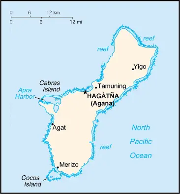
GUAM is the most southerly and the largest of the Mariana Islands in the northwest Pacific Ocean. It consists mainly of a high coralline limestone plateau with some low volcanic mountains in the south of the island.

Google Maps, Country Facts and Route Planner
GUAM is the most southerly and the largest of the Mariana Islands in the northwest Pacific Ocean. It consists mainly of a high coralline limestone plateau with some low volcanic mountains in the south of the island.
 |
 |
 |
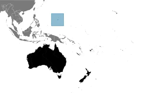
| Borderline map of Guam | Location map of Guam | Flag of Guam |
Google Maps and Detailed Facts of Guam (GU). This page lets you explore Guam and its border countries (Country Location: Oceania, an island in the North Pacific Ocean, about three-quarters of the way from Hawaii to the Philippines) through detailed Satellite imagery – fast and easy as never before Google Maps.
Find comprehensive information about this country’s diversity below: Google Maps, geography, economy, science, people, culture, environment, government, and history – All in One Wiki page.
There is also a Street View and free Driving Directions at your service. Your Google Satellite Map Sightseeing in Guam, in Oceania, starts here at Driving Directions and Maps.com.