Google Maps™ driving directions home » Faroe Islands map

Faroe Islands

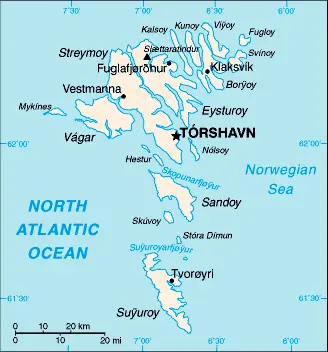
Driving Directions Faroe Islands

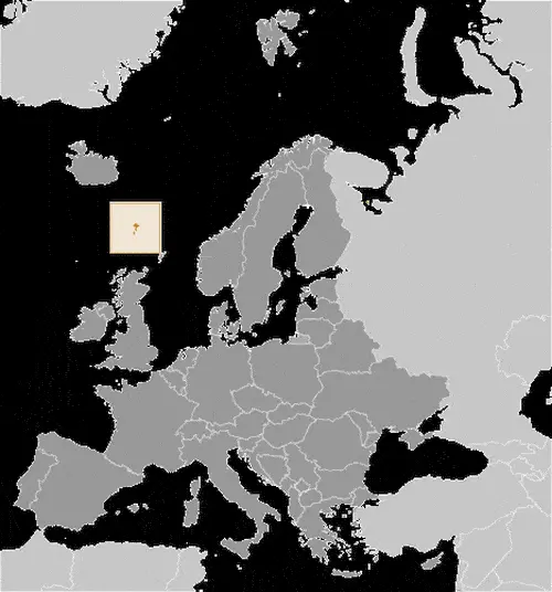
FAROE (FAEROE) ISLANDS (Foroyar) has been a self-governing region of Denmark since 1948. They consist of a group of 18 basaltic islands and situated in the North Atlantic, approximately halfway between the Shetland Islands and Iceland. The landscape of these islands characterized by steep, stepped peaks rising out of the sea to nearly 900 meters or 3,000 feet and glaciated, trough-shaped valleys.

Read more

Google Maps™ driving directions home » Faroe Islands map

Faroe Islands Google Map

This image shows the draft map of Faroe Islands, Europe. For more details of the map of Faroe Islands, please see this page below. This image shows the location of Faroe Islands, Europe. For more geographical details of Faroe Islands, please see this page below. This image shows the flag of Faroe Islands, Europe. For more details of the flag of Faroe Islands, please see this page below.
Borderline map of Faroe Islands Location map of Faroe Islands Flag of Faroe Islands

Faroe Islands Google map

Google Maps and Detailed Facts of Faroe Islands (FO). This page lets you explore the Faroe Islands and its border countries (Country Location: Northern Europe, island group between the Norwegian Sea and the North Atlantic Ocean, about halfway between Iceland and Norway) through detailed Satellite imagery – fast and easy as never before Google Maps.

Find comprehensive information about this country’s diversity below: Google maps, geography, economy, science, people, culture, environment, government, and history – All in One Wiki page.

There is also a Street View and free Driving Directions at your service. Your Google Satellite Map Sightseeing in the Faroe Islands, in Europe, starts here at Driving Directions and Maps.com.

Read more