Google Maps™ Driving Directions (Home) »

Navigate America’s Core with USA-Interstate-Map: Unlocking the Nation’s Lifelines

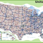
Imagine a vibrant web of blue, red, and green lines stretching across the United States, weaving together cities, towns, and landscapes into a dynamic network of movement and commerce. This USA-Interstate-Map reveals the nation’s Eisenhower Interstate Highway System, complemented by other National Highway System (NHS) routes, from the bustling I-95 corridor on the East Coast …