
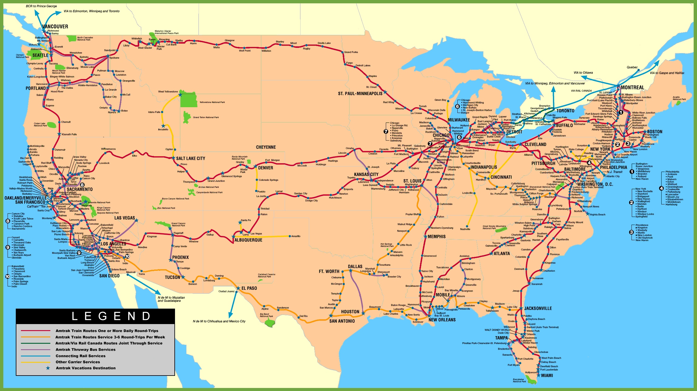
Imagine a vibrant network of red, blue, purple, and yellow lines crisscrossing the United States, connecting bustling cities, quaint towns, and scenic landscapes in a dynamic web of rail travel and adventure. This USA-Rail-Map unveils Amtrak’s extensive passenger rail system, along with connecting bus routes and other rail carriers, stretching from Seattle’s Pacific Northwest to Miami’s sunny shores, spanning all 50 states, Canada, and Mexico. Whether you’re a train enthusiast dreaming of a cross-country journey on the Coast Starlight, a traveler seeking sustainable transport, or a geography buff fascinated by America’s rail infrastructure, this map offers a detailed guide to the tracks that link the nation. Let’s embark on an expansive journey through its rail lines, uncovering the historical significance, cultural allure, and modern-day utility they bring to life across America!
USA-Rail-Map Insights
Navigating America’s Rail Corridors
This richly detailed USA-Rail-Map showcases Amtrak’s passenger rail network with red lines for daily or multi-daily routes, blue for 3-6 round-trips-per-week services, purple for Thruway bus connections, and yellow for other rail carriers, extending from Portland, Oregon, to Boston, Massachusetts, with routes into Canada and Mexico. It highlights iconic routes like the California Zephyr from Chicago to San Francisco, the Empire Builder from Chicago to Seattle, and the Northeast Regional along the East Coast, connecting major hubs like New York, Washington, D.C., and Los Angeles. The map includes national parks, urban areas, and border crossings, with a legend clarifying service frequency and Amtrak Vacations destinations, offering a comprehensive tool for travel planning, geographic exploration, and understanding America’s rail landscape as of 2025.
Boundless Adventures for Travelers and Sustainability Advocates
Train enthusiasts and eco-conscious travelers use this map to plan scenic journeys, such as riding the Southwest Chief from Los Angeles to Chicago through the Southwest’s deserts or the Crescent from New York to New Orleans through the South’s historic towns. Amtrak’s Thruway bus connections extend rail access to remote areas, while other carriers like regional freight lines support freight transport, reducing road congestion. Urban planners and environmentalists value its depiction of sustainable transport options, and educators teach about America’s rail history, from the Transcontinental Railroad’s 1869 completion to today’s Amtrak network, serving over 32 million passengers annually. This map remains a vital resource for anyone seeking efficient, scenic, and green travel across the U.S., fostering connectivity and conservation as of 2025.
Captivating Tales of America’s Rails
Did you know Amtrak, established in 1971, revitalized passenger rail travel in the U.S., building on a legacy that began with the first transcontinental railroad in 1869, connecting the East and West Coasts? This USA-Rail-Map reflects that evolution, showcasing routes like the Sunset Limited from New Orleans to Los Angeles, which traverse diverse terrains, and the Acela Express, offering high-speed service along the Northeast Corridor. States like California lead in rail investment, while rural areas like North Dakota rely on connecting bus services, highlighting the system’s adaptability. With Amtrak’s expansion plans and historic routes like the Auto Train, each line on this map tells a story of innovation, nostalgia, and progress, linking America’s past and present as of 2025.