
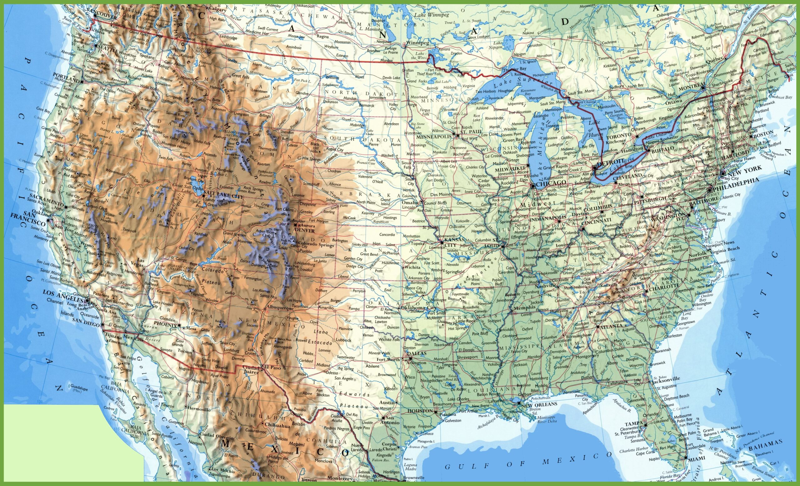
Picture a vivid tapestry of the United States, where mountains rise in shades of brown, plains stretch in soft greens, and rivers carve paths across the land. This USA-Physical-Map reveals America’s diverse physical geography, from the Rocky Mountains in Colorado to the Mississippi River’s winding course through the Midwest, spanning all 50 states. Whether you’re an outdoor adventurer, a geography enthusiast, or a planner studying the land, this map offers a breathtaking view of the nation’s natural features. Let’s explore its rugged beauty and the stories etched in its terrain!
USA-Physical-Map Insights
Unveiling America’s Natural Features
This detailed USA-Physical-Map showcases the U.S.’s physical landscape with color-coded elevations: brown for mountains like the Sierra Nevada in California, green for plains like the Great Plains in Kansas, and blue for water bodies like the Great Lakes and Gulf of Mexico. It highlights major rivers, such as the Colorado and Missouri, and mountain ranges, including the Appalachians in the East, with insets for Alaska and Hawaii. The map’s intricate design includes state and international borders, offering a clear view of America’s topography from Maine to Hawaii.
Practical Uses for Exploration and Study
Hikers and geologists use this map to identify mountain ranges like the Cascades in Washington or valleys like Death Valley in California for outdoor adventures. Educators teach physical geography with its depiction of elevation and landforms, while environmental scientists analyze it for climate and resource studies. Urban planners and engineers reference it for infrastructure projects, making it an essential tool for understanding America’s natural landscape.
Captivating Geographic Facts
Did you know the U.S. spans some of the world’s most dramatic terrain, with Denali in Alaska reaching 20,310 feet—the highest peak in North America—and Death Valley in California dipping to 282 feet below sea level, the lowest? This USA-Physical-Map reflects that diversity, showing the arid Southwest deserts, fertile Midwest plains, and forested Northeast, shaped by millions of years of geological activity as of 2025.