
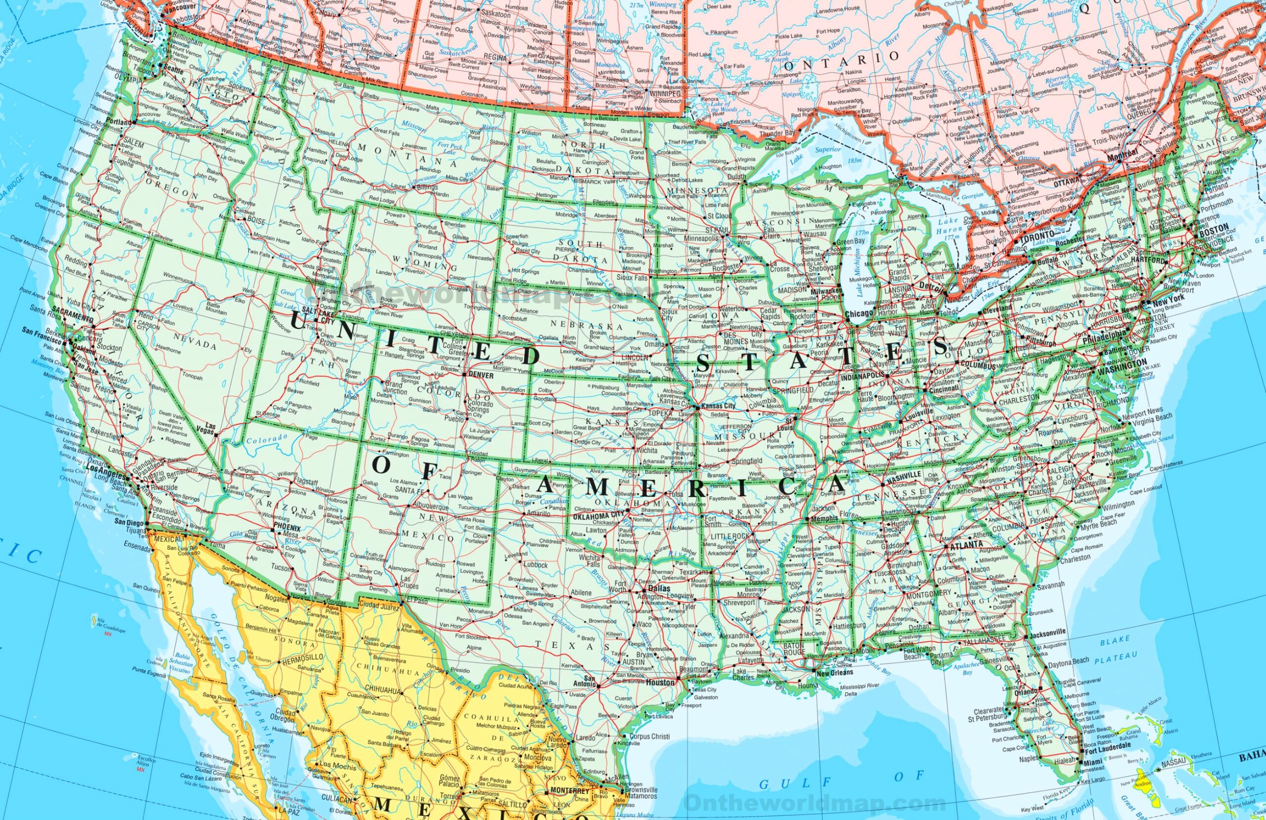
Picture a sprawling web of green and red lines stretching across the United States, connecting cities, towns, and remote corners in a vibrant dance of travel and trade. This USA-Road-Map reveals the nation’s extensive road network, from major interstates like I-95 along the East Coast to scenic byways through the Rockies, covering all 50 states and beyond. Whether you’re planning a cross-country road trip, managing logistics, or studying U.S. geography, this map guides you through America’s arteries. Let’s navigate its detailed routes and the stories they tell!
USA-Road-Map Insights
Navigating America’s Road System
This detailed USA-Road-Map highlights the U.S. road network with green lines for major highways, red for secondary routes, and black for local roads, stretching from California to Maine, with insets for Alaska and Hawaii. It marks key cities like New York, Chicago, and Los Angeles, and includes neighboring regions like Canada and Mexico. The map’s clear design shows state borders, major rivers like the Mississippi, and mountain ranges, offering a comprehensive tool for travel and planning across the USA.
Practical Applications for Travelers and Businesses
Road trippers use this map to plot journeys between cities like Seattle and Miami, identifying stops or optimal routes. Trucking companies and logistics firms rely on it for efficient delivery paths, while urban planners assess infrastructure needs. Educators teach transportation geography with its visual layout, and emergency services use it for evacuation planning, ensuring seamless navigation across America’s vast landscape as of 2025.
Fascinating Roadway Insights
Did you know the U.S. has over 4 million miles of roads, with the Interstate Highway System, started in 1956, spanning nearly 48,000 miles? This USA-Road-Map reflects that network, including iconic routes like Route 66 and the Alaska Highway. States like Texas lead in road mileage, while rural areas like Montana feature scenic, less-traveled paths, showcasing the diversity and scale of America’s transportation infrastructure.