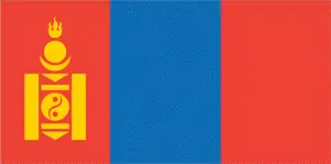
Google Maps™ driving directions home » Asia maps » Mongolia

Mongolia

Driving Directions Mongolia

MONGOLIA is a large, central Asian republic that shares a long northern border with Russia and is surrounded by China‘s other sides.

The border with China extends for 4,670 kilometers or 2,901 miles. Mongolia consists mainly of a high plateau from which mountains rise in the west. The principal ranges are the Altai Mountains, which extend southeastward, and the Hangayn Mountains in the central west­ern area.

Driving Directions


The most significant peaks are found in the Altai Mountains. In the east and southeast, the plateau’s elevation is generally lower and arid; semidesert scrubland gradually gives way to the real desert of the Gobi, which stretches across the southeastern portion of the country.

Several large lakes occur in Mongolia’s mountainous regions, and there are salt lakes and salt pans in the arid, desert regions. Several large rivers cross the country, arising mainly in the mountains. The principal rivers are the Selenge and its tributaries, which flow northeastwards from the Hangayn Mountains, the Kerulen in the east, and the Onhon in the north. Four vegetational zones are recognized in Mongolia, which grades into one another: coniferous forest in the mountains, forest-steppe, steppe, and semidesert/desert.

Mongolia is a sparsely populated country whose people continue to adhere to a traditional, pastoral way of life-based on the herding of grazing animals. Since the people live close to the land upon which their well-being depends, they have a great sense of respect for their country’s natural flora and fauna. Hence Mongolia preserves a wide range of species that have become rare in other parts of central Asia. The importance of conservation, particularly when set against development challenges, is well recognized by the government.

Mongolia has a dry continental climate with long, freezing winters and short, mild summers, during which most of the yearly rainfall experienced. Rain may not fall in parts of the desert for several years and, while daytime conditions can be searingly hot, the temperature may plunge at night to near freezing and, in winter, can fall as low as -20°C or 4°F.

The capital and largest city in Mongolia is Ulaanbaatar. Although many people still follow a seminomadic way of life based on animal herding, some 58 percent of Mongolians classed as urban dwellers.

Mongolia has valuable iron ore reserves, coal, copper, molybdenum, fluorspar, tungsten, uranium, gold, and silver. Ulaanbaatar is one of several industrial centers that developed to exploit some of these minerals, although others have yet to extract them.

Manufacturing industries are generally on a small scale and include the processing of wool, hides, leather, furs, meat and dairy produce, textiles, wooden goods, agricultural equipment, and building products. The collapse of trade with the former Soviet Union has created severe economic problems for Mongolia, and it is increasingly looking to Japan and China for business and financial assistance.

Google maps™ Mongolia


Mongolia has five topographic regions: the Altai range (the largest mountain system); the Great Lakes Depression (lakes and plains); the Hangayn-Hentiyn Mountains (medium-altitude older mountains with gentle slopes and valleys); the uplifted eastern plains (smooth and rolling terrain, sprinkled with pastures, forests, and rivers); and the Gobi Desert (hilly in the west with salt lakes and marshes in flat lowlands and sand desert).

Mongolia is a landlocked nation. The closest ocean is the Pacific’s Yellow Sea, which is 700 kilometers (435 miles) to the east across northeast China.

Did you know about Mongolia?

The canyons of the Flaming Cliffs contain archaeological sites that were first excavated in the early twentieth century. Early examples of dinosaur eggs have been found there, as well as many significant dinosaur skeletons from the late Cretaceous period.

Click here for Mongolia Google maps, MapQuest & more detailed country facts.