
 Location: South Asia
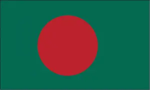
Official name: People’s Republic of Bangladesh
Formation (date of independence / date current borders were established): 1971 / 1971
Capital city: Dhaka
Population: 164 million / 3180 people per sq mile (1228 people per sq km)
Total land area: 55,598 square miles (144,000 square km)
Language(s) spoken: Bengali (official language), Urdu, Chakma, Marma (Magh), Garo, Khasi, Santhali, Tripuri, Mro
Main religions: Muslim (mainly Sunni) 88%, Hindu 11%, Other 1%
Ethnic mix: Bengali 98%, Other 2%
Government type: Parliamentary system
Currency: Taka = 100 poisha
Literacy rate: 56%
Calorie consumption (daily per person): 2250 kilocalories
For more detailed country information, driving directions, and Google Maps, please visit Bangladesh‘s corresponding page.