
Driving Directions and Google Map of the Philippines — Roads, Routes & Navigation Guide

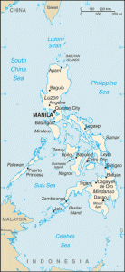
The Philippines — the Republic of the Philippines — is a Southeast Asian archipelago nation of 7,641 islands spread across 300,000 square kilometres of the western Pacific Ocean. With a population of approximately 115 million, it is one of the world’s most populous countries and one of the most geographically complex — a driver travelling from the northernmost tip of Luzon to the southernmost reaches of Mindanao must cross open sea multiple times, boarding RORO (Roll-On Roll-Off) ferries to carry their vehicle between island groups. Driving in the Philippines means navigating not just roads, but an entire island-hopping logistics chain.
The Philippines drives on the right-hand side of the road, using left-hand drive vehicles — a legacy of American colonial influence following 1898. This distinguishes the Philippines from its immediate Southeast Asian neighbours Malaysia and Indonesia, which both drive on the left. An International Driving Permit (IDP) alongside a valid home country licence is required for all foreign drivers. The blood alcohol limit is 0.05% BAC — the same EU standard as most of continental Europe. The currency is the Philippine Peso (PHP / ₱). Emergency services are reached on 911 (the unified emergency number, introduced in 2016) or 117 (national emergency hotline). Use the route planner on our homepage for driving directions across the Philippines.
Road Network Overview
The Philippines has a road network of approximately 216,000 kilometres, administered by the Department of Public Works and Highways (DPWH) for national roads and by local government units for provincial, city, and barangay (village) roads. Road quality is highest on Luzon, particularly in Metro Manila and along the expressway corridors; it deteriorates significantly on more remote islands and in the interior of Mindanao and Palawan. The national road system is anchored by the Pan-Philippine Highway (also known as AH26 — Asian Highway 26), a continuous route from Aparri in the far north of Luzon to General Santos in southern Mindanao, incorporating RORO ferry crossings between the main island groups.
Expressways of Luzon
Luzon — the largest island and home to Metro Manila — has by far the most developed expressway network in the Philippines. Key expressways include:
- NLEX — North Luzon Expressway: The main expressway heading north from Metro Manila (connecting from Balintawak Cloverleaf) through Bulacan, Pampanga, and Tarlac toward Dagupan and Pangasinan. Managed by NLEX Corporation, it connects to SCTEX and TPLEX for long-distance Luzon travel northward. The NLEX is the primary route to Clark International Airport and the former US military base area now developed as Clark Freeport Zone.
- SLEX — South Luzon Expressway: The primary expressway heading south from Metro Manila through Laguna and Batangas, eventually connecting via the STAR Tollway to Sto. Tomas and Lipa City. SLEX is the main artery to the Laguna industrial corridor (home to numerous automotive and electronics factories), CALAX, and Batangas Port for inter-island ferries.
- Metro Manila Skyway (Stages 1, 2, and 3): A three-stage elevated expressway system running north–south through the heart of Metro Manila, operated by San Miguel Corporation. Stage 3, completed in 2021, extended the Skyway to Balintawak in the north, creating a direct elevated connection between NLEX and SLEX for the first time and dramatically reducing Metro Manila through-transit times. The Skyway is the fastest option for traversing Metro Manila by car.
- CAVITEX — Cavite Expressway: Connects the R-1 Expressway (Manila Bay area) south through Cavite province toward Kawit and beyond, giving access to the southern Metro Manila suburbs without using congested surface roads.
- CALAX — Cavite-Laguna Expressway: A newer expressway connecting CAVITEX in Cavite to SLEX in Laguna, progressively opening in sections. When fully open, it will create a more direct southern orbital link bypassing congested national roads.
- NAIAX — NAIA Expressway: The dedicated elevated expressway providing direct access to Ninoy Aquino International Airport (NAIA) Terminals 1, 2, and 3 from the Skyway system, significantly reducing access times to the airport.
- SCTEX — Subic-Clark-Tarlac Expressway: A 94-kilometre expressway connecting NLEX at Tarlac to Clark Freeport Zone and Subic Bay Freeport Zone, serving the economic corridor between Manila’s northern satellite cities and the former US military bases.
- TPLEX — Tarlac-Pangasinan-La Union Expressway: Extends north from SCTEX through Pangasinan and into La Union, continuing the expressway corridor toward the Ilocos Region and the far north of Luzon.
Cebu and Mindanao
Outside Luzon, the expressway network is limited. Cebu island in the Visayas has the South Road Properties (SRP) coastal reclamation road and several major national roads, but no full expressway equivalent. Mindanao — the second-largest island — has an extensive national road network connecting Davao (the largest city in Mindanao), Cagayan de Oro, General Santos, Zamboanga, and Cotabato, but road quality and safety vary significantly by region. Note that parts of western Mindanao (Bangsamoro Autonomous Region in Muslim Mindanao — BARMM) have historically experienced security concerns; foreign governments advise checking current travel advisories before driving in this area.
Speed Limits
Speed limits in the Philippines are set by the Land Transportation Office (LTO) under Republic Act 4136 (Land Transportation and Traffic Code) and related regulations. Enforcement is by the PNP Highway Patrol Group (PNP-HPG) and MMDA traffic enforcers in Metro Manila. Speed cameras are present on key expressways; mobile radar is used on national highways.
| Road Type | Speed Limit | Notes |
|---|---|---|
| Expressways / tollways | 100 km/h | Some sections posted at 80 km/h; minimum speed 60 km/h on most expressways |
| National / provincial highways | 80 km/h | Outside built-up areas; as posted |
| Urban / city streets | 50 km/h | Default in cities and municipalities |
| School zones (during school hours) | 30 km/h | Strictly enforced; heavy fines apply |
| Residential / barangay roads | 20–30 km/h | As posted; speed humps (humps) very common |
Speed humps are widespread on Philippine roads, including on many national highways passing through barangays. They vary in height and visibility — unmarked or poorly lit humps are a significant hazard, particularly at night. Always reduce speed when approaching populated areas, market areas, and any roadside settlement.
Toll Roads & RFID Payment
The Philippines has made RFID (Radio Frequency Identification) the mandatory cashless payment method at all expressway toll gates since January 2021, under a Toll Regulatory Board (TRB) directive. All motor vehicles using expressways must have an RFID tag affixed to the windscreen. Two separate RFID systems operate on different expressways — both are required for drivers who use multiple toll road operators:
- EasyTrip (NLEX Corporation): used on NLEX, SCTEX, TPLEX, CAVITEX, and CALAX. The EasyTrip RFID tag is linked to an EasyTrip account, topped up via the EasyTrip app, over-the-counter at NLEX plazas, or at selected merchants.
- AutoSweep (San Miguel Corporation / Citra): used on SLEX, Star Tollway, Metro Manila Skyway (Stages 1, 2, 3), NAIAX, and MCX. The AutoSweep RFID tag is similarly linked to an AutoSweep account, managed via the AutoSweep app or top-up at SLEX plazas and partner merchants.
Visitors renting a car for expressway use should confirm with the rental company which RFID tags are fitted and whether the account is pre-loaded. Some rental companies charge a daily RFID administration fee. Cash lanes still exist at most toll plazas for vehicles without RFID — queues at cash lanes can be very long, especially during peak hours. Getting both RFID accounts set up before travel is strongly recommended for any significant driving on Luzon expressways.
| Route | Approx. Toll (Class 1 car, 2026) |
|---|---|
| NLEX: Balintawak → San Fernando, Pampanga (~60 km) | ₱108–130 |
| SLEX: Alabang → Calamba, Laguna (~40 km) | ₱78–96 |
| Metro Manila Skyway Stage 3 (full, Buendia → Balintawak) | ₱104–112 |
| NAIAX (NAIA Expressway, per section) | ₱22–45 |
| SCTEX: NLEX junction → Clark (approx.) | ₱56–72 |
Toll rates are set by individual concessionaires and reviewed by the Toll Regulatory Board (TRB). Check the EasyTrip app (easytripph.com) or AutoSweep app for current rates before travel.
Road Rules & Driving Law
The Philippines drives on the right; vehicles have the steering wheel on the left. Visitors from other right-hand traffic countries (continental Europe, the Americas, most of Asia) will find the driving side familiar. Visitors from left-hand traffic countries (UK, Australia, Malaysia, Indonesia) must consciously adjust. Road signs are generally in English — the Philippines is a bilingual nation (Filipino and English) and road signage, speed limits, and traffic instructions are consistently in English.
International Driving Permit (IDP): Required alongside a valid home country licence for all foreign drivers. The IDP and national licence together are valid for up to 90 days from the date of entry for most nationalities. After 90 days, foreign residents must apply for a Philippine driver’s licence through the Land Transportation Office (LTO). Rental car companies will check IDP validity at the time of vehicle collection.
Drink driving: The blood alcohol limit is 0.05% BAC (50 mg per 100 ml of blood) under Republic Act 10586 (Anti-Drunk and Drugged Driving Act of 2013). Violation carries serious penalties: first offence — a fine of ₱20,000 and imprisonment of 3 months; second offence — ₱80,000 and 6–12 months’ imprisonment, plus a 1-year licence suspension; third offence — perpetual licence revocation. PNP-HPG enforces drink-drive laws with roadside sobriety and breathalyser testing. Driving after any alcohol consumption is strongly discouraged.
Seatbelts: Mandatory for all vehicle occupants under Republic Act 8750 (Seat Belts Use Act of 1999). The driver is responsible for ensuring all passengers are buckled. Children under 12 must not be seated in the front passenger seat, and child restraint seats are required under the Child Safety in Motor Vehicles Act. Fines of ₱1,000–5,000 apply for non-compliance.
Mobile phones: Use of a handheld mobile device while driving is prohibited under Republic Act 10913 (Anti-Distracted Driving Act of 2016). First offence fines start at ₱5,000, increasing significantly for repeat offences. Hands-free use (Bluetooth, mounted device holder) is permitted. Enforcement has increased substantially in Metro Manila and on expressways.
Compulsory Third Party Liability (CTPL) insurance: All registered vehicles in the Philippines must carry valid CTPL insurance — a government-mandated minimum liability policy covering personal injury or death of third parties. CTPL is purchased annually alongside vehicle registration at the LTO. For rental vehicles, CTPL is included; comprehensive insurance is strongly recommended to cover vehicle damage.
PNP-HPG and traffic enforcement: The Philippine National Police Highway Patrol Group (PNP-HPG) enforces traffic laws on national highways and expressways. The MMDA (Metro Manila Development Authority) deploys traffic enforcers on major roads within Metro Manila. Visitors stopped by traffic enforcers should request a formal traffic violation receipt (TVR) if a citation is issued — paying fines only through official channels and getting an official receipt protects against unofficial solicitation.
Tricycles and jeepneys: These uniquely Philippine road users require special awareness. Jeepneys — the colourful, extended jeep-style buses that are an icon of Philippine culture — stop unpredictably to pick up and drop off passengers anywhere along their route, with no fixed bus stops. Tricycles (motorcycle-sidecar combinations) operate on local and barangay roads and can appear suddenly from side streets. Pedicabs (bicycle-powered sidecars) are common in residential areas. Maintain vigilance and a generous following distance behind any public transport vehicle.
Fuel & Petrol Stations
Fuel is widely available throughout Luzon and major urban areas of the Visayas and Mindanao. The main fuel station brands are Petron (the largest network, partially government-linked), Shell, Caltex, Phoenix Petroleum, Seaoil, and PTT. On expressways, fuel stations are located at designated service areas. The main fuel grades are:
- RON 91 (Unleaded): The lowest grade regular petrol; widely available. Suitable for older or basic engines.
- RON 95 (Premium Unleaded): The standard grade for modern passenger vehicles. Recommended for most rental cars.
- RON 97 / RON 100 (Super Premium): High-octane fuel for performance engines; available at major stations in urban areas.
- Diesel: Available everywhere; used by trucks, buses, SUVs, and many Philippine-specification pick-up trucks. Diesel is the most common fuel type for commercial vehicles.
Fuel prices in the Philippines fluctuate weekly with global oil markets and are published by the Department of Energy (DOE) each Tuesday. On remote islands and in mountain provinces, fuel availability may be limited — fill up whenever the opportunity arises. In very isolated barangays, fuel may only be available in repurposed bottles from roadside sellers at higher prices. Always carry a sufficient reserve when venturing off main national roads.
Driving in Metro Manila
Metro Manila — the National Capital Region (NCR) — is one of the most densely populated and traffic-congested urban areas in the world. The region encompasses 17 cities and municipalities with a population exceeding 13 million (greater metropolitan area approximately 24 million). EDSA (Epifanio de los Santos Avenue), the main circumferential highway looping through the heart of Metro Manila, is notorious as one of the most congested roads in the world. Peak-hour traffic on EDSA can reduce speeds to near zero for hours at a time.
Number Coding (UVVRP — Unified Vehicular Volume Reduction Program): Metro Manila operates a vehicle restriction scheme based on the last digit of the licence plate number. On designated weekdays, vehicles with certain plate endings are prohibited from using EDSA and other major roads within specified hours (typically 07:00–20:00). The scheme has been periodically suspended, modified, and reinstated — check the current MMDA policy before driving in central Manila. Motorcycles, public utility vehicles (jeepneys, buses, tricycles), and emergency vehicles are generally exempt.
EDSA Carousel: EDSA has a dedicated Bus Rapid Transit (BRT) carousel lane in the centre of the highway, reserved exclusively for the EDSA Carousel bus service. Private vehicles must not enter the carousel lane at any time — enforcement is strict and fines are significant.
For visitors, the most practical Metro Manila advice parallels Jakarta: Grab (the dominant ride-hailing app) is cheap, widely available, and eliminates the stress of navigation and parking. The MRT-3 (Metro Rail Transit Line 3) runs along EDSA and connects key north–south points efficiently. If you must drive, use the Skyway system to bypass surface congestion, use Waze for real-time routing, and budget three to four times the theoretical journey time during peak hours. Avoid central Metro Manila roads between 07:00–09:30 and 17:00–20:00 if at all possible.
Parking in Metro Manila: Parking in commercial areas of Metro Manila is managed by private car park operators in shopping malls, office buildings, and multi-storey structures. Malls are generally the most convenient — SM Malls, Ayala Malls, Robinsons Malls, and Megamall all have large car parks. On-street parking is regulated by MMDA in certain zones. Illegal parking can result in towing (impounding) by the MMDA; retrieval requires payment at the MMDA impounding facility, which can be time-consuming and costly.
RORO Ferry Travel Between Islands
The Strong Republic Nautical Highway (SRNH) is a network of RORO (Roll-On Roll-Off) ferry routes that, together with roads, creates a continuous driveable corridor from Luzon through the Visayas and down to Mindanao. RORO ferries allow drivers to drive their vehicle directly onto the vessel, cross the sea channel, and drive off the other side — making overland-style travel across the Philippine archipelago possible. Key RORO routes on the main corridor include:
- Batangas Port → Calapan, Oriental Mindoro (~1.5 hours): Luzon to Mindoro island crossing.
- Roxas, Mindoro → Caticlan, Aklan (Boracay gateway) (~3–4 hours): Mindoro to northern Panay.
- Matnog, Sorsogon → Allen, Northern Samar (~3 hours): Southern Luzon (Bicol) to Samar — the main Luzon–Visayas vehicle crossing.
- San Ricardo, Southern Leyte → Lipata, Surigao del Norte (~1.5 hours): Leyte to Mindanao crossing.
- Liloan, Southern Leyte → Lipata, Surigao: Alternative Visayas–Mindanao link.
RORO ferries are operated by multiple private companies including 2GO Travel, Cokaliong Shipping, Montenegro Shipping Lines, and various smaller operators. Advance booking for vehicles is strongly recommended during peak travel periods (Holy Week / Easter, Christmas, and summer — April–May). Arrive at the port well ahead of departure time; vehicle loading queues can be long and strict cut-off times apply. Ferry schedules are subject to weather cancellations — particularly during typhoon season (June–November).
Driving on the Major Islands
Luzon (outside Metro Manila): The roads radiating from Metro Manila into Luzon’s provinces are generally well-maintained national highways. The Bicol Express route south from Manila through Laguna, Quezon, and the Bicol Peninsula to Matnog (ferry port to Samar) passes through lush agricultural lowlands and the shadow of Mount Mayon — the near-perfect volcanic cone in Albay considered the world’s most perfectly shaped stratovolcano. The road to Baguio City (the mountain capital of the Cordillera at 1,500 metres) via either Kennon Road (scenic, steep, and narrow) or Marcos Highway (wider, more modern) is a dramatic highland drive through pine forests. The Cordillera mountain roads in Benguet and Mountain Province, including the Halsema Highway — the highest road in the Philippines, reaching nearly 2,200 metres — are adventurous, scenic, and require confident mountain driving skills.
Cebu: Cebu island has a well-developed road network for the Visayas. The main highway runs north–south along the western coast from Cebu City to Toledo (west) and southern Cebu. The Trans-Central Highway crosses the mountainous spine of the island, offering dramatic views and access to highland communities. Mactan Island — connected to Cebu City by two bridges and home to Mactan-Cebu International Airport — is easily navigable by car. The southern part of Cebu island, including Oslob (whale shark viewing) and Moalboal (diving), is reachable by a 2–3 hour drive on the south coastal road.
Palawan: Palawan — the archipelagic province ranked among the world’s most beautiful islands — has a single main highway running south from Puerto Princesa (the provincial capital and only city) toward Quezon and the central and southern reaches of the island. The northern road leads toward Sabang (underground river, UNESCO World Heritage Site) and eventually toward the tourism hub of El Nido — approximately 230 km from Puerto Princesa on a road that has been progressively improving but still includes rough, unsealed sections. Driving from Puerto Princesa to El Nido takes 5–6 hours on the best road days; a 4WD is recommended for the full journey and essential for side roads. Road conditions in Palawan are considerably more demanding than on the main Philippine islands.
Mindanao: The Philippines’ second-largest island has a road network centred on major cities — Davao (the largest city in Mindanao by area), Cagayan de Oro, General Santos, and Cotabato. Roads in and around Davao are well-maintained; the Davao–Cagayan de Oro coastal highway is the main intercity route on the northern coast. Exercise caution and check current travel advisories before driving in the Bangsamoro region (western Mindanao and parts of Sulu Archipelago), where security conditions vary.
Road Hazards: Typhoons, Floods & More
Typhoons (Bagyo): The Philippines is one of the most typhoon-prone nations on earth, typically experiencing 20 typhoons per year, of which 8–9 make landfall. The active typhoon season runs from June through November, with September–November the peak period. During a typhoon, road travel should stop entirely — do not attempt to drive during typhoon conditions. Storm surges, landslides, fallen trees, debris, and flash floods make roads genuinely life-threatening during and immediately after a typhoon. Monitor PAGASA (pagasa.dost.gov.ph) for current typhoon tracks and Public Storm Warning Signals (PSWS 1–4). Signal 3 and above typically results in road closures and suspension of all public transport.
Flooding: Metro Manila and low-lying coastal areas flood severely during heavy monsoon rains (habagat — southwest monsoon, June–September) and typhoon events. The Pasig River system and many urban waterways in Metro Manila overflow regularly. Never attempt to drive through floodwater — even 30 cm of fast-moving water can carry away a vehicle. MMDA and DPWH issue flood advisories on social media and through local radio — monitor these during wet season travel.
Earthquakes: The Philippines sits on the Pacific Ring of Fire and experiences frequent seismic activity. A major earthquake can damage roads, bridges, and elevated expressways immediately after the event. If driving during an earthquake, pull safely to the side of the road away from power lines and overpasses and wait for shaking to stop before proceeding.
Road conditions and potholes: Outside expressways and major national roads, potholes are extremely common on Philippine roads and are a major cause of accidents, particularly at night. Flooded sections, subsiding shoulders, and road damage from typhoons are widespread during and after rainy season. Always reduce speed on unfamiliar roads, especially at night, and assume there may be road damage ahead after any significant rainfall.
Animals and informal road use: Carabao (water buffalo) used for farming, stray dogs, chickens, and goats cross roads in rural areas. In mountain provinces, livestock may be on roads at any hour. Informal road uses such as drying rice or corn on the road surface are common in agricultural areas — proceed slowly and sound your horn gently to alert farmers.
Scenic Drives & Road Trip Routes
Kennon Road to Baguio City (Benguet, Luzon): The original mountain road from Rosario in La Union ascending through the Cordillera to Baguio City at 1,500 metres is one of the Philippines’ most dramatic drives. The road clings to steep canyon walls, crosses the Bued River gorge multiple times on historic bridges, and passes through waterfalls and pine forests. It is narrow, prone to rockfalls, and closed after heavy rain — but on a clear day, it is magnificent. Kennon Road requires careful, slow driving and should not be attempted in large vehicles or in poor weather.
Halsema Highway — Mountain Province: The Halsema Highway from Baguio north to Bontoc in Mountain Province is the highest road in the Philippines, cresting at nearly 2,200 metres in the Cordillera mountain range. The road passes through Sagada (the famous hanging coffins), traditional Igorot villages, and extraordinary highland scenery. It is narrow, winding, and subject to landslides and fog. Drive extremely slowly, use your horn on blind bends, and allow full days for sections that appear short on a map.
Mount Mayon Circumferential Road (Albay, Bicol): The ring road around the base of Mount Mayon — one of the world’s most symmetrical stratovolcanoes, rising 2,462 metres from the Albay plain — offers spectacular views of the volcano from every angle. The road passes through agricultural villages, lava fields from past eruptions, and lush coconut plantations. Mayon is active; check PHIVOLCS (Philippine Institute of Volcanology and Seismology) alerts for current status and exclusion zones before approaching.
Palawan — Puerto Princesa to El Nido: The drive north from Puerto Princesa through the forests of central Palawan to the bay-studded coast of El Nido is one of the Philippines’ great road adventures. The road passes through Sabang (gateway to the Puerto Princesa Subterranean River National Park — UNESCO World Heritage Site), Port Barton (a quieter beach alternative), and finally the limestone karst towers and turquoise bays of El Nido. Allow a full day for the journey and carry extra fuel; road quality improves as investment in the route increases but sections remain rough.
Cebu Transcentral Highway: The mountain highway crossing Cebu island from Cebu City west to Toledo on the opposite coast passes through highland barangays, cool mountain air, and coffee-growing highlands before descending to the copper-mining western coast. The views from the ridgeline at the summit — particularly at sunrise — across Cebu City and Cebu Strait to the east and down to Toledo Bay to the west are spectacular.
FAQ: Driving in the Philippines
Which side of the road does the Philippines drive on?
The Philippines drives on the right-hand side of the road, with left-hand drive vehicles — the same as the United States, continental Europe, and most of the Americas. This is different from neighbouring Malaysia and Indonesia, which drive on the left. Road signs throughout the Philippines are in English, making navigation accessible to most foreign visitors.
Do I need an IDP to drive in the Philippines?
Yes — a valid International Driving Permit (IDP) is required alongside your home country driving licence. Together, they are valid for up to 90 days from your date of entry. IDP requirements are enforced by rental car companies and at PNP-HPG checkpoints. IDPs must be obtained before travel from an authorised motoring organisation in your home country. After 90 days, a Philippine LTO driver’s licence is required.
How do I pay tolls on Philippine expressways?
All Philippine expressways require RFID payment — cash is no longer accepted at most toll gates. Two systems operate: EasyTrip (for NLEX, SCTEX, TPLEX, CAVITEX, CALAX) and AutoSweep (for SLEX, Skyway, NAIAX). Both require a windscreen RFID tag linked to a prepaid account. For rental cars, confirm with the rental company which RFID tags are fitted and the top-up procedure. Cash lanes still exist as a fallback at some plazas but have very long queues.
What is the drink-drive limit in the Philippines?
The blood alcohol limit is 0.05% BAC (50 mg per 100 ml of blood) under the Anti-Drunk and Drugged Driving Act (RA 10586). This is the same as the EU standard. Penalties are severe: fines of ₱20,000 and imprisonment for a first offence, escalating to licence revocation for a third offence. Roadside breathalyser testing is conducted by PNP-HPG. Visitors should not drive after consuming any alcohol.
Can I drive my car between islands in the Philippines?
Yes — the Philippines’ RORO (Roll-On Roll-Off) ferry network allows you to drive your vehicle aboard a ferry and sail to another island. The main corridor runs from Batangas (south of Manila) through Mindoro, Panay, Leyte, and down to Mindanao. Key crossings include Matnog (Luzon) to Allen (Samar), and San Ricardo (Leyte) to Lipata (Surigao, Mindanao). Advance vehicle booking is essential during peak season (Holy Week, Christmas, summer). Ferry schedules can be disrupted by typhoons.
Is it safe to drive in Metro Manila?
Driving in Metro Manila is challenging but manageable for experienced drivers. The main difficulties are severe congestion (particularly on EDSA), complex one-way street networks, unpredictable public transport vehicles (jeepneys, buses), motorcycle filtering, and the Number Coding restriction on some plates during weekday peak hours. Using Waze for real-time routing is essential. For many visitors, using Grab (ride-hailing) or the MRT-3 for Metro Manila travel, and reserving self-driving for provincial trips outside the city, is the most practical approach.
Sources and Update Note
This Philippines driving guide draws on information from the Department of Public Works and Highways (DPWH) (dpwh.gov.ph) for road network data, the Land Transportation Office (LTO) (lto.gov.ph) for licensing and vehicle regulations, the Toll Regulatory Board (TRB) for toll road policy, NLEX Corporation (nlex.com.ph) and San Miguel Corporation (AutoSweep) for RFID toll systems and rates, the Metro Manila Development Authority (MMDA) (mmda.gov.ph) for Metro Manila traffic rules, the Philippine National Police Highway Patrol Group (PNP-HPG) for traffic law enforcement, PAGASA (pagasa.dost.gov.ph) for typhoon and weather data, PHIVOLCS (phivolcs.dost.gov.ph) for volcanic hazard information, and Republic Act 4136, RA 8750, RA 10586, and RA 10913 for legal requirements.
RFID toll accounts (EasyTrip and AutoSweep) and tollway rates are reviewed periodically — verify current rates via the respective apps before travel. Number Coding (UVVRP) policy in Metro Manila is subject to change by MMDA — always check the current scheme before driving in central Manila. Ferry schedules on RORO routes are subject to weather cancellations, especially during typhoon season. This guide reflects information current as of February 2026.