
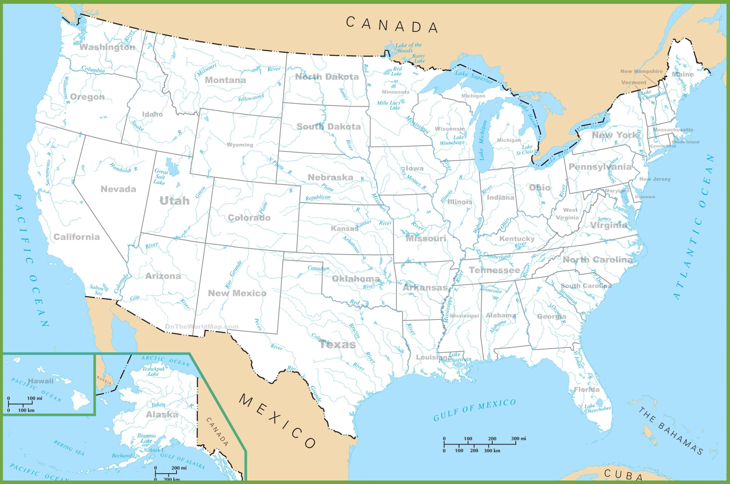
Imagine a serene map of the United States, where blue lines trace the mighty rivers, streams, and lakes that pulse through the nation, connecting its cities, sustaining its ecosystems, and shaping its history. This USA-Rivers-Map unveils the intricate network of waterways, from the Mississippi River’s 2,300-mile journey through the Midwest to the Colorado River’s dramatic path through the Southwest, spanning all 50 states, Alaska, and Hawaii. Whether you’re a kayaker planning a river adventure, a historian tracing America’s settlement patterns, an environmental scientist studying water systems, or a geography enthusiast marveling at the land’s natural arteries, this map offers a detailed guide to the flowing lifeblood of the nation. Let’s embark on a comprehensive exploration of its waterways, uncovering their ecological significance, cultural impact, and practical insights for understanding America as of 2025!
USA-Rivers-Map Insights
Mapping America’s Vital Waterways
This detailed USA-Rivers-Map showcases the U.S.’s river systems with blue lines for major rivers, streams, and lakes—highlighting the Mississippi River flowing from Minnesota to the Gulf of Mexico, the Colorado River cutting through the Grand Canyon, and the Columbia River winding from British Columbia to the Pacific Ocean—set against a clean white backdrop. It marks key cities along these waterways, such as St. Louis on the Mississippi, Portland on the Columbia, and Pittsburgh at the confluence of the Ohio and Monongahela, with state boundaries and neighboring regions like Canada and Mexico for context. The map spans from Maine’s coastal streams to Hawaii’s volcanic-fed rivers, with insets for Alaska and Hawaii, and includes a scale for distance, providing a versatile tool for navigation, education, and geographic analysis across America’s 3,796,742 square miles as of 2025.
Boundless Opportunities for Adventurers, Scientists, and Planners
Kayakers, anglers, and outdoor enthusiasts use this map to plan expeditions, targeting rivers like the Snake in Idaho for whitewater rafting or the Hudson in New York for serene paddling, while boaters navigate lakes like the Great Lakes or reservoirs like Lake Mead. Environmental scientists and conservationists analyze it to study water quality, flood risks, and ecosystem health, such as the Mississippi Delta’s wetlands or the Colorado’s arid basin challenges. Educators teach hydrology and geography with its depiction of America’s water distribution, while urban planners and engineers assess river basins for flood control, irrigation, and transportation infrastructure. This map remains an essential resource for anyone exploring or studying the U.S., fostering adventure, scientific discovery, and strategic planning across the nation’s waterways as of 2025.
Fascinating Stories of America’s Rivers and Lakes
Did you know the Mississippi River, the second-longest in North America at 2,300 miles, has shaped U.S. history since Native American times, fueling trade, agriculture, and cities like New Orleans since the 1700s? This USA-Rivers-Map reflects that legacy, showcasing the Missouri River’s 2,341-mile journey as its largest tributary, the Colorado River’s 1,450-mile path carving the Grand Canyon over 6 million years, and the Columbia River’s 1,243-mile flow supporting salmon runs for millennia. States like Arkansas highlight the Arkansas River, while rural areas like Montana cherish the Yellowstone, all critical to settlement, commerce, and ecology. As of 2025, this map tells a story of natural wonder, human reliance—think Lewis and Clark’s 1804–1806 exploration of the Missouri—and ongoing conservation challenges, each waterway weaving a narrative of America’s past, present, and future across its 3,796,742 square miles.