
Embark on a fascinating journey with the Randalls and Wards Islands map, a 2023 guide that unveils two interconnected islands in the heart of New York City! Nestled between Manhattan, the Bronx, and Queens along the East River and Harlem River, these 531-acre landmasses blend urban infrastructure with green spaces, offering a unique slice of the USA. Whether you’re a local uncovering nearby history, a traveler seeking diverse landscapes, or a map enthusiast intrigued by urban planning, this map opens the door to their multifaceted charm. Join us as we navigate their parks, facilities, and stories, revealing why these islands stand out in NYC.
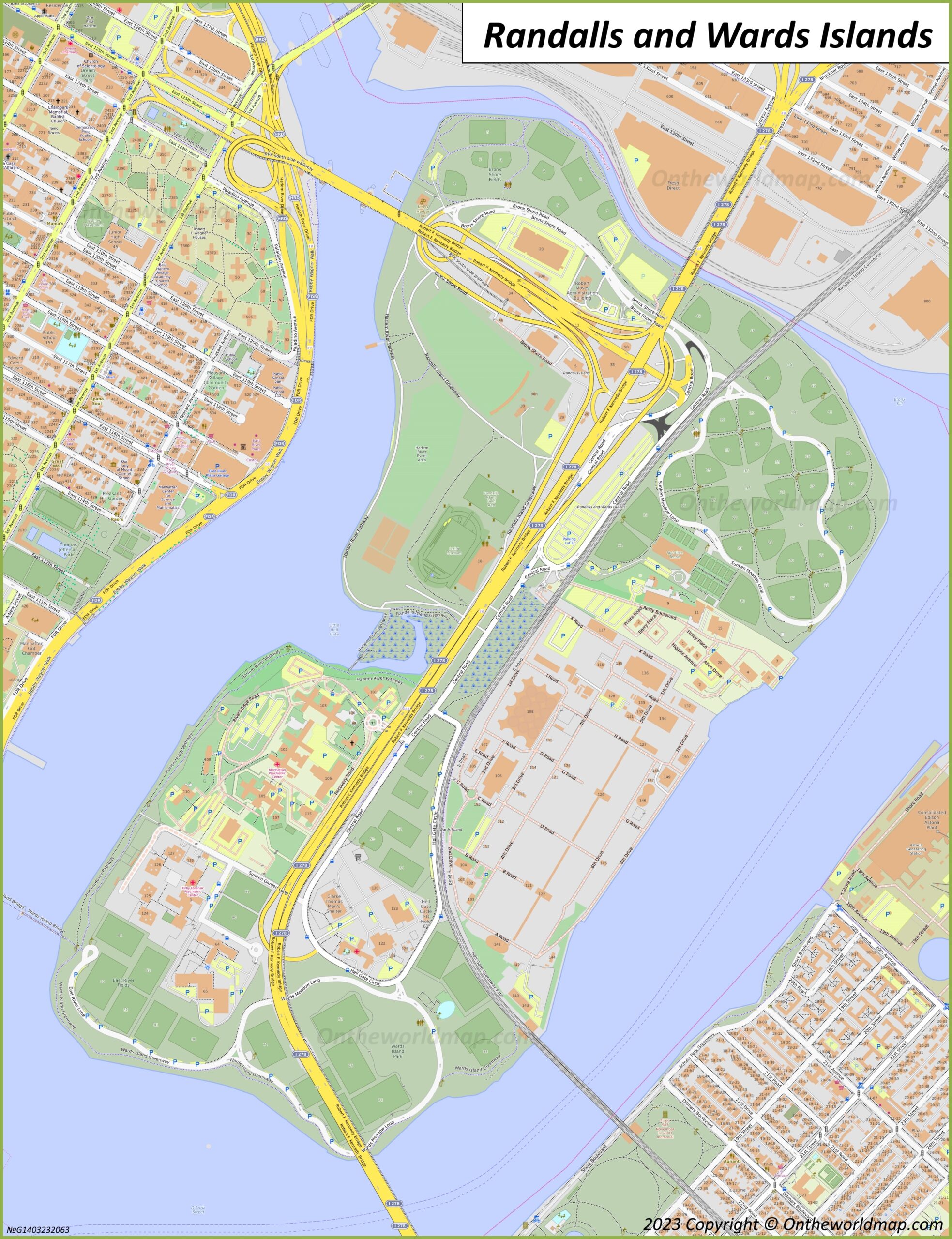
Randalls and Wards Islands Map Description: Unraveling a Dual Landscape
The Randalls and Wards Islands map, updated in 2023, details the merged islands’ expansive 531 acres with precision. The map highlights a network of yellow roads, including the RFK Triborough Bridge, connecting the islands to surrounding boroughs. Randalls Island, to the north, features green areas like Randalls Island Park, with athletic fields, the Icahn Stadium, and the Central Recreation Area. Wards Island, to the south, showcases the Manhattan Psychiatric Center, correctional facilities, and the New York City Fire Department Training Academy, marked in orange. Blue waters of the East and Harlem Rivers frame the islands, with bridges and pathways linking parks, sports complexes, and infrastructure, creating a vibrant urban-natural hybrid.
Purpose of the Map: Supporting Community and Exploration
This map serves as an essential tool for residents, visitors, and city officials navigating Randalls and Wards Islands. Locals use it to access parks for recreation, find the 18-hole golf course, or reach the Metro-North station. Tourists rely on it to explore historical sites like the Hell Gate Lighthouse or enjoy events at the amphitheater. City planners and emergency services leverage its layout to manage facilities, from psychiatric care to fire training, while park management ensures the 480 acres of parkland remain accessible. Whether you’re jogging, attending a concert, or studying urban design, this map streamlines every purpose.
Recreation and Public Access
For visitors, the map guides them to recreational hotspots, such as the soccer fields or the waterfront esplanade, with clear markers for parking and entrances. It supports community events, like the Governors Ball Music Festival, and offers routes for cyclists and pedestrians, making the islands a year-round destination for outdoor enthusiasts.
Infrastructure and Historical Management
Beyond recreation, the map reflects the islands’ dual role as functional and historical spaces. Once separate until joined by landfill in 1930, they now host critical infrastructure, including water treatment plants and a potter’s field with over 1 million burials. The 2023 update highlights ongoing maintenance and preservation efforts, balancing urban needs with the legacy of sites like the Indian Cave, a Native American relic.
Interesting Facts: Delving into Randalls and Wards Islands’ Rich History
- Landfill Legacy: Joined in 1930 by landfill from subway excavations, the islands expanded from 205 acres to 531, creating a unified urban park.
- Potter’s Field: Wards Island’s cemetery, active since 1843, holds over 1 million unclaimed bodies, including Civil War soldiers and AIDS victims.
- Sports Hub: Randalls Island Park boasts 51 athletic fields, Icahn Stadium, and a velodrome, hosting events like the Millrose Games.
- Historical Haunts: The Hell Gate Lighthouse, built in 1877, guided ships through treacherous waters, now a picturesque ruin.
- Cultural Crossroads: Home to a Native American village in the 17th century, the islands reflect a deep historical tapestry beneath their modern use.
The Randalls and Wards Islands map invites you to explore a dynamic blend of nature and necessity in NYC. Grab this guide, plan your visit, and wander its parks or ponder its past. Ready to discover an urban oasis? These islands await with green spaces and gripping stories!
Uncover more USA travel treasures with our expert tips—your next city adventure is just a bridge away!