
 Location: Australasia & Oceania
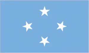
Official name: Federated States of Micronesia
Formation (date of independence / date current borders were established): 1986 / 1986
Capital city: Palikir (Pohnpei Island)
Population: 106,836 / 394 people per sq mile (152 people per sq km)
Total land area: 271 square miles (702 square km)
Language(s) spoken: Trukese, Pohnpeian, Kosraean, Yapese, English (official language)
Main religions: Roman Catholic 50%, Protestant 47%, Other 3%
Ethnic mix: Chuukese 49%, Pohnpeian 24%, Other 14%, Kosraean 6%, Yapese 5%, Asian 2%
Government type: Nonparty system
Currency: US dollar = 100 cents
Literacy rate: 81%
Calorie consumption (daily per person): Not available
For more detailed country information, driving directions, and Google Maps, please visit Micronesia‘s corresponding page.