
 Location: West Indies
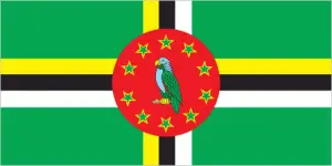
Official name: Commonwealth of Dominica
Formation (date of independence / date current borders were established): 1978 / 1978
Capital city: Roseau
Population: 72,969 / 252 people per sq mile (97 people per sq km)
Total land area: 291 square miles (754 square km)
Language(s) spoken: French Creole, English (official language)
Main religions: Roman Catholic 77%, Protestant 15%, Other 8%
Ethnic mix: Black 87%, Mixed race 9%, Carib 3%, Other 1%
Government type: Parliamentary system
Currency: East Caribbean dollar = 100 cents
Literacy rate: 88%
Calorie consumption (daily per person): 3115 kilocalories
For more detailed country information, driving directions, and Google Maps, please visit Dominica‘s corresponding page.