
Step onto a historic stage with the Liberty Island Map, a 2023 guide that unveils the layout of this iconic 12-acre island in New York Harbor! Home to the Statue of Liberty, this New York City treasure welcomes millions of visitors annually, serving as a symbol of freedom across the USA. Whether you’re a traveler eager to explore this global landmark, a history buff tracing its past, or a map enthusiast captivated by unique sites, this map invites you to navigate its grounds. Join us as we wander through its paths, monuments, and stories, uncovering the enduring allure of Liberty Island.
Liberty Island Map Description: Unraveling a Historic Layout
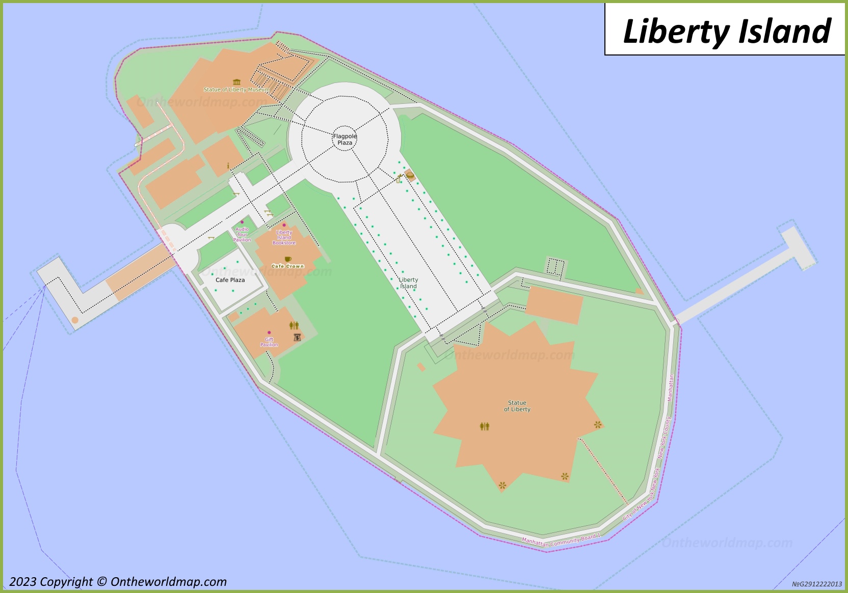
The Liberty Island Map, updated in 2023, details the island’s compact 12-acre expanse with precision. The map centers on the Statue of Liberty, a star-shaped pedestal surrounded by green lawns and pathways, with orange structures marking key areas like the Statue of Liberty Museum and the Flagpole Plaza. The Cafe Plaza and Liberty Island Bookstore offer visitor amenities, while the Audio Tour Pavilion provides educational resources. Dashed lines trace walking routes, with the Manhattan/County Boardwalk framing the waterfront. Ferry docks on the north and south sides connect to the mainland, creating a clear guide to this small yet significant island set against the blue waters of New York Harbor.
Purpose of the Map: Enhancing Visitor Experience and Preservation
This map serves as an essential tool for the 4 million visitors exploring Liberty Island each year. Tourists use it to navigate to the Statue of Liberty, locate the museum, or plan a stop at the cafe for a break. National Park Service rangers rely on it to guide tours, manage crowds, and ensure safety, while historians and preservationists use it to monitor the island’s historic structures. Ferry operators leverage its layout to coordinate schedules, and city officials study its design to balance tourism with conservation. Whether you’re snapping a photo, learning history, or resting, this map enhances every visit.
Visitor Navigation and Education
For visitors, the map directs them from the ferry docks to the Statue of Liberty and museum, with clear markers for rest areas and tour points. It supports educational exploration, highlighting the Audio Tour Pavilion, and ensures accessibility with defined pathways, making the island a welcoming destination for all.
Preservation and Operational Support
Beyond tourism, the map supports the island’s preservation as a National Monument. The 2023 update reflects ongoing maintenance of the statue and surrounding grounds, ensuring the 1886 landmark remains intact. It aids rangers in managing the 12-acre site, balancing visitor access with the protection of its historic and natural features.
Interesting Facts: Uncovering Liberty Island’s Rich Legacy
- Symbol of Freedom: Gifted by France in 1886, the Statue of Liberty welcomed over 12 million immigrants, symbolizing hope for a new life.
- Island Evolution: Originally 3 acres, landfill expanded it to 12 acres by 1892 to accommodate the statue’s pedestal.
- Visitor Magnet: Attracting 4 million annually, it’s the most visited National Park Service site in the U.S.
- Historical Haunts: Once a military fort, Fort Wood’s star shape forms the statue’s base, adding to its storied past.
- Restoration Milestone: A $87 million renovation in 1986 restored the statue for its centennial, ensuring its longevity.
The Liberty Island Map invites you to explore a timeless symbol with ease and inspiration. Grab this guide, plan your visit, and stand in the shadow of liberty. Ready to connect with history? Liberty Island awaits with open arms!
Discover more USA travel treasures with our expert tips—your next historic adventure starts here!