
Driving Directions and Google Map of Colombia — Roads, Toll Routes & Navigation Guide

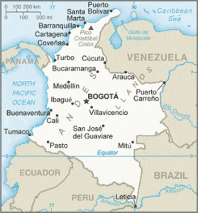
Colombia is South America’s gateway — a country of extraordinary geographic diversity where snow-capped Andean peaks, lush coffee highlands, Caribbean beaches, Pacific rainforest, and Amazon jungle are all reachable by road. Stretching across 1.14 million square kilometres on the northwest corner of South America, Colombia has invested massively in its road infrastructure over the past decade through the 4G and 5G highway concession programmes, connecting cities and regions that were once separated by arduous mountain tracks. Use our free driving directions and Google Map below to plan any journey — from the highland altiplano of Bogotá to the coffee-scented Eje Cafetero, from Medellín’s valley metropolis to Cartagena’s Caribbean coast.
Colombia drives on the right side of the road, using left-hand drive vehicles — the same convention as the United States, Brazil, and most of continental Europe. The national speed limit on autopistas (motorways) is 120 km/h; on primary national roads it is 80 km/h; and in urban areas the standard limit is 60 km/h, reduced to 30 km/h near schools and in residential zones. Colombia’s drink-drive law (Law 1696 of 2013) effectively establishes near-zero tolerance, with administrative sanctions starting at a BAC of just 0.02%. All vehicles on Colombian roads — including foreign-registered and rental cars — must carry a valid SOAT (mandatory accident insurance) document. Toll plazas (peajes) are frequent on inter-city routes; carry Colombian pesos in cash for toll payments, as not all plazas accept cards.
Road Network Overview
Colombia’s road network totals approximately 206,000 kilometres, of which around 17,000 km are classified as primary national roads. The network is divided between roads managed by INVIAS (Instituto Nacional de Vías), which handles secondary and tertiary roads, and roads under concession to the ANI (Agencia Nacional de Infraestructura), which oversees the major toll highways under the 4G and 5G concession programmes. The country’s road infrastructure has undergone a dramatic transformation since 2014 through the 4G programme — the largest road-building initiative in Colombian history — which is constructing and upgrading some 8,000 km of highways to motorway or dual-carriageway standard, dramatically reducing travel times between major cities.
The major roads of Colombia radiate from Bogotá, the capital, which sits at 2,640 m altitude on the Cundinamarca altiplano. The most important national routes are the Ruta 45 (Ruta del Sol), which connects Bogotá northward to Medellín and then the Caribbean coast at Barranquilla and Cartagena; the Ruta 25 (Panamericana / Troncal de Occidente), which runs the length of the western Andean corridor from Ecuador in the south to Panama in the north, passing through Cali and Medellín; and the Ruta 40, which links the north coast to Bogotá via Bucaramanga and Tunja. The Ruta 45A connects Bogotá to Cali via the Magdalena River valley and the newly opened La Línea tunnel.
A transformative piece of infrastructure completed in 2020 is the Túnel de La Línea — at 8.65 km, the longest road tunnel in the Americas — which passes through the Central Cordillera at 2,200 m between Cajamarca (Tolima) and Calarcá (Quindío). The tunnel replaced the notoriously dangerous and fog-shrouded Alto de La Línea mountain pass, reducing the Bogotá–Cali travel time from around 8 hours to approximately 5.5–6 hours and dramatically improving year-round reliability on this critical corridor. The tunnel is a tolled section of the Ruta 40 concession.
Speed Limits
Speed limits in Colombia are set by the National Traffic Code (Código Nacional de Tránsito, Law 769 of 2002) and subsequent resolutions from the Ministry of Transport. They are enforced by the Dirección de Tránsito y Transporte (DITRA) of the Policía Nacional on highways and by Secretarías de Movilidad in cities. Fixed and mobile speed cameras operate on major urban arteries and key inter-city corridors.
| Road type | Speed limit | Notes |
|---|---|---|
| Autopista / motorway | 120 km/h | Dual-carriageway 4G/5G concession roads; limited access; signs confirm posted limit |
| National primary road | 80 km/h | Single-carriageway rutas nacionales; reduced to 60 km/h on mountain curves |
| Urban / built-up area | 60 km/h | Standard urban limit; residential and centro histórico streets often 30 km/h |
| School zone / residential | 30 km/h | Policías acostados (speed bumps) common near schools, hospitals, and town centres; unmarked in rural areas |
Speed enforcement relies on a combination of fixed radar cameras (fotomultas) on urban expressways — particularly in Bogotá, Medellín, and Cali — and mobile DITRA units stationed on inter-city corridors. Fines (comparendos) issued by camera are sent to the registered owner’s address and can be settled at traffic authorities (Secretaría de Tránsito) or online through the SIMIT national traffic fine portal. Unpaid fines can result in vehicle immobilisation at roadblocks. Mountain roads in the Andes frequently have posted reductions below 80 km/h on tight curves; these must be observed strictly as the roads have little margin for error.
Toll Roads & TAG Electronic Payment
Colombia operates an extensive network of peajes (toll plazas) on its national and concession roads. Toll collection is managed by two main entities: INVIAS, which operates traditional government-run plazas on non-concession national roads, and private concessionaires under the ANI 4G/5G programme, which charge tolls on upgraded motorway-standard routes. Cash payment (Colombian pesos) is accepted at all plazas; card acceptance has been expanding but should not be relied upon at all locations.
| Route / Corridor | Typical toll (light vehicle, 2025) | Notes |
|---|---|---|
| Bogotá – Medellín (Autopista Medellín / Ruta 62) | ~COP 60,000–90,000 total | Multiple plazas along ~414 km; includes Túnel de Occidente (La Quiebra) section near Santa Fe de Antioquia |
| Bogotá – Cali (Ruta 40 / La Línea) | ~COP 70,000–110,000 total | Includes Túnel de La Línea toll (~COP 20,000); 460 km route; multiple plazas through Tolima, Eje Cafetero |
| Bogotá – Bucaramanga (Ruta 45 / Briceño-Tunja-Sogamoso) | ~COP 50,000–75,000 total | New 4G dual-carriageway sections significantly improve this Altiplano corridor |
| Medellín – Caribbean coast (Ruta 25 / Autopista al Mar) | ~COP 40,000–60,000 total | Túnel de Occidente (La Quiebra) included; descends from Andes to Caribbean lowlands |
| Bogotá – Villavicencio (Ruta 40 / Autopista Llanos) | ~COP 30,000–45,000 total | Descent from Bogotá altiplano (2,600 m) to Llanos Orientales (500 m); includes Autopistas para la Prosperidad section |
An electronic toll tag system known as TAG is in operation on major 4G concession routes, allowing pre-registered vehicles to pass through dedicated lanes without stopping. TAG transponders can be obtained from concessionaires and banks. However, penetration of the TAG system remains lower than in some other countries — most travellers simply pay cash at manual booths. Always carry an adequate supply of Colombian peso bills (COP 5,000 and 10,000 denominations are useful) for toll payments on inter-city routes. Keep your vehicle registration document (tarjeta de propiedad) and SOAT insurance certificate with you at all times, as these are checked at toll plazas and police checkpoints.
Road Rules & Licences
Driving Licence & IDP
Foreign nationals may drive in Colombia on a valid foreign driving licence, provided it is current and carries a photograph of the holder. Colombia recognises IDPs issued under both the 1949 Geneva Convention and the 1968 Vienna Convention. While many visitors drive without incident on their home-country licence, it is strongly recommended to carry an IDP alongside the original licence, particularly if the home licence is not in Spanish — traffic officers and car hire companies prefer to see an IDP for ease of verification. Rental companies in Colombia universally require a minimum age of 21 or 25 (depending on the vehicle category), a credit card, and a valid foreign licence.
Blood Alcohol Limit (BAC)
Colombia’s drink-driving law is among the strictest in South America. Law 1696 of 2013 establishes a graduated penalty system starting at a BAC of just 0.02% — the point at which administrative sanctions apply. At this level (equivalent to roughly one small beer for an average adult), the driver receives a fine and licence suspension. At 0.04% the penalties increase significantly; at 0.08% or above, the driver is arrested and faces criminal charges under the Penal Code, with potential imprisonment of up to 10 years if the intoxicated driving causes death or serious injury. In practice, any alcohol consumption before driving should be considered unsafe and illegal in Colombia. DITRA and Movilidad conduct frequent nocturnal and holiday roadblock operations — including breath tests — throughout major cities and on inter-city corridors.
SOAT — Mandatory Insurance
All vehicles in Colombia must carry a valid SOAT (Seguro Obligatorio de Accidentes de Tránsito) — a mandatory state-backed accident insurance policy covering bodily injury and death resulting from road accidents. SOAT is purchased annually and the document must be physically present in the vehicle; a digital copy on a smartphone is increasingly accepted at checkpoints. Rental vehicles will have SOAT included in the rental agreement. Foreign-registered vehicles entering Colombia (e.g., through the Panamericana border crossing with Ecuador at Ipiales) must either carry a valid SOAT or purchase one at the border. SOAT can be purchased at insurance company offices, banks, petrol stations, and pharmacies throughout Colombia.
Pico y Placa — Plate Restriction Scheme
Pico y Placa (literally “peak and plate”) is a traffic demand management scheme that restricts vehicles from entering certain urban zones during rush hours based on the last digit of their number plate. The scheme operates in Bogotá, Medellín, Cali, and several other cities. Rules vary by city and are updated periodically — in Bogotá, the restriction applies Monday to Friday during morning (06:00–09:00) and afternoon (15:00–19:30) peak hours, with different plate digits blocked on different days in a rotating schedule. Vehicles found violating Pico y Placa face significant fines. Foreign visitors in rental cars are subject to the scheme; check the current schedule with your rental company or consult the Secretaría de Movilidad website for the city you are visiting. Taxis, motorcycles, emergency vehicles, and electric vehicles are often exempt or governed by different rules.
Other Key Road Rules
- Seatbelts: Compulsory for driver and all passengers. Children under ten must use an approved child restraint system appropriate to their weight.
- Mobile phones: Prohibited while driving; hands-free kits are permitted. Fines apply and are increasingly enforced by cameras in cities.
- Headlights: Daytime running lights are mandatory for all vehicles on national roads outside urban areas — headlights must be on at all times on the highway, day or night. This is strictly enforced at police checkpoints.
- Emergency triangle and reflective vest: Vehicles must carry a reflective safety vest and at least two warning triangles for use in breakdowns. Failure to carry these items is an infraction (comparendo).
- Horn use: On mountain roads it is compulsory to sound the horn before blind curves where visibility is limited — “Toque la bocina” signs indicate where. This is a genuine safety measure on narrow Andean roads.
- Cycling: Many cities have expanded bicycle infrastructure; give cyclists a minimum 1 m clearance and be aware of Sunday Ciclovías in Bogotá, when major roads are closed to vehicles for cyclists and pedestrians from 07:00 to 14:00.
- Overtaking: Strictly on the left only; overtaking on the right is illegal. On mountain roads, overtaking is only permitted where solid centre lines give way to broken lines, and only when the full overtaking zone is clearly visible.
Fuel & Service Stations
Fuel in Colombia is sold under four main categories. Corriente (regular unleaded) is the standard grade, approximately RON 87, and is the cheapest option — suitable for most standard vehicles. Extra is the premium unleaded grade at approximately RON 92–95, recommended for modern high-compression engines and vehicles specified to run on higher-octane fuel by the manufacturer. Diesel (diésel) is widely available and is the fuel of choice for trucks, buses, and many SUVs and pickup trucks used on Colombian rural roads. Gas Natural Vehicular (GNV) — compressed natural gas — is available at specialist stations in major cities, particularly Bogotá, Barranquilla, and Cali, and powers a significant proportion of the taxi fleet. Electric vehicle charging infrastructure is beginning to appear at service stations in cities.
Fuel prices in Colombia are partially subsidised and regulated by the government, making them considerably lower than in Europe but higher than in Venezuela. Prices vary slightly by region — fuel is more expensive in remote areas and the Llanos Orientales, where transport costs inflate the pump price. The main fuel brands are Terpel (the dominant chain), Biomax, Primax, and Petrobras. Service stations (estaciones de servicio) in cities and on major national routes are generally open 24 hours. In remote rural areas and smaller towns, stations may close in the evenings and may have limited stock — it is advisable to fill up before departing cities when heading into the Andes, the Llanos, or the Pacific region. Payment by card is possible at many modern stations, but cash (COP) is always accepted and useful as a backup.
Driving in Bogotá
Bogotá is one of South America’s largest cities, home to approximately 8–9 million people in the urban area, and sits at a remarkable altitude of 2,640 m on the Cundinamarca savanna. It is also one of the continent’s most challenging cities to drive in — not because the roads are inherently complicated, but because of the sheer volume of traffic, the aggressive driving culture, and the city’s notorious congestion. The main arteries — the Autopista Norte, the Autopista Sur, the Avenida Boyacá (the city’s ring road), the Calle 26 (Avenida El Dorado leading to the international airport), and the Avenida Caracas — are wide multi-lane arterial roads that flow reasonably well outside peak hours but grind to a near standstill during morning (06:00–09:00) and evening (17:00–20:00) rush hours, Monday through Friday.
The Pico y Placa scheme in Bogotá restricts vehicles by plate number during rush hours on weekdays. Ride-sharing apps InDrive, Uber (which operates legally as a P2P platform in Colombia), and Cabify are widely available and often more practical than self-driving for visitors unfamiliar with the city’s geography. TransMilenio — Bogotá’s BRT (Bus Rapid Transit) system — operates in dedicated central lanes on the main arteries; private vehicles are strictly prohibited from entering TransMilenio lanes, which are enforced by cameras. Parking in Bogotá requires vigilance — use formal parqueaderos (parking buildings or lots) rather than street parking where possible; never leave valuables visible in a parked vehicle.
The Ciclovía is a beloved Bogotá institution: every Sunday and public holiday, approximately 120 km of the city’s main roads are closed to vehicles from 07:00 to 14:00, transforming the streets into a recreational space for cyclists, runners, and skaters. If driving in Bogotá on a Sunday morning, plan routes that avoid the closed corridors (Avenida Caracas, Calle 26, Circunvalar, and others are affected). The altitude — 2,640 m — affects vehicle performance: expect slightly reduced engine power, especially if coming from sea level. Allow extra time for acclimatisation if you have recently arrived in the city.
Driving in Medellín & the Andes
Medellín, the capital of Antioquia department, is Colombia’s second city and sits in the Valle de Aburrá — a narrow north-south valley in the Western Cordillera at around 1,500 m. The city has transformed dramatically since the 1990s and is now celebrated for its urban innovation, connectivity, and quality of life. The main urban expressway is the Autopista Regional running north-south through the valley alongside the Medellín River; the Autopista Las Vegas connects the south of the city toward El Poblado, Envigado, and Itagüí. Traffic congestion is significant during rush hours but generally more manageable than Bogotá. The Pico y Placa scheme operates in Medellín on weekdays.
The routes into and out of Medellín are spectacular but demanding. The road from Bogotá (Ruta 62 / Autopista Medellín) climbs into the Central Cordillera and then descends through the Andean foothills, taking roughly 8–9 hours on the mostly two-lane road (drive times vary significantly depending on traffic, roadworks, and weather). The Autopista al Mar (Route 62 west) connects Medellín to the Caribbean coast and the Gulf of Urabá, passing through the Túnel de Occidente (La Quiebra) — the second-longest road tunnel in Colombia at 4.7 km — and the colonial town of Santa Fe de Antioquia. The scenery on the descent to Bolívar, crossing the Cauca River valley and climbing into the Serranía de Abibe, is outstanding. The drive to the coast (Turbo/Necoclí for the Darién/San Blas boats) takes approximately 6–7 hours in good conditions.
Driving in Cali & Valle del Cauca
Cali, the capital of Valle del Cauca, is Colombia’s third-largest city and the salsa capital of the world. It sits at around 1,000 m in the valley of the Cauca River, between the Western and Central Cordilleras. Cali is connected to Bogotá via the improved Route 40 through the La Línea tunnel (approximately 5.5–6 hours), and to the Pacific port of Buenaventura — Colombia’s busiest port — via the Route 40 over the Western Cordillera through Loboguerrero and Buga. The Buenaventura road is a critical freight artery but is one of the more challenging drives in the country — steep, narrow in places, frequently affected by landslides and fog, and with very heavy truck traffic.
Within Cali, the main arteries include the Autopista Simón Bolívar (running north-south through the city), Avenida Roosvelt, and Calle 5. The Pico y Placa scheme operates in Cali on weekdays. Cali’s roads are less congested than Bogotá’s but driving standards can be unpredictable; motorcycles are extremely numerous throughout the Valle del Cauca. The surrounding Valle is one of the most productive agricultural regions in South America — the drive north from Cali to Palmira, Buga, and Tuluá passes through flat sugarcane country with a well-maintained four-lane highway. Heading south from Cali toward Popayán and the border with Ecuador (the Panamericana / Route 25), the road climbs back into the Andes, passing through the historically significant colonial city of Popayán and the Galeras volcano region near Pasto.
Regional Roads & Routes
Caribbean Coast & Ruta del Sol
The Caribbean coast — the region containing the cities of Barranquilla, Cartagena, and Santa Marta — is connected to Bogotá and the interior by the Ruta 45 (Ruta del Sol), a massive 4G concession project that has created a modern, largely dual-carriageway link from the altiplano to the coast. The full Bogotá–Barranquilla journey is approximately 1,050 km; expect 12–14 hours of driving or split over two days. The route passes through the Magdalena River lowlands, the city of Bucaramanga (a worthwhile stop), and the Caribbean lowlands of Bolívar department. The coastal zone around Cartagena, Santa Marta, and the Parque Tayrona is accessible by well-paved roads; the Troncal del Caribe (Route 90) connects the coast’s cities.
Eje Cafetero — Coffee Region
The Eje Cafetero (Coffee-Growing Axis) comprises the departments of Caldas, Risaralda, and Quindío in the central Andes, where Colombia’s world-famous arabica coffee is grown on the steep slopes of the Cordillera Central. The region’s main cities — Manizales, Pereira, and Armenia — are all connected by good roads to both the Autopista Medellín–Bogotá and the Route 40 to Cali. Driving through the coffee region is one of Colombia’s most rewarding experiences: winding roads through bamboo-shaded coffee fincas, colourful Paisa architecture in the small towns of Salento and Filandia, and the spectacular Cocora Valley — home to the towering wax palms (Colombia’s national tree) near Salento — are all easily accessible by car. The road from Armenia to Salento and into the Cocora Valley is paved but narrow and steep in sections; allow extra time.
Llanos Orientales & Amazonia
Colombia’s vast eastern plains — the Llanos Orientales of Meta, Casanare, and Arauca departments — are accessed from Bogotá via the Autopista al Llano (Route 40 east), which drops 2,100 m from the altiplano to the plains in a series of dramatic curves. The road to Villavicencio (the gateway to the Llanos) is one of Colombia’s most improved 4G routes, now largely dual carriageway with tunnels and viaducts. Beyond Villavicencio, the road continues to San Martín, Puerto López, and Puerto Carreño on the Venezuela border — increasingly remote and requiring a 4WD vehicle and significant planning. The Amazon region (Putumayo, Caquetá, Amazonas departments) is partially accessible by road but Leticia — the main Amazon gateway city — has no road connection to the rest of Colombia and is reached only by air or river boat.
Hazards & Safety
Security on Rural Roads
Colombia’s security situation has improved dramatically over the past two decades following the demobilisation of the FARC and the implementation of the 2016 Peace Agreement. The majority of tourist and inter-city routes are now safe to travel in daylight hours. However, some secondary and tertiary roads in certain departments — particularly Cauca, Nariño, Putumayo, Arauca, Norte de Santander, and parts of Chocó — continue to experience activity by dissident groups (FARC disidencias), ELN guerrillas, and criminal organisations. The Colombian government’s Travellers’ Advisory recommends consulting official sources (including the country’s Consejería Presidencial para la Seguridad) and travelling during daylight only on any route outside major tourist corridors. Avoid night driving on rural roads throughout Colombia as a general rule.
Landslides (Derrumbes)
Landslides are one of the most common road hazards in Andean Colombia. The steep, geologically young Cordillera ranges receive intense rainfall — particularly during the temporadas de lluvias (rainy seasons, broadly April–June and September–November) — and road-blocking derrumbes can occur with little warning. Major arteries (Bogotá–Medellín, Bogotá–Cali via La Línea, Cali–Buenaventura, the Caribbean coast road) are subject to periodic closures lasting hours or days after heavy rain. Before long-distance drives, check road conditions via the INVIAS road conditions app or the INVIAS website, which shows real-time blockages on the national road network. Local radio stations (Caracol Radio, RCN) carry frequent road condition updates. Always carry water, snacks, and a charged phone if heading into remote mountain territory.
Motorcycles
Motorcycles are Colombia’s most numerous vehicle class, totalling tens of millions nationwide. In cities, motos fill every gap in traffic and often disregard lane markings. In rural areas, motorcycles carry entire families or heavily loaded cargo and operate at all hours. Check mirrors and blind spots constantly, as motos approach unexpectedly at speed. Particular caution is needed on mountain roads where motorcycles may be slow on climbs but extremely fast on descents. Many motorcycle riders do not signal lane changes.
Speed Bumps (Policías Acostados / Reductores de Velocidad)
Speed bumps in Colombia — called policías acostados (“lying-down policemen”) or reductores de velocidad — are extremely common, including on national roads passing through small towns and villages. They are often poorly marked or unmarked, particularly on secondary routes. Even on 80 km/h roads, an unmarked speed bump in a village at 80 km/h can cause serious vehicle damage. Slow down when approaching any inhabited area on a rural road, and watch for yellow painted bumps or the standard warning sign (a vehicle with wavy lines). At night they are particularly hard to see.
Scenic Routes
- Carretera de las Flores — Bogotá to Santa Fe de Bogotá / Zipaquirá (Route 55): The road north from Bogotá to the Salt Cathedral at Zipaquirá and the Sabana de Bogotá passes through the flower-growing country of the Cundinamarca altiplano — one of the world’s largest cut-flower producing regions. The drive is gentle and scenic, with views of open páramo grassland and flower greenhouses stretching to the Andean ridgeline. Distance from Bogotá: approximately 50 km; one hour each way.
- Carretera Bogotá – Villeta – La Vega (Route 50): This short but spectacular drive from Bogotá westward drops rapidly from the 2,600 m altiplano to the subtropical Magdalena River valley floor at 800 m, descending through cloud forest, lush ravines, and the thermal springs town of Villeta in approximately 2–2.5 hours. The descent on Route 50 (Vía a La Vega) is via a series of dramatic switchbacks offering panoramic views over the Andes.
- Eje Cafetero Loop — Salento, Valle del Cocora & Coffee Fincas: A circular route through the Coffee Region connecting Pereira, Armenia, Salento, the Cocora Valley (wax palms), and the coffee-producing fincas of Quindío and Risaralda. Roads are paved but narrow; the Cocora Valley access road becomes a jeep track above Salento. Willys Jeeps (the iconic local vehicle) can be hired in Salento for the final ascent into the valley. Allow a full day for the complete loop from Pereira.
- Carretera Panamericana — Pasto to Ipiales & Las Lajas: The southernmost section of Colombia’s portion of the Pan-American Highway descends from Pasto (2,530 m) through increasingly dramatic Andean scenery to the border city of Ipiales and the spectacular Santuario de Las Lajas — a neo-Gothic basilica built into a river gorge that is one of South America’s most photographed religious sites. The 83 km drive takes approximately 1.5–2 hours and crosses several high-altitude páramo sections.
- Ruta del Libertador — Bogotá to Boyacá: North of Bogotá on Route 55, the road passes through Tunja and into the historic Boyacá department, a landscape of colonial towns, emerald mines, and the battlefield of Boyacá — where Simón Bolívar secured Colombian independence in 1819. The towns of Villa de Leyva (colonial stone-paved streets, white-washed buildings) and Paipa (thermal springs) are among the most picturesque in Colombia and are easily reached in 3–4 hours from Bogotá.
- Carretera al Mar — Medellín to the Caribbean: The Autopista al Mar (Route 62) descending from Medellín through the Andes to the Caribbean lowlands of Urabá passes through extraordinary biodiversity — cloud forest, the Cauca River canyon, the Santa Fe de Antioquia colonial town, and tropical lowland jungle. The drive from Medellín to Turbo on the Gulf of Urabá is approximately 6 hours and passes through some of the most biodiverse terrain on Earth.
Frequently Asked Questions
Can I drive in Colombia with my home driving licence?
Yes — foreign nationals can drive in Colombia on a valid foreign driving licence, provided it is current and bears the holder’s photograph. It is strongly recommended to also carry an International Driving Permit (IDP) alongside your original licence, especially if it is not issued in Spanish. Colombia recognises both the 1949 Geneva Convention and 1968 Vienna Convention IDPs. Rental car companies in Colombia require a valid foreign licence and most prefer to see an IDP as well.
What is SOAT and do I need it as a foreign visitor driving in Colombia?
SOAT (Seguro Obligatorio de Accidentes de Tránsito) is Colombia’s mandatory accident insurance, covering bodily injury and death resulting from road traffic accidents. All vehicles driven in Colombia — including rental vehicles and foreign-registered vehicles entering from neighbouring countries — must carry a valid SOAT. Rental cars will have SOAT included. Foreign drivers entering by land (e.g., from Ecuador at the Ipiales/Rumichaca border) must either carry SOAT or purchase it at the border crossing. Driving without valid SOAT is a serious infraction resulting in vehicle immobilisation.
What is Pico y Placa and does it apply to tourists?
Pico y Placa is a vehicle restriction scheme operating in Bogotá, Medellín, Cali, and other Colombian cities during morning and evening peak hours on weekdays. Vehicles are prohibited from circulating in restricted zones based on the last digit of their number plate on designated days, in a rotating schedule. Yes, it applies to all vehicles including tourist and rental cars. Check the current schedule with your rental company or the relevant Secretaría de Movilidad before driving in any major Colombian city on a weekday.
Are Colombian roads safe to drive on?
The main inter-city routes and tourist corridors are safe to drive during daylight hours. Security has improved dramatically across Colombia since the 2016 Peace Agreement. However, night driving on rural roads should be avoided throughout the country. Some secondary routes in departments including Cauca, Nariño, Arauca, and Chocó have elevated risk due to armed group activity — always consult current government travel advisories before venturing off the main tourist routes. Landslides (derrumbes) are a significant hazard on Andean roads during the rainy seasons.
Do Colombian petrol stations accept credit cards?
Many petrol stations in Colombian cities now accept Visa and Mastercard, and Terpel has been expanding card acceptance across its network. However, in rural areas, remote towns, and at smaller independent stations, cash (Colombian pesos) is often the only accepted payment method. Always carry sufficient cash when driving between cities, as the next card-accepting station may be hours away on some routes. ATMs (cajeros automáticos) are available in all cities and most mid-sized towns.
What does the 123 emergency number cover in Colombia?
123 is Colombia’s National Unified Emergency Number (NUSE — Número Único de Seguridad y Emergencias), which covers police (Policía Nacional), fire service (Cuerpo de Bomberos), and medical emergencies (ambulance / Cruz Roja) in most cities and departments. In addition, 156 is the dedicated carretera (highway) emergency line for reporting accidents, breakdowns, and road hazards on national roads. 119 is the health emergency line. If in doubt, call 123 and the operator will dispatch the appropriate service.
Sources & Update Note
The information in this guide is compiled from official Colombian sources and verified road information as of February 2026, including: INVIAS (Instituto Nacional de Vías) — road network, conditions, and INVIAS secondary road management; ANI (Agencia Nacional de Infraestructura) — 4G/5G concession toll roads and infrastructure programme; Ministerio de Transporte de Colombia — National Traffic Code, speed limits, and licence regulations; Policía Nacional de Colombia / DITRA — traffic enforcement and BAC regulations; Secretaría de Movilidad de Bogotá, Medellín, and Cali — Pico y Placa schedules and urban traffic management; Fondo de Prevención Vial — road safety statistics; and ProColombia / Colombia Tourism for scenic route information. Road conditions, toll tariffs, fuel prices, and Pico y Placa schedules are subject to change; always verify current information locally before travel.