
Hop on board as we dive into the vibrant world of the Bronx Bus Map! This colorful guide offers a fascinating glimpse into one of New York City’s most dynamic boroughs, blending urban life with green spaces and historical charm. Whether you’re a local looking to navigate with ease or a tourist eager to explore, this map unlocks the pulse of the Bronx.
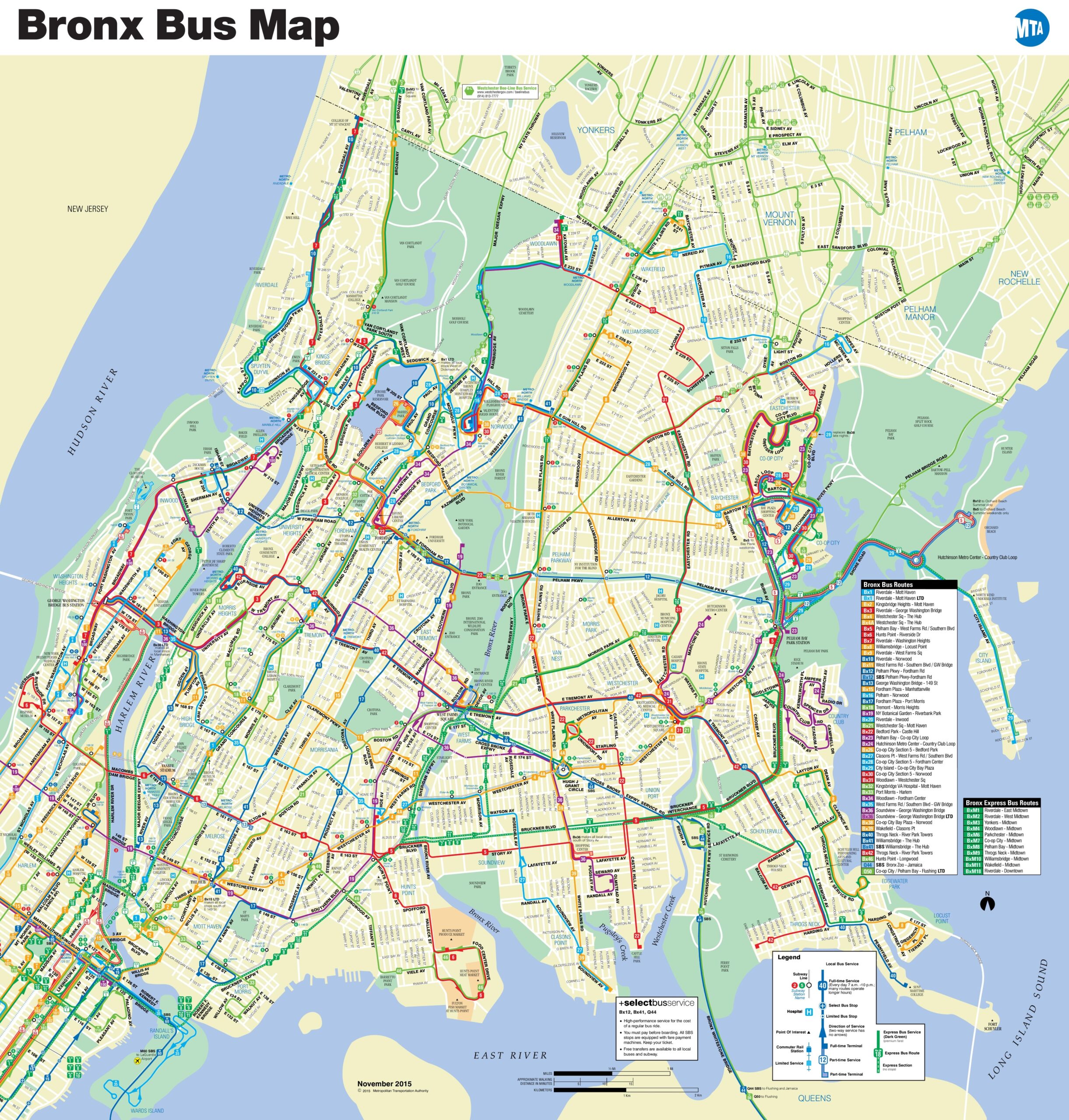
Bronx Bus Map Description: Navigating the Heart of the Bronx
The Bronx Bus Map, crafted by the MTA, showcases an intricate network of bus routes weaving through this bustling borough. Spanning from the Hudson River in the west to the East River in the east, the map highlights a web of colorful lines—red, green, blue, and more—representing dozens of bus routes. Key areas like the Bronx Zoo, Yankee Stadium, and Van Cortlandt Park stand out, surrounded by densely packed streets and neighborhoods such as Pelham Parkway and Morrisania. The map includes a detailed legend, pinpointing express routes, local services, and major hubs like the Harlem River crossings. Updated as of November 2015, it reflects a snapshot of the borough’s public transit system, complete with geographical markers like the Long Island Sound to the east.
Purpose of the Map: Your Key to Bronx Mobility
This bus map serves as an essential tool for residents and visitors alike, simplifying travel across the Bronx’s 42 square miles. Commuters rely on it to plan daily routes, connect to subway lines, or reach popular spots like the New York Botanical Garden. Tourists use it to explore cultural landmarks, from the historic Arthur Avenue to the scenic shores of City Island. Urban planners also leverage such maps to optimize transit efficiency and expand services, making it a vital resource for both practical navigation and city development.
Interesting Facts: Unveiling the Bronx’s Unique Story
- Geographical Gem: The Bronx spans 42 square miles and houses over 1.4 million people, making it a compact yet diverse urban landscape.
- Historical Roots: Named after Jonas Bronck, the first European settler in the area, the borough became part of NYC in 1898, shaping its rich multicultural tapestry.
- Green Escape: Home to over 7,000 acres of parkland, including the largest in NYC—Pelham Bay Park—the Bronx balances city life with nature.
- Transit Evolution: The bus system complements the borough’s subway lines, with routes dating back to the early 20th century, adapting to the growing needs of its communities.
Discover more about navigating NYC’s boroughs with our detailed guides—perfect for your next adventure!
The Bronx Bus Map opens a window into a borough brimming with life, history, and opportunity. Grab a copy, plan your route, and immerse yourself in the Bronx’s unique vibe. Ready to explore? Let this map be your guide!