
Imagine a vibrant map stretching across North America, where the United States and Mexico intertwine in a seamless blend of deserts, mountains, and cities, connected by a bold black line marking their shared border. This USA-Mexico-Map reveals the geography of both nations, from Alaska’s rugged wilderness to Florida’s sunny beaches in the U.S., and from Tijuana’s Pacific coast to Cancún’s Caribbean shores in Mexico, framed by the Pacific and Atlantic Oceans. Whether you’re a traveler planning a cross-border adventure, a historian tracing the ties between these nations, a geographer studying continental landscapes, or a planner analyzing regional connections, this map offers a detailed guide to North America’s southern half. Let’s embark on a comprehensive exploration of its territories, uncovering the natural wonders, historical bonds, and practical insights it holds for understanding the U.S. and Mexico.
USA-Mexico-Map Insights
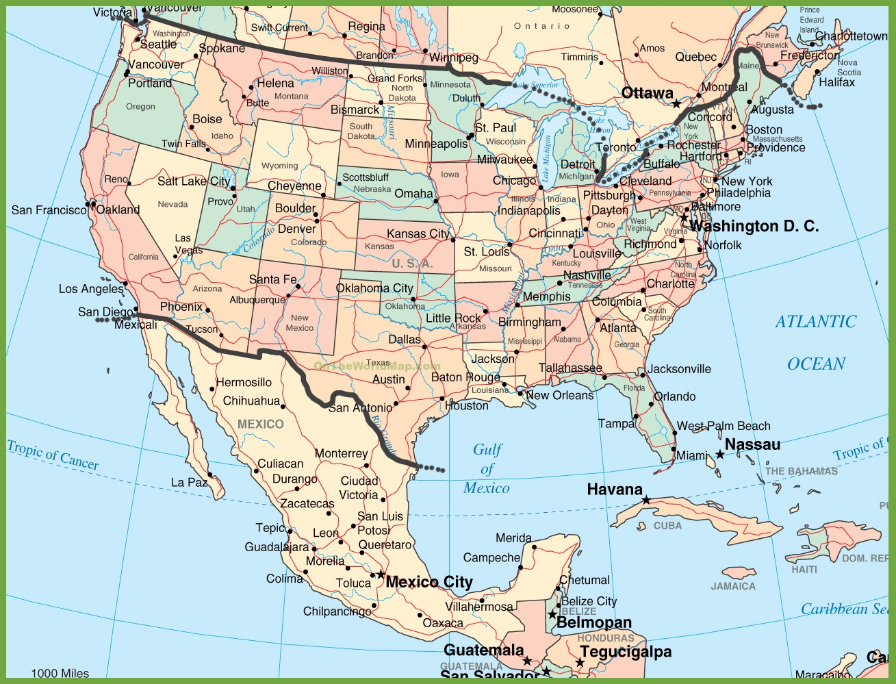
Mapping North America’s Southern Connection
This detailed USA-Mexico-Map showcases the geography of the United States and Mexico with pastel shades—soft peach and pink for the U.S., and warm tan for Mexico—highlighting major cities like New York, Chicago, and Los Angeles in the U.S., and Mexico City, Guadalajara, and Monterrey in Mexico, linked by roads and a black border line. It features natural landmarks such as the Rocky Mountains spanning the U.S. Southwest, the Sierra Madre in Mexico, and rivers like the Rio Grande forming part of the border, with insets for Alaska and Hawaii. The map spans from Washington’s Pacific Northwest to Florida’s Atlantic coast, and from Baja California’s deserts to Yucatán’s jungles, with a scale for distance and compass rose, offering a versatile tool for navigation, education, and geographic analysis across North America’s 7.7 million square miles.
Boundless Opportunities for Travelers, Scholars, and Planners
Cross-border travelers use this map to plan trips, driving from San Diego to Tijuana via I-5 or flying from Houston to Cancún for beach vacations, while hikers explore shared ranges like the Sierra Madre Occidental or the Grand Canyon’s proximity to Sonora. Historians study it to understand the 1848 Treaty of Guadalupe Hidalgo, which set the U.S.-Mexico border, reflecting complex relations, trade, and migration. Geographers analyze continental climates, from Mexico’s tropical south to the U.S.’s arid Southwest, and urban planners assess trade routes, like those linking El Paso and Juárez. Educators teach about North American geography, population distribution, and economic ties, fostering insight into cultural exchange. This map remains a vital resource for anyone exploring or studying the U.S. and Mexico, enhancing travel, historical understanding, and strategic planning across the region.
Captivating Stories of North America’s Bond
Did you know the U.S.-Mexico border, stretching 1,954 miles, symbolizes both cooperation and tension since the 1848 treaty, with shared history in trade, migration, and cultural exchange, like the Spanish influence in the Southwest and NAFTA’s economic ties? This USA-Mexico-Map reflects that connection, showcasing the Colorado River’s path through Arizona and Sonora, the Rio Grande’s role in border communities like Laredo and Nuevo Laredo, and Alaska’s distant link to Mexico via trade routes. Mexico’s dense population contrasts with U.S. urban density, like New Jersey versus Veracruz, while both nations face natural challenges like drought. This map tells a story of collaboration, natural splendor—think Baja’s deserts and California’s coast—and cultural fusion, each line and landmark weaving a narrative of North America’s shared past and dynamic present across its vast landscape.