
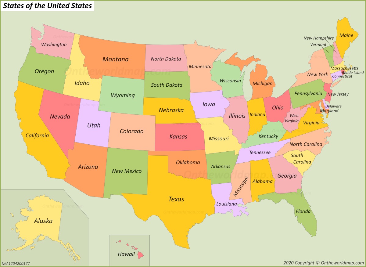
Picture a vibrant mosaic of the United States, where each state shines in its own unique color, creating a striking visual of America’s diverse regions. This USA-States-Map isn’t just a simple outline—it’s a colorful guide to the 50 states, from Washington’s pink hue in the Northwest to Florida’s green glow in the Southeast. Whether you’re a geography enthusiast, a traveler planning a route, or someone curious about the nation’s layout, this map offers a fresh perspective on the USA’s vast expanse. Let’s explore its vivid details and the stories behind its borders!
USA-States-Map Description
This eye-catching USA-States-Map paints the United States in a rainbow of colors, with each of the 50 states highlighted in distinct shades like yellow, green, pink, orange, purple, and peach. From California’s sunny yellow in the West to Maine’s bright yellow in the Northeast, the map clearly delineates state boundaries without cluttering the design with cities or capitals. It includes Alaska and Hawaii in insets, maintaining a clean, focused look that emphasizes the geographical layout. The pastel backdrop and bold colors make it easy to distinguish regions, such as the Midwest’s mix of greens and purples or the Southeast’s array of pinks and greens, offering a simple yet beautiful representation of the USA’s expanse.
Purpose of the USA-States-Map
This type of map is a go-to resource for educators, travelers, and anyone needing a quick overview of U.S. state boundaries. Teachers use it to help students learn state locations and regional divisions, while travelers consult it to understand the layout for road trips or regional planning. Businesses tap into it for market segmentation by state, and government agencies rely on it for policy planning or census data visualization. Its minimalist design also makes it a popular choice for decorative purposes, adding a touch of Americana to classrooms, offices, or homes.
Interesting Facts
Did you know the USA’s 50 states cover more than 3.8 million square miles, making it the world’s fourth-largest country by land area? This USA-States-Map reveals the country’s regional diversity—California’s vast coastline contrasts with Alaska’s rugged wilderness, while the Great Plains of Kansas and Nebraska differ from the mountainous terrain of Colorado and Wyoming. Historically, state borders often trace back to colonial divisions, Native American territories, or natural features like rivers, with major shifts like the 1848 Treaty of Guadalupe Hidalgo shaping the Southwest. The map’s colors also hint at the USA’s climatic variety, from Hawaii’s tropical climate to Minnesota’s snowy winters.