
Picture a rainbow stretched across the United States, with each state glowing in its own unique hue. This colorful USA-Rainbow-Map isn’t just a feast for the eyes—it’s a gateway to understanding the geography and layout of America’s 50 states. Whether you’re planning a cross-country road trip or simply curious about the nation’s layout, this map invites you to explore the diverse landscapes and regions that define the USA. Let’s dive into its vibrant details and uncover the stories it holds!
USA-Rainbow-Map Description
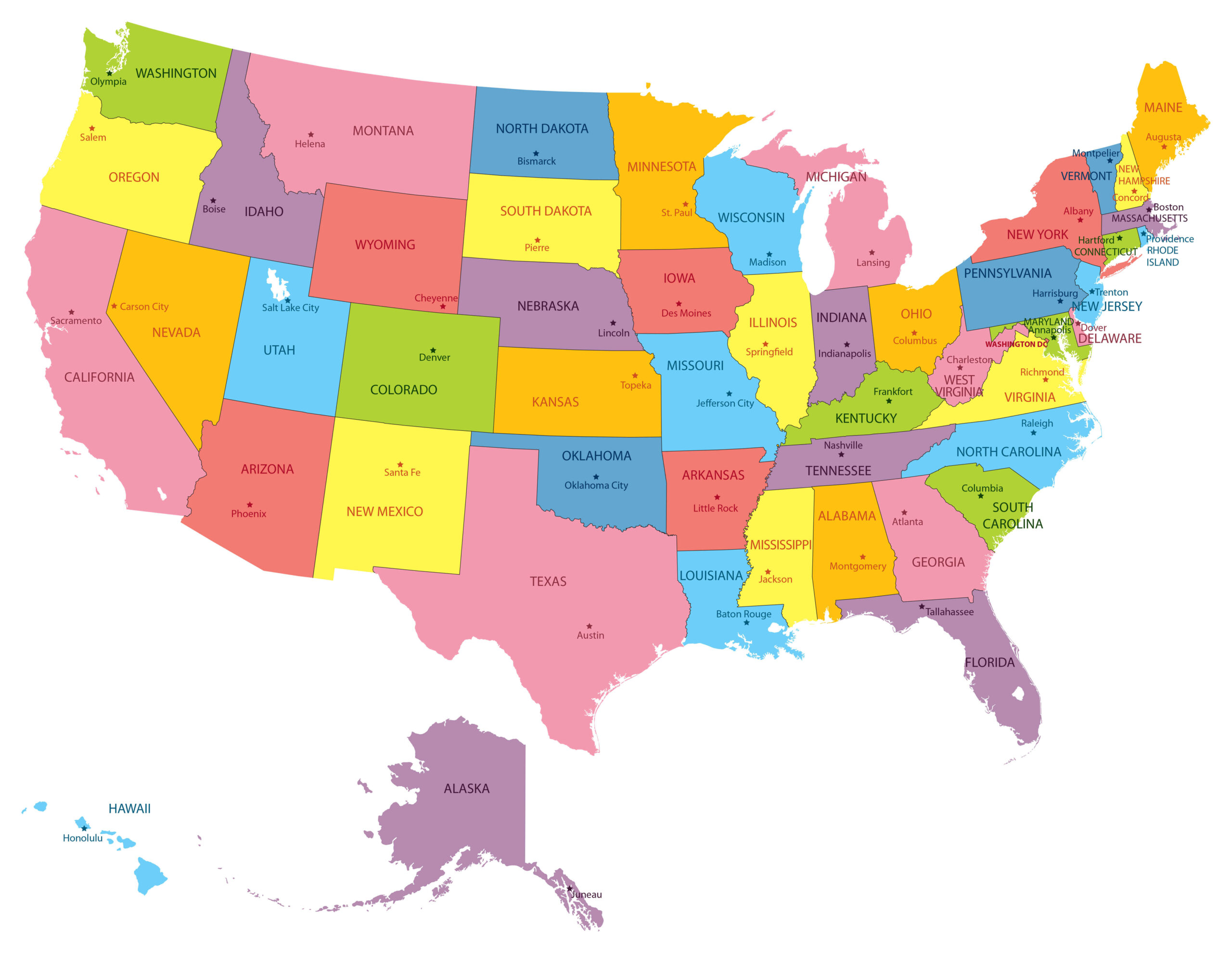
This eye-catching map showcases the United States in a kaleidoscope of colors, with each state painted in distinct shades like green, yellow, pink, blue, purple, and orange. From Washington’s lush green in the Pacific Northwest to Florida’s deep purple in the Southeast, the USA-Rainbow-Map highlights all 50 states, including Alaska and Hawaii, positioned below the mainland for clarity. Each state’s name stands out in bold, alongside its capital city marked by a star—think Salem for Oregon, Denver for Colorado, or Austin for Texas. The map’s clean design and vivid palette make it easy to identify borders, locate states, and appreciate the vastness of the country, stretching from the Atlantic to the Pacific.
Purpose of the USA-Rainbow-Map
This type of map serves as an essential tool for educators, travelers, and anyone eager to grasp the USA’s geography. Teachers use it to teach students about state locations, capitals, and regional differences. Travelers consult it to plan routes, understand distances, or discover new destinations across the country. Businesses leverage such maps for market analysis, targeting specific regions, while government agencies use them for demographic studies or disaster planning. Its simplicity and visual appeal also make it perfect for decorative purposes, bringing a touch of Americana to homes or offices.
Interesting Facts
Did you know the USA spans over 3.8 million square miles, making it the fourth-largest country by land area? This USA-Rainbow-Map reveals the sheer diversity of its regions—California’s sunny coast contrasts with Alaska’s rugged wilderness, while the Midwest’s flat prairies differ from the mountainous Rockies in Colorado and Wyoming. Historically, many state borders reflect early colonial claims or geographic features like rivers and mountains, shaped by treaties and expansions like the Louisiana Purchase in 1803. Plus, the vibrant colors might remind you that the USA hosts an incredible variety of climates, cultures, and ecosystems, from Hawaii’s tropical islands to Maine’s snowy winters.