Explore the countries in Oceania with all their Wiki, find information on weather, population, facts, history, landmarks of major cities data, and enjoy free Google maps Satellite imagery & Street views. Each Country Profile in Oceania provides information on Geography data, area maps, Google maps, flag, history, area, population, the capital city, largest cities, economy, spoken languages, ethnicity/race, religion, literacy rate, government, and many more!
In this map category of Oceania, you will find these countries and their capital cities:
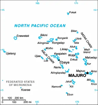
MARSHALL ISLANDS is an archipelago of over 1,000 atolls and islets in eastern Micronesia to Kiribati‘s northwest in the western Pacific Ocean, which were almost uninhabited until the 1880s. The climate is tropical maritime with little temperature variation, and rainfall is at its heaviest from July to October.
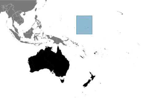
Google Maps and Detailed Facts of the Marshall Islands (HM). This page lets you explore the Marshall Islands and its border countries (Country Location: Oceania, two archipelagic island chains of 29 atolls, each made up of many small islets, and five single islands in the North Pacific Ocean, about halfway between Hawaii and Australia) through detailed Satellite imagery – fast and easy as never before Google Maps.
Find comprehensive information about this country’s diversity below: Google maps, geography, economy, science, people, culture, environment, government, and history – All in One Wiki page.
There is also a Street View and free Driving Directions at your service. In Oceania, your Google Satellite Map Sightseeing in the Marshall Islands starts here at Driving Directions and Maps.com.
Melekeok is one of the most populated cities in Palau, and at the same time, this city is the capital of this country. Located in Oceania, you may find the city easily with the following GPS coordinates: 07.20N latitude / 134.28E longitude. For routing in Melekeok, please check the free driving directions Melekeok service below.
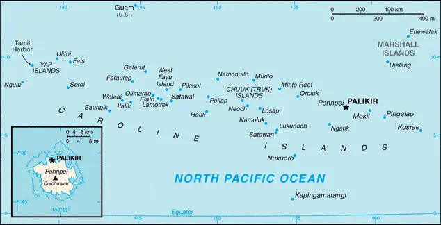
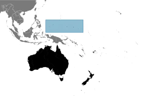
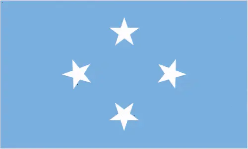
MICRONESIA was formerly part of the US-administered UN Trust Territory of the Pacific, known as the Caroline Islands, and became independent in 1990. This self-governing republic consists of around 600 islands in the Caroline Islands Archipelago, scattered across the western Pacific Ocean roughly 4,025 kilometers or 2,500 miles southwest of Hawaii.
There are four states: Yap, Chuuk (was Truk), Pohnpeé, and to the extreme east, Kosrae.
Google Maps and Detailed Facts of Micronesia (FM). This page lets you explore Micronesia and its border countries (Country Location: Oceania, island group in the North Pacific Ocean, about three-quarters of the way from Hawaii to Indonesia) through detailed Satellite imagery – fast and easy as never before Google Maps.
Find comprehensive information about this country’s diversity below: Google maps, geography, economy, science, people, culture, environment, government, and history – All in One Wiki page.
There is also a Street View and free Driving Directions at your service. Your Google Satellite Map Sightseeing in Micronesia, in Oceania, starts here at Driving Directions and Maps.com.
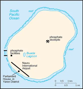
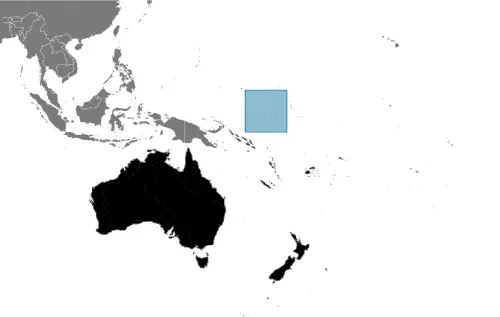
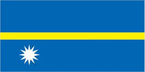
NAURU is the smallest of the states in Oceania and one of the world’s smallest republics, occupying just over 21 square kilometers or 8 square miles in the central Pacific.
Google Maps and Detailed Facts of Nauru (NR). This page lets you explore Nauru and its border countries (Country Location: Oceania, an island in the South Pacific Ocean, south of the Marshall Islands) through detailed Satellite imagery – fast and easy as never before Google Maps.
Find comprehensive information about this country’s diversity below: Google maps, geography, economy, science, people, culture, environment, government, and history – All in One Wiki page.
There is also a Street View and free Driving Directions at your service. Your Google Satellite Map Sightseeing in Nauru, in Oceania, starts here at Driving Directions and Maps.com.
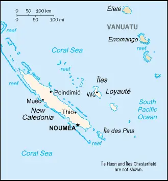
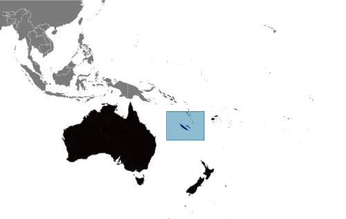
NEW CALEDONIA or Nouvelle Calédonie is the most southerly of the Melanesian countries in the Pacific Ocean. It is a French overseas territory, but there has been ongoing unrest in the country between the indigenous Melanesians and the French settlers over the question of independence.
The main island, Nouvelle Calédonie, is 400 kilometers or 248 miles long and rises to a height of 1,639 meters or 5,377 feet at Mount Panie.
Google Maps and Detailed Facts of New Caledonia (NC). This page lets you explore New Caledonia and its border countries (Country Location: Oceania, islands in the South Pacific Ocean, east of Australia) through detailed Satellite imagery – fast and easy as never before Google Maps.
Find comprehensive information about this country’s diversity below: Google maps, geography, economy, science, people, culture, environment, government, and history – All in One Wiki page.
There is also a Street View and free Driving Directions at your service. Your Google Satellite Map Sightseeing in New Caledonia, in Oceania, starts here at Driving Directions and Maps.com.
NEW ZEALAND lies over 2,000 kilometers or 1,242 miles southeast of Australia in the South Pacific. It comprises two major islands – North Island and South Island – Stewart Island and the Chatham Islands and many smaller islands. The country’s features vary from extensive grassland and alpine meadows to mountains, fjords, and subtropical rainforests.
This website uses cookies to improve your experience. AcceptRead More
Privacy & Cookies Policy
Privacy Overview
This website uses cookies to improve your experience while you navigate through the website. Out of these, the cookies that are categorized as necessary are stored on your browser as they are essential for the working of basic functionalities of the website. We also use third-party cookies that help us analyze and understand how you use this website. These cookies will be stored in your browser only with your consent. You also have the option to opt-out of these cookies. But opting out of some of these cookies may affect your browsing experience.
Necessary cookies are absolutely essential for the website to function properly. This category only includes cookies that ensures basic functionalities and security features of the website. These cookies do not store any personal information.
Any cookies that may not be particularly necessary for the website to function and is used specifically to collect user personal data via analytics, ads, other embedded contents are termed as non-necessary cookies. It is mandatory to procure user consent prior to running these cookies on your website.