
Reykjavík is one of the most populated cities in Iceland, and at the same time, this city is the capital of this country. Located in Europe, you may find the city easily with the following GPS coordinates: 64.10N latitude / 21.57W longitude. For routing in Reykjavík, please check the free driving directions Reykjavík service below.
Europe maps
Explore the countries in Europe with all their Wiki, find information on weather, population, facts, history, landmarks of major cities data, and enjoy free Google maps Satellite imagery & Street views. Each Country Profile in Europe provides information on Geography data, area maps, Google maps, flag, history, area, population, the capital city, largest cities, economy, spoken languages, ethnicity/race, religion, literacy rate, government, and many more!
In this map category, you will find these European countries and their capital cities:
Albania, Andorra, Austria, Belarus, Belgium, Bosnia and Herzegovina, Bulgaria, Croatia, Czech Republic, Denmark, Estonia, Finland, France, Germany, Greece, Hungary, Iceland, Ireland, Italy, Latvia, Liechtenstein, Lithuania, Luxembourg, Macedonia, Malta, Montenegro, Moldova, Monaco, Netherlands, Norway, Poland, Portugal, Romania, Russia, San Marino, Serbia, Slovakia, Slovenia, Spain, Sweden, Switzerland, Ukraine, United Kingdom, Vatican City.
Google Maps™ driving directions home » Europe maps
Riga Google maps
Riga is one of the most populated cities in Latvia, and at the same time, this city is the capital of this country. Located in Europe, you may find the city easily with the following GPS coordinates: 56.53N latitude / 24.08E longitude. For routing in Riga, please check the free driving directions Riga service below.
Google Maps™ driving directions home » Europe maps
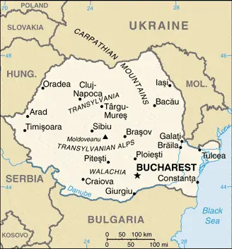
Romania
Driving Directions Romania
ROMANIA is located in southeast Europe and bordered by Ukraine, Moldova, Bulgaria, Serbia, and Hungary. In the southeast, the republic’s coastline stretches for approximately 200 kilometers or 125 miles along the Black Sea’s shores.
The Carpathian Mountains run through the north, east, and center of Romania and dominate most countries. The Carpathians are geologically unstable, and Romania periodically experiences severe earthquakes.
Google Maps™ driving directions home » Europe maps
Romania Google Map
 |
 |
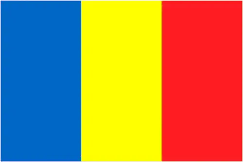 |
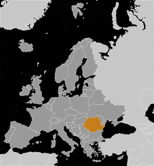
| Borderline map of Romania | Location map of Romania | Flag of Romania |
Google Maps and Detailed Facts of Romania (RO). This page lets you explore Romania and its border countries (Country Location: Southeastern Europe, bordering the Black Sea, between Bulgaria and Ukraine) through detailed Satellite imagery – fast and easy as never before Google Maps.
Find comprehensive information about this country’s diversity below: Google maps, geography, economy, science, people, culture, environment, government, and history – All in One Wiki page.
There is also a Street View and free Driving Directions at your service. Your Google Satellite Map Sightseeing in Romania, in Europe, starts here at Driving Directions and Maps.com.
Google Maps™ driving directions home » Europe maps
Rome Google maps
Rome is one of the most populated cities in Italy, and at the same time, this city is the capital of this country. Located in Europe, you may find the city easily with the following GPS coordinates: 41.54N latitude / 12.29E longitude. For routing in Rome, please check the free driving directions Rome service below.
Google Maps™ driving directions home » Europe maps
Russia
Driving Directions Russia
RUSSIA is the largest single country globally, extending into two continents and around almost half of the globe. Mainland Russia stretches from the Gulf of Finland in the west to the Pacific Ocean’s shores in the east and from the Arctic Ocean in the north to the Caucasus in the south. Russian territory also includes several large islands and the enclave of Kaliningrad (bordering the Baltic Sea, Poland, and Lithuania).
Google Maps™ driving directions home » Europe maps
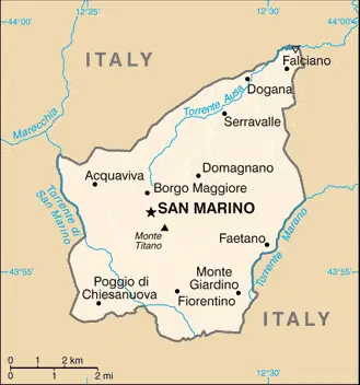
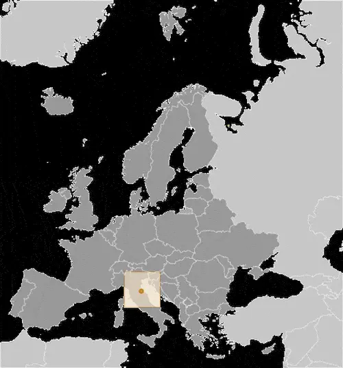
San Marino
Driving Directions San Marino
SAN MARINO is a tiny landlocked republic in central Italy, lying in the Apennine Mountain’s eastern foothills. It is one of two small, independent enclaves (the Vatican City being the other), surrounded by Italy’s country, which had survived from the time when the region consisted of autonomous city-states. Given Italy’s turbulent history and the fact that the larger, more powerful states tended to swallow up the smaller ones, San Marino’s survival is truly remarkable.
Google Maps™ driving directions home » Europe maps
San Marino Google Map
 |
 |
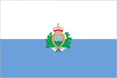 |
| Borderline map of San Marino | Location map of San Marino | Flag of San Marino |
Google Maps and Detailed Facts of San Marino (SM). This page lets you explore San Marino and its border countries (Country Location: Southern Europe, an enclave in central Italy) through detailed Satellite imagery – fast and easy as never before Google Maps.
Find comprehensive information about this country’s diversity below: Google maps, geography, economy, science, people, culture, environment, government, and history – All in One Wiki page.
There is also a Street View and free Driving Directions at your service. Your Google Satellite Map Sightseeing in San Marino, in Europe, starts here at Driving Directions and Maps.com.
Google Maps™ driving directions home » Europe maps
San Marino Google maps
San Marino is one of the most populated cities in San Marino, and at the same time, this city is the capital of this country. Located in Europe, you may find the city easily with the following GPS coordinates: 43.55N latitude / 12.30E longitude. For routing in San Marino, please check the free driving directions San Marino service below.
Google Maps™ driving directions home » Europe maps
Sarajevo Google maps
Sarajevo is one of the most populated cities in Bosnia and Herzegovina, and at the same time, this city is the capital of this country. Located in Europe, you may find the city easily with the following GPS coordinates: 43.52N latitude / 18.26E longitude. For routing in Sarajevo, please check the free driving directions Sarajevo service below.