
Lilongwe is one of the most populated cities in Malawi, and at the same time, this city is the capital of this country. Located in Africa, you may find the city easily with the following GPS coordinates: 14.00S latitude / 33.48E longitude. For routing in Lilongwe, please check the free driving directions Lilongwe service below.
Africa maps
Explore the countries in Africa with all their Wiki, find information on weather, population, facts, history, landmarks of major cities data, and enjoy free Google maps Satellite imagery & Street views. Each Country Profile in Africa provides information on Geography data, area maps, Google maps, flag, history, area, population, the capital city, largest cities, economy, spoken languages, ethnicity/race, religion, literacy rate, government, and many more!
In this map category, you will find these African countries and their capital cities:
Algeria, Angola, Benin, Botswana, Burkina Faso, Burundi, Cameroon, Cape Verde, Chad, Comoros, Democratic Republic of the Congo, Republic of Congo, Côte d’Ivoire, Djibouti, Egypt, Equatorial Guinea, Eritrea, Ethiopia, Gabon, Gambia, Ghana, Guinea, Guinea-Bissau, Guyana, Kenya, Lesotho, Liberia, Libya, Madagascar, Malawi, Mali, Mauritania, Mauritius, Morocco, Mozambique, Namibia, Niger, Nigeria, Rwanda, São Tomé and Príncipe, Senegal, Seychelles, Sierra Leone, Somalia, South Africa, Sudan, Swaziland, Tanzania, Togo, Tunisia, Uganda, Zambia, Zimbabwe.
Google Maps™ driving directions home » Africa maps
Lomé Google maps
Lomé is one of the most populated cities in Togo, and at the same time, this city is the capital of this country. Located in Africa, you may find the city easily with the following GPS coordinates: 06.09N latitude / 01.20E longitude. For routing in Lomé, please check the free driving directions Lomé service below.
Google Maps™ driving directions home » Africa maps
Luanda Google maps
Luanda is one of the most populated cities in Angola, and at the same time, this city is the capital of this country. Located in Africa, you may find the city easily with the following GPS coordinates: 08.50S latitude / 13.15E longitude. For routing in Luanda, please check the free driving directions Luanda service below.
Google Maps™ driving directions home » Africa maps
Lusaka Google maps
Lusaka is one of the most populated cities in Zambia, and at the same time, this city is the capital of this country. Located in Africa, you may find the city easily with the following GPS coordinates: 15.28S latitude / 28.16E longitude. For routing in Lusaka, please check the free driving directions Lusaka service below.
Google Maps™ driving directions home » Africa maps
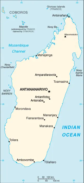
Madagascar
Driving Directions Madagascar
MADAGASCAR is an island state in the Indian Ocean. It lies off the southeast coast of Africa and is separated from the mainland by the Mozambique Channel. There are several smaller islands. The main island is the fourth-largest island in the world.
Google Maps™ driving directions home » Africa maps
Madagascar Google Map
 |
 |
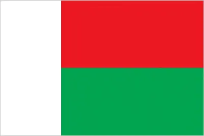 |
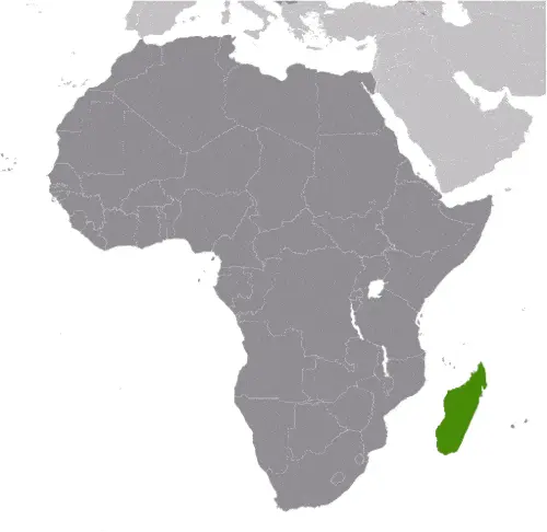
| Borderline map of Madagascar | Location map of Madagascar | Flag of Madagascar |
Google Maps and Detailed Facts of Madagascar (MG). This page lets you explore Madagascar and its border countries (Country Location: Southern Africa, an island in the Indian Ocean, east of Mozambique) through detailed Satellite imagery – fast and easy as never before Google Maps.
Find comprehensive information about this country’s diversity below: Google maps, geography, economy, science, people, culture, environment, government, and history – All in One Wiki page.
There is also a Street View and free Driving Directions at your service. Your Google Satellite Map Sightseeing in Madagascar, in Africa, starts here at Driving Directions and Maps.com.
Google Maps™ driving directions home » Africa maps
Malabo Google maps
Malabo is one of the most populated cities in Equatorial Guinea, and at the same time, this city is the capital of this country. Located in Africa, you may find the city easily with the following GPS coordinates: 03.45N latitude / 08.50E longitude. For routing in Malabo, please check the free driving directions Malabo service below.
Google Maps™ driving directions home » Africa maps
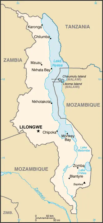
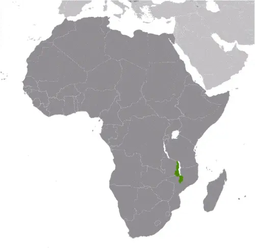
Malawi
Driving Directions Malawi
MALAWI lies along the southern and western shores of the third-largest lake in Africa, Lake Malawi. Tanzania and Zambia bound it to the north and northwest and Mozambique to the south and east.
This narrow country is only a little over 800 kilometers or 496 miles long and up to 160 kilometers or 99 miles to its fullest. It was formerly the British colony of Nyasaland (“Land of the Lake”) and was named by the 19th-century explorer David Livingstone.
Google Maps™ driving directions home » Africa maps
Malawi Google Map
 |
 |
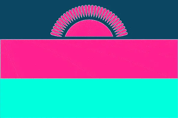 |
| Borderline map of Malawi | Location map of Malawi | Flag of Malawi |
Google Maps and Detailed Facts of Malawi (MW). This page lets you explore Malawi and its border countries (Country Location: Southern Africa, east of Zambia, west, and north of Mozambique) through detailed Satellite imagery – fast and easy as never before Google Maps.
Find comprehensive information about this country’s diversity below: Google maps, geography, economy, science, people, culture, environment, government, and history – All in One Wiki page.
There is also a Street View and free Driving Directions at your service. Your Google Satellite Map Sightseeing in Malawi, in Africa, starts here at Driving Directions and Maps.com.
Google Maps™ driving directions home » Africa maps
Mali
Driving Directions Mali
MALI is a landlocked republic in West Africa. Shaped somewhat like a butterfly with one wing more massive than the other, it consists mainly of level plains interrupted by isolated groups of hills and mountains. It rises to 1,155 meters or 3,790 feet in the Adrar des Iforas Mountains in the northeast.
The northern third lies within the Sahara Desert, which is slowly encroaching southwards, and life here revolves around the few oases. Southwest of the real desert lies a region of dry grassland called the Sahel, and this gives way to better-watered land surrounding the Rivers Niger and Senegal and their tributaries.