
Khartoum is one of the most populated cities in Sudan, and at the same time, this city is the capital of this country. Located in Africa, you may find the city easily with the following GPS coordinates: 15.50N latitude / 32.55E longitude. For routing in Khartoum, please check the free driving directions Khartoum service below.
Africa maps
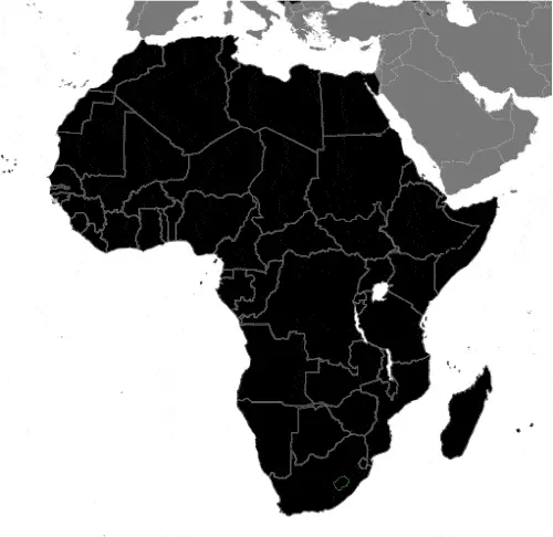
Explore the countries in Africa with all their Wiki, find information on weather, population, facts, history, landmarks of major cities data, and enjoy free Google maps Satellite imagery & Street views. Each Country Profile in Africa provides information on Geography data, area maps, Google maps, flag, history, area, population, the capital city, largest cities, economy, spoken languages, ethnicity/race, religion, literacy rate, government, and many more!
In this map category, you will find these African countries and their capital cities:
Algeria, Angola, Benin, Botswana, Burkina Faso, Burundi, Cameroon, Cape Verde, Chad, Comoros, Democratic Republic of the Congo, Republic of Congo, Côte d’Ivoire, Djibouti, Egypt, Equatorial Guinea, Eritrea, Ethiopia, Gabon, Gambia, Ghana, Guinea, Guinea-Bissau, Guyana, Kenya, Lesotho, Liberia, Libya, Madagascar, Malawi, Mali, Mauritania, Mauritius, Morocco, Mozambique, Namibia, Niger, Nigeria, Rwanda, São Tomé and Príncipe, Senegal, Seychelles, Sierra Leone, Somalia, South Africa, Sudan, Swaziland, Tanzania, Togo, Tunisia, Uganda, Zambia, Zimbabwe.
Google Maps™ driving directions home » Africa maps
Kigali Google maps
Kigali is one of the most populated cities in Rwanda, and at the same time, this city is the capital of this country. Located in Africa, you may find the city easily with the following GPS coordinates: 01.59S latitude / 30.04E longitude. For routing in Kigali, please check the free driving directions Kigali service below.
Google Maps™ driving directions home » Africa maps
Kinshasa Google maps
Kinshasa is one of the most populated cities in the Democratic Republic of Congo, and at the same time, this city is the capital of this country. Located in Africa, you may find the city easily with the following GPS coordinates: 04.20S latitude / 15.15E longitude. For routing in Kinshasa, please check the free driving directions Kinshasa service below.
Google Maps™ driving directions home » Africa maps
Lesotho
Driving Directions Lesotho
LESOTHO is a small, landlocked kingdom surrounded by the Republic of South Africa. Snow-capped mountains and treeless uplands, cut by spectacular gorges, cover two-thirds of the “mountain kingdom.”
Google Maps™ driving directions home » Africa maps
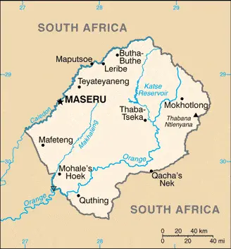
Lesotho Google Map
 |
 |
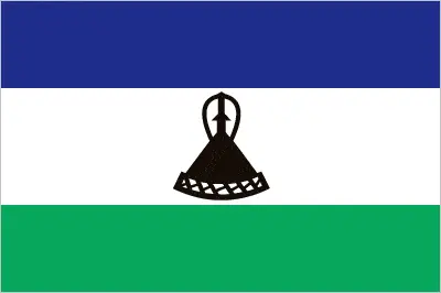 |
| Borderline map of Lesotho | Location map of Lesotho | Flag of Lesotho |
Google Maps and Detailed Facts of Lesotho (LS). This page lets you explore Lesotho and its border countries (Country Location: Southern Africa, an enclave of South Africa) through detailed Satellite imagery – fast and easy as never before Google Maps.
Find comprehensive information about this country’s diversity below: Google maps, geography, economy, science, people, culture, environment, government, and history – All in One Wiki page.
There is also a Street View and free Driving Directions at your service. Your Google Satellite Map Sightseeing in Lesotho, in Africa, starts here at Driving Directions and Maps.com.
Google Maps™ driving directions home » Africa maps
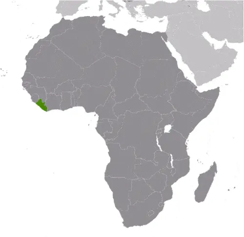
Liberia
Driving Directions Liberia
LIBERIA is a republic located in West Africa. Founded in 1847 as a homeland for freed slaves from North America, Liberia is the only African country never to have been ruled by a foreign power.
It has a treacherous coast with rocky cliffs and lagoons enclosed by sand bars, which stretches for 560 kilometers or 348 miles from Sierra Leone to Côte d’Ivoire.
Google Maps™ driving directions home » Africa maps
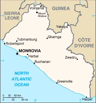
Liberia Google Map
 |
 |
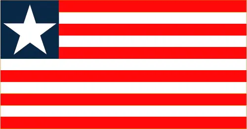 |
| Borderline map of Liberia | Location map of Liberia | Flag of Liberia |
Google Maps and Detailed Facts of Liberia (LR). This page lets you explore Liberia and its border countries (Country Location: Western Africa, bordering the North Atlantic Ocean, between Cote d’Ivoire and Sierra Leone) through detailed Satellite imagery – fast and easy as never before Google Maps.
Find comprehensive information about this country’s diversity below: Google maps, geography, economy, science, people, culture, environment, government, and history – All in One Wiki page.
There is also a Street View and free Driving Directions at your service. Your Google Satellite Map Sightseeing in Liberia, in Africa, starts here at Driving Directions and Maps.com.
Google Maps™ driving directions home » Africa maps
Libreville Google maps
Libreville is one of the most populated cities in Gabon, and at the same time, this city is the capital of this country. Located in Africa, you may find the city easily with the following GPS coordinates: 00.25N latitude / 09.26E longitude. For routing in Libreville, please check the free driving directions Libreville service below.
Google Maps™ driving directions home » Africa maps
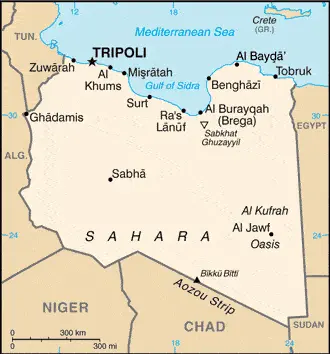
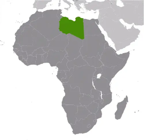
Libya
Driving Directions Libya
LIBYA is a vast, north African country that stretches from the south coast of the Mediterranean to, and in some parts beyond, the Tropic of Cancer. The Socialist People’s Libyan Arab Jamahiriya is an oil-rich country, but most of its territory is uninhabited, consisting of a rocky or sandy desert with extensive “sand seas.”
Google Maps™ driving directions home » Africa maps
Libya Google Map
 |
 |
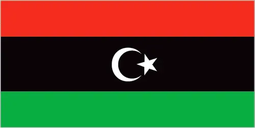 |
| Borderline map of Libya | Location map of Libya | Flag of Libya |
Google Maps and Detailed Facts of Libya (LY). This page lets you explore Libya and its border countries (Country Location: Northern Africa, bordering the Mediterranean Sea, between Egypt, Tunisia, and Algeria) through detailed Satellite imagery – fast and easy as never before Google Maps.
Find comprehensive information about this country’s diversity below: Google maps, geography, economy, science, people, culture, environment, government, and history – All in One Wiki page.
There is also a Street View and free Driving Directions at your service. Your Google Satellite Map Sightseeing in Libya, in Africa, starts here at Driving Directions and Maps.com.