
Google Maps and Detailed Facts of the Cayman Islands (CJ). This page lets you explore the Cayman Islands and its border countries (Country Location: the Caribbean, three-island group (Grand Cayman, Cayman Brac, Little Cayman) in the Caribbean Sea, 240 km south of Cuba and 268 km northwest of Jamaica) through detailed Satellite imagery – fast and easy as never before Google Maps.
Find comprehensive information about this country’s diversity below: Google maps, geography, economy, science, people, culture, environment, government, and history – All in One Wiki page.
There is also a Street View and free Driving Directions at your service. Your Google Satellite Map Sightseeing in the Cayman Islands, Central America, and the Caribbean starts here at Driving Directions and Maps.com.
Cayman Islands Google Maps & Satellite Maps
The map below shows the Cayman Islands with its cities, towns, highways, main roads, streets, and Street Views. To find a location, use the form below, type any city or place, view a simple map, and click the “show map” button.
The Google map above shows the Cayman Islands with its location: Central America and the Caribbean (geographic coordinates: 19 30 N, 80 30 W) and the international borders of Cayman Islands; 0 km; furthermore, its inland counties boundaries.
Hint: Look at the Street view in the Cayman Islands, Central America, and the Caribbean. All you have to do is drag and pull the little yellow man (named: Pegman) on the Google map above the desired location. After that, whenever it is available (in more than 50 countries globally), blue stripes will appear to show the photos and details from Google’s regularly updated data image base. If you have signed in to your Google account currently, you may have a look at the satellite map of this country/area as well.
The map of the Cayman Islands, Central America, and the Caribbean are for informational use only. No representation is made or warrantied given any map or its content by Driving Directions and Maps site. The user assumes all risks of using this Cayman Islands Google map and facts/wiki.
About the Cayman Islands in detail
| Borderline map of Cayman Islands | Location map of Cayman Islands | Flag of Cayman Islands |
|---|---|---|
 | 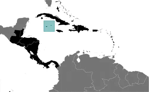 | 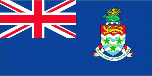 |
Where are the Cayman Islands?
The Cayman Islands, in case if you are looking on the map under the Coordinates 19 18 N 81 23 W otherwise in Central America, and the Caribbean, in Caribbean, three-island group (Grand Cayman, Cayman Brac, Little Cayman) in the Caribbean Sea, 240 km south of Cuba and 268 km northwest of Jamaica.
What is the capital city of the Cayman Islands?
The capital city of the Cayman Islands is George Town.
What is the time in George Town?
It is the same time as Washington, D.C. during Standard Time; George Town’s timezone is UTC-5.
What is the Internet code for the Cayman Islands?
The Top Level Domain (TLD) for the Cayman Islands is: .ky
What is the size of the Cayman Islands?
The Cayman Islands territory is 264 sq km; land: 264 sq km, water: 0 sq km.
If we want to describe the size of the Cayman Islands territory, it is 1.5 times Washington, DC.
If we would like to walk around and discover the Cayman Islands, we can cover 0 km.
What is the water coverage of the Cayman Islands?
We have already mentioned what percentage of Cayman Islands is covered by water (see below), including 160 km coastline.
What is the climate like in the Cayman Islands?
The Cayman Islands’ climate is tropical marine: warm, rainy summers (May to October) and cold, relatively dry winters (November to April).
Geographical data of Cayman Islands
Cayman Islands’ elevation; mean height: N/A, elevation extremes; lowest point: the Caribbean Sea 0 m, highest point: The Bluff on Cayman Brac 43 m.
The specific geographical details of the Cayman Islands include a low-lying limestone base surrounded by coral reefs.
Suppose we would like to describe the countries location from a different perspective. In that case, it is safe to say and easy to read from a map; the Cayman Islands is an important location between Cuba and Central America.
Resources and land use of Cayman Islands
The country’s main mined products are fish, climate, and beaches that foster tourism. The population partly uses the earlier highlighted land territory and partly left in its natural state: agricultural land: 11.2%; arable land 0.8%; permanent crops 2.1%; permanent pasture 8.3%; forest: 52.9%; other: 35.9% (2011 estimate).
Population data of Cayman Islands
The number of inhabitants of the Cayman Islands is 57,268 (July 2016 estimate).
If we examine the proportion of the population distribution, it is safe to say that majority of the population resides in Grand Cayman.
If we look at the proportion of the urbanized and barely populated areas, these are the urban population: 100% of the total population (2015).
Most of the Cayman Islands population is concentrated in GEORGE TOWN (capital) 31,000 (2014).
Ethnicity in the Cayman Islands
According to ethnicity details, the ethnic groups are mixed 40%, white 20%, black 20%, expatriates of various ethnic groups 20%.
Spoken languages in the Cayman Islands
The Cayman Islands’ spoken languages are the following: English (official language) 90.9%, Spanish 4%, Filipino 3.3%, other 1.7%, unspecified 0.1% (2010 estimate).
What are the most important religions in the Cayman Islands?
During the general census, researchers examine the churches, according to this: Protestant 67.8% (includes Church of God 22.6%, Seventh Day Adventist 9.4%, Presbyterian/United Church 8.6%, Baptist 8.3%,Pentecostal 7.1%, non-denominational 5.3%, Anglican 4.1%, Wesleyan Holiness 2.4%), Roman Catholic 14.1%, Jehovah’s Witness 1.1%, other 7%, none 9.3%, unspecified 0.7% (2010 estimate).
Further population data of Cayman Islands
The proportion of gender and age tells a lot about the society as follows 0-14 years: 18.13% (male 5,226 / female 5,154) 15-24 years: 12.59% (male 3,577 / female 3,635) 25-54 years: 43% (male 12,010 / female 12,615) 55-64 years: 14.22% (male 3,872 / female 4,272) 65 years and over: 12.06% (male 3,231 / female 3,676) (2016 estimate). It also a significant factor in a society the population growth rate, which in the case of Cayman Islands is 2.05% (2016 estimate).
The population growth rate is based on two elements, birth and the death rate. In Cayman Islands the birth rate is 12.1 births / 1,000 population (2016 estimate), the death rate 5.7 deaths / 1,000 population (2016 estimate).
In this day and age in developed societies, the first child borns later compared to the previous centuries and decades, so childbearing is extended. In the Cayman Islands, the average age of mothers at the first childbirth is N/A.
Although the children’s birth is postponed in the best-case scenario, the parents can still see their kids grow as life expectancy also extended. In the case of the Cayman Islands, these figures are. With the introduction of modern medicine, vaccinations, and proper hygienic conditions, the infant mortality rate is in a steep decline. The infant mortality statistics in the Cayman Islands are the following: N/A. Relevant data is the budget of healthcare, which is in the case of this country is N/A.
Economic data of Cayman Islands
Suppose we would like to describe a country, we also have to mention its economy; With no direct taxation, the islands are a thriving offshore financial center. More than 93,000 companies were registered in the Cayman Islands as of 2008, including almost 300 banks, 800 insurers, and 10,000 mutual funds. Tourism is also a mainstay, accounting for about 70% of GDP and 75% foreign currency earnings. The tourist industry is aimed at the luxury market and caters mainly to visitors from North America. Total American tourist arrivals exceeded 1.9 million in 2008.
GDP is a prominent figure, as all the relevant calculations and statistics are based on it. GDP in the Cayman Islands is $2.25 billion (2008 estimate).
Another important indicator is the rate of GDP growth, which in the Cayman Islands is 1.7% (2014 estimate), 1.2% (2013 estimate) 1.6% (2012 estimate).
These statistics affect the world economy; remember, in 2015, the Chinese real GDP growth rate was worse than expected; The world markets fall, and the Chinese stock exchange was temporarily suspended.
A further major factor of a country’s economy, the GDP per capita. In the Cayman Islands, this is $43,800 (2004 estimate).
The Trinity is in common places in the economy, such as agriculture, industry, and services.
What are the agricultural products the Cayman Islands produces?
The main agricultural products of the Cayman Islands are vegetables, fruit; livestock; turtle farming.
The essential segments are tourism, banking, insurance and finance, construction, construction materials, and furniture. The crucial and regularly mentioned GDP is based on tourism, banking, insurance and finance, construction, construction materials, furniture.
Drinking water source in the Cayman Islands
It is essential to mention that – thanks to the development of the infrastructure -, the rate of potable water improved: urban: 97.4%, rural: 97.4% of the population. Unimproved: urban: 2.6%, rural: 2.6% of the population (2015 estimate).
The average number of childbirth in the Cayman Islands
The average delivery number is 1.85 children born / woman (2016 estimate).
Population, median age, migration, and citizenship in the Cayman Islands
The population’s average age is 39.9 years; male: 39.2 years, female: 40.5 years (2016 estimate). The age of adulthood varies in every country of the world in the Cayman Islands; it is 18 years of age, universal.
When we are experiencing an unprecedented scale of migration and globalization, it is an important factor in the number of new immigrants. In Cayman Islands is 14.1 migrant(s) / 1,000 population. Note: major destination for Cubans trying to migrate to the US (2016 estimate). It is important to know how to apply for citizenship: see the United Kingdom.
Is the Cayman Islands a safe destination? Healthcare services and infectious diseases in the Cayman Islands
Many of the travelers are looking into the healthcare services and infectious diseases of their destinations. In the Cayman Islands, the hospital beds density is N/A.
According to the WHO rating regarding contagious diseases in the Cayman Islands note: active local transmission of Zika virus by Aedes species mosquitoes has been identified in this country (as of August 2016); it poses a significant risk (a large number of cases possible) among US citizens if bitten by an infective mosquito; other less common ways to get Zika are through sex, via blood transfusion, or during pregnancy, in which the pregnant woman passes Zika virus to her fetus (2016).
However, HIV is not curable but maintainable. Let’s do not forget when the disease surfaced; it was a world-threatening condition. Unfortunately, in some countries, it is still very high the number of infected patients and fatalities due to the disease.
In the Cayman Islands, the number of HIV/AIDS deaths: N/A.
Regarding tourism obesity, is not an important issue, but we have to mention health statistics, as it is the plague of the 20th and the 21st century. The rate of obese adults in the Cayman Islands is N/A.
What are the natural hazards in the Cayman Islands? Is there any?
The most known natural risk in the Cayman Islands are hurricanes (July to November).
More interesting facts about the Cayman Islands
A few words about the past, as every country and society, is connected to its history; The Cayman Islands were colonized from Jamaica by the British during the 18th and 19th centuries and were administered by Jamaica after 1863. In 1959, the islands became a territory within the Federation of the West Indies. When the Federation dissolved in 1962, the Cayman Islands chose to remain a British dependency. The region has transformed itself into a significant offshore financial center.
In every nation’s memory, some cornerstones placed the country on the timeline of history. The date of declaration of independence of Cayman Islands: none (overseas territory of the UK).
The flag and other symbols of the Cayman Islands
The colors, symbols, and animals on the flag usually have a historical background or an important milestone or memory of the nation.
This case is not an exception either; a blue field with the flag of the UK in the upper hoist-side quadrant and the Caymanian coat of arms centered on the outer half of the flag; the coat of arms includes a crest with a pineapple, representing the connection with Jamaica, and a turtle, representing Cayman’s maritime tradition, above a shield bearing a golden lion, symbolizing Great Britain, below which are three green stars (representing the three islands) surmounting white and blue wavy lines representing the sea and a scroll at the bottom bearing the motto HE HATH FOUNDED IT UPON THE SEAS.
Apart from the flag, the symbol of national unity is the national anthem. The anthem’s primary purpose is to share the nation’s core values, endeavors, and patriotic feelings.
National symbols of Cayman Islands: green sea turtle.
Constitution of Cayman Islands
The existence of the nation is based on the constitution. Some constitutions knew worldwide as the U.S. Constitution was accepted on the 17th of September 1787 in Philadelphia, the United States of America’s Constitution.
It is not related to the declaration of independence that Nicolas Cage stole in the movie National Treasure 🙂
What is the legal system of the Cayman Islands?
Most of the time, the legal system of a country is the focus of lawyers. It is a common fact that there are two main approaches in the world, “the law in books” and “the law in action.”
In the Anglo-Saxon world, the practice is the “law in action,” while in the rest of the world, the law is based on Roman law, the “law in books.”
The legal system of the Cayman Islands is English common law and local statutes.
It was Aristotle who founded the Theory of 3 separations of powers. In his view, these are the council of public affairs, the magistrates, and the justice system. The age of enlightenment was the time when terminologies have defined the way we still use them. In most democratic countries, the three authorities separated from each other. In dictatorships, the rules usually interweaved in one hand.
About the legislative branch of the Cayman Islands, we can highlight the following structures unicameral Legislative Assembly (20 seats; 18 members directly elected by majority vote and two ex officio members – the deputy governor and attorney general – appointed by the governor; members serve 4-year terms).
About the unemployment rate, labor force, and poverty line in the Cayman Islands
One of the major problems of the 21st-century economy is unemployment. Governments are struggling to maintain a low level of unemployment rate. Still, due to automation, the cheap 3rd world labor, and the outsourcing of workflow, these attempts fail. In the Cayman Islands, the labor force is 39,000 (2007 estimate). Please bear in mind that the population in Cayman Islands is total: 6 deaths / 1,000 live births; male: 6.8 deaths / 1,000 live births, female: 5.1 deaths / 1,000 live births (2016 estimate) – as we already mentioned above.
The rate of unemployment in the Cayman Islands is 4% (2008).
Widely known that the gap between the rich and poor is widening on an enormous scale.
According to the 2017 shocking Oxfam report, the most affluent eight people’s fortune is equal to the wealth of the poorest half of the world’s population.
In the Cayman Islands, the households’ income and consumption compared to the entire population: lowest 10%: N/A% highest 10%: N/A%.
Another widely used indicator is the so-called GINI index, which measures the inequalities of statistical dispersion, but is mainly used for measuring the sharing of income and fortune.
The GINI index was named after its founder Corrado Gini, an Italian economist. Gini index has grades between 0-1, but often it is used on a percentage basis. It is 0 if the examined criteria territorial distribution is equal. It is one of the criteria concentrated on the territory. In the Cayman Islands, the GINI index is N/A.
The states usually set up a poverty line, which is more or less, is a subjective measure. It varies by country; its base is often the minimum pension, the most deficient 20 percent, the X percent of income per capita, etc.
In the Cayman Islands, the poverty line is the lowest 10%: N/A% highest 10%: N/A%.
About the budget and central governments debt of Cayman Islands
The available budget mainly defines the state’s economy. The Cayman Islands budget is; revenues: $859.5 million, expenditures: $742 million (2016 estimate). Taxes and other revenues are 38.2% of GDP (2016 estimate).
The budget deficit (Budget surplus (+) or deficit (-)) is N/A.
The fiscal year in the Cayman Islands is 1 April – 31 March.
In the country’s economy, we have to consider the public debt. Public debt is the consolidated sum of the state’s local, federal, and central government debt.
Inflation rate and prime lending rate in the Cayman Islands
A few further interesting and relevant economic data are inflation rate: 1.4% (2016 estimate), -2.9% (2015 estimate), and the commercial bank prime lending rate: N/A.
Export/import partners and data of Cayman Islands
With the export of products, industrial tools, and other services, the Cayman Islands generates revenue. The Cayman Islands’ export value is $47.6 million (2016 estimate), $45 million (2015 estimate). The total revenue of these activities: turtle products, manufactured consumer goods.
The most important export partners of the Cayman Islands are N/A.
The most important imported products are foodstuffs, manufactured goods, fuels, and the countries from where the import is coming: N/A.
Renewable energies used in the Cayman Islands
To suppress the pollution of the environment, renewable energies have to replace fossil energy. The more the proportion of renewable energies in a country means more effort against the pollution. In the Cayman Islands, the indicator of how much of the country’s produced energy comes from the hydroelectric source is 0% of the total installed capacity (2012 estimate).
To indicate how much another renewable energy produced is 0% of total installed capacity (2012 estimate).
Telecommunication data of Cayman Islands, calling code
To maintain the economy, the development of a reliable and modern telecommunications infrastructure is crucial. We can say the following about the Cayman Islands; reasonably good overall telephone system with a high fixed-line. Domestic: liberalization of the telecom market in 2003; competition in the mobile-cellular market in 2004 boosted subscriptions dramatically. International: country code – 1-345; landing points for the Maya-1, Eastern Caribbean Fiber System (ECFS), and the Cayman-Jamaica Fiber System submarine cables that provide links to the US and parts of Central and South America; satellite earth station – 1 Intelsat (Atl (2015).
Transport infrastructure in the Cayman Islands
In the 21st century, we often say that the world has become small and there are no distances anymore. With widespread air travel when (sometimes) there are no visa restrictions, it is easy to reach other countries, but if the distance is not too long, we can also use railway or water transportation.
The number of airports in the Cayman Islands: 3 (2013), and the number of heliports: N/A.
The total length of the roadways in the Cayman Islands: total: 785 km, paved: 785 km (2007).
The total length of the waterways in the Cayman Islands: N/A.
Facts & data about the Cayman Islands
Name of the country: conventional long way: none, traditional short form: Cayman Islands, etymology: the islands’ name comes from the native Carib word “caiman,” describing the marine crocodiles living there.
| Abbreviation: Cayman Islands | Geographic coordinates: 19 30 N, 80 30 W | Country Location: Central America and the Caribbean |
| Capital of Cayman Islands: George Town | GPS of the Capital: 19 18 N 81 23 W | Position: the Caribbean, three-island group (Grand Cayman, Cayman Brac, Little Cayman) in the Caribbean Sea, 240 km south of Cuba and 268 km northwest of Jamaica |
| Land area: total: 264 sq km; land: 264 sq km, water: 0 sq km | Terrain: low-lying limestone base surrounded by coral reefs | Area comparative: 1.5 times the size of Washington, DC |
| Population: 57,268 (July 2016 estimate) | Population grow rate: 2.05% (2016 estimate) | Sex ratio: at birth: 1.02 male(s) / female, 0-14 years: 1.01 male(s) / female, 15-24 years: 0.98 male(s) / female, 25-54 years: 0.95 male(s) / female, 55-64 years: 0.91 male(s) / female, 65 years and over: 0.89 male(s) / female, total population: 0.95 male(s) / female (2016 estimate) |
| Exports: $47.6 million (2016 estimate), $45 million (2015 estimate) | Imports: $585.2 million (2016 estimate), $579.5 million (2015 estimate) | Import partners: N/A |
| Urbanization: urban population: 100% of the total population (2015) | Major urban area(s): GEORGE TOWN (capital) 31,000 (2014) | Median age: total: 39.9 years; male: 39.2 years, female: 40.5 years (2016 estimate) |
| Internet users: total: 43,000. Percent of the population: 77% (July 2015 estimate) | Telephones (fixed-lines): total subscriptions: 33,534. Subscriptions per 100 inhabitants: 60 (July 2015 estimate) | Telephones (mobile, cellular): total: 93,000. Subscriptions per 100 inhabitants: 166 (July 2015 estimate) |
| Unemployment rate: 4% (2008) | Nationality: Caymanian(s) adjective: Caymanian | National holidays: Constitution Day, first Monday in July |
| Life expectancy at birth: total population: 81.2 years. Male: 78.5 years, female: 84 years (2016 estimate) | Total fertility rate: 1.85 children born / woman (2016 estimate) | Birthrate: 12.1 births / 1,000 population (2016 estimate) |
| Literacy: age 15 and over has ever attended school. Total population: 98.9%; male: 98.7%, female: 99% (2007 estimate) | Legal system: English common law and local statutes | Suffrage: 18 years of age, universal |
| Industries: tourism, banking, insurance and finance, construction, construction materials, furniture | Industrial production growth rate: 2.4% (2016 estimate) | GDP real growth rate: 1.7% (2014 estimate) 1.2% (2013 estimate) 1.6% (2012 estimate) |
Do you like this Cayman Islands Google maps™ & country information page?
Would you please do us a favor: Share or like this page using the icons at the top of the page? We also do encourage you to visit our Facebook page for more travel and country-related information.
Many thanks for visiting and sharing this map & country information site!